Calendar An icon of a desk calendar. Cancel An icon of a circle with a diagonal line across. Caret An icon of a block arrow pointing to the right. Email An icon of a paper envelope. Facebook An icon of the Facebook "f" mark. Google An icon of the Google "G" mark. Linked In An icon of the Linked In "in" mark. Logout An icon representing logout. Profile An icon that resembles human head and shoulders. Telephone An icon of a traditional telephone receiver. Tick An icon of a tick mark. Is Public An icon of a human eye and eyelashes. Is Not Public An icon of a human eye and eyelashes with a diagonal line through it. Pause Icon A two-lined pause icon for stopping interactions. Quote Mark A opening quote mark. Quote Mark A closing quote mark. Arrow An icon of an arrow. Folder An icon of a paper folder. Breaking An icon of an exclamation mark on a circular background. Camera An icon of a digital camera. Caret An icon of a caret arrow. Clock An icon of a clock face. Close An icon of the an X shape. Close Icon An icon used to represent where to interact to collapse or dismiss a component Comment An icon of a speech bubble. Comments An icon of a speech bubble, denoting user comments. Comments An icon of a speech bubble, denoting user comments. Ellipsis An icon of 3 horizontal dots. Envelope An icon of a paper envelope. Facebook An icon of a facebook f logo. Camera An icon of a digital camera. Home An icon of a house. Instagram An icon of the Instagram logo. LinkedIn An icon of the LinkedIn logo. Magnifying Glass An icon of a magnifying glass. Search Icon A magnifying glass icon that is used to represent the function of searching. Menu An icon of 3 horizontal lines. Hamburger Menu Icon An icon used to represent a collapsed menu. Next An icon of an arrow pointing to the right. Notice An explanation mark centred inside a circle. Previous An icon of an arrow pointing to the left. Rating An icon of a star. Tag An icon of a tag. Twitter An icon of the Twitter logo. Video Camera An icon of a video camera shape. Speech Bubble Icon A icon displaying a speech bubble WhatsApp An icon of the WhatsApp logo. Information An icon of an information logo. Plus A mathematical 'plus' symbol. Duration An icon indicating Time. Success Tick An icon of a green tick. Success Tick Timeout An icon of a greyed out success tick. Loading Spinner An icon of a loading spinner. Facebook Messenger An icon of the facebook messenger app logo. Facebook An icon of a facebook f logo. Facebook Messenger An icon of the Twitter app logo. LinkedIn An icon of the LinkedIn logo. WhatsApp Messenger An icon of the Whatsapp messenger app logo. Email An icon of an mail envelope. Copy link A decentered black square over a white square.

Police appeal for care amid Met Office weather warnings

Post Thumbnail

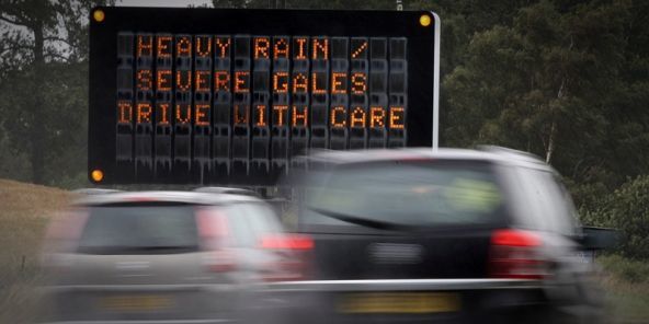
Police are warning the public to be aware of deteriorating weather in the coming hours.

An amber ‘Be Prepared’ warning has been put in place by the Met Office and is valid until midnight tonight before turning to a yellow ‘Be Aware’ warning tomorrow.

The advice is to prepare for heavy rain, severe gale force winds and increased risk of surface water and river flooding. The Scottish Environment Protection Agency has issued a flood alert for Dundee and Angus.

The Met Office said: “A deep area of low pressure will bring rain and strong winds to southern, then central Scotland during today. The rain will become more persistent and heavy at times, particularly over southeast Scotland where it is likely to persist until around dawn tomorrow morning, so any impacts are more likely to occur later in the period due to cumulative effects.

“The rain will edge northwards during this evening and overnight, with the heaviest rain over northeast Scotland on Tuesday with drier interludes and scattered showers elsewhere. A ridge of high pressure will build during Wednesday and Thursday with showers dying out.

“In addition to the rain, easterly winds are starting to strengthen from the south. These will reach gale force, with gusts to around 60mph in places, and extend northwards during the day. The strongest winds are expected to affect exposed, eastern coastal areas mainly the Firth of Forth, Tay Estuary & Grampian areas later this evening and during the early hours of Tuesday, with gusts of over 70mph possible in places.”

Police say drivers should reduce their speed and drive with the utmost care. Anyone who is travelling should allow plenty of time for their journey, reduce their speed and drive according to the conditions. This includes keeping a safe distance from the vehicle in front and using dipped headlights where appropriate.

You can access up-to-the-minute traffic information at www.trafficscotland.org or on Twitter @trafficscotland. Met Office warnings are also updated at www.metoffice.gov.uk/public/weather/warnings/