Scotland woke to more high winds and wintry showers but the impact of the so-called weather bomb is set to recede over the day.
The Met Office has a yellow “be aware” warning in place for Tayside and Fife until 10am.
Although gusts of wind reached 75mph in some places overnight, they are not expected to continue throughout the day.
However, driving conditions were made more hazardous in many places because of wintry showers bringing snow or sleet.
Courier photographer John Stevenson filmed these scenes in the Glenshee area:
There was snow in many parts of Angus, Perthshire and Dundee this morning.
Police Scotland said the inclement weather caused two minor collisions on the roads this morning but no serious injuries.
Both the Tay and Forth Road Bridges were closed to double decker buses.
Despite fears the weather bomb would plunge Scotland into chaos, much of the east coast emerged unscathed from the storm
However, electricity supplies to the Western Isles were knocked out because of the storm yesterday.
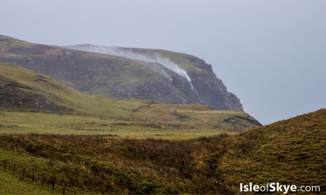
And, on the Isle of Skye the weather bomb even seemed to defeat gravity.
A picture of water “flowing” up the cliffs of Toravaig by Portree on the Isle of Skye went viral went posted online.
The photo was taken by Dave Liley of the isleofskye.com website.
The process behind the storm rapid cyclogenesis is known colloquially as a “weather bomb”.
