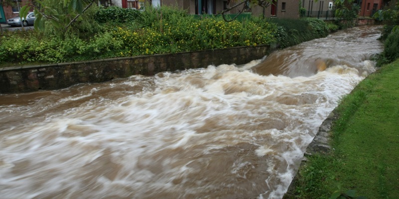
Scotland faces its wettest August in 60 years despite expert predictions that summers are getting hotter and drier.
Although summer may have been particularly sodden this year, UK climate change projections issued in 2009 say Scotland will face warmer, wetter winters and hotter, drier summers in the future.
However, they warn that periods of wet weather are likely to be far wetter than they are at present.
That will be come as no surprise to Scots who are facing up to the wettest August since records began.
The Met Office has already issued a severe weather warning for Tayside and Fife due to torrential rainfall and there has been flooding across the area over the past few days.
In some parts of Scotlan, including Leuchars, more rain has fallen in the last two days than normally seen in the average month of August.
The Scottish Environment Protection Agency issued 29 flood warnings and 14 flood alerts on Thursday.
Flooding caused disruption or cancellation to a number of rail services during the morning rush hour, with services being reduced to half-hourly between Edinburgh and Glasgow and a reduced service on the East Coast main line.
Transport minister Keith Brown said further rain was forecast across Scotland for the next few days. Heavy rainfall is expected for Friday night but the forecasters said the weekend is likely to be much more settled.
A Met Office spokesman said up to 115mm more rain is expected by the end of the week, bringing total precipitation this month to 188mm.Sunnier weekendThe wettest August on record was 1948 when 206.6mm of rain fell but that total will nearly have been equalled after just two weeks of the month this year.
The spokesman said the damp weather is expected to continue into the weekend although it should ease off after heavy rain on Friday night.
He said, “Over the weekend there will still be clouds and showers but there will also be sunny spells.”
But he added there is no underlying cause to the downpours seen this summer.
“It’s not down to climate change or anything like that it’s just natural variability,” he said.
“There have been some long periods of heavy rainfall but in terms of the monthly averages they have not been too far out. In terms of the total amount of rain, it has not been that unusual.”
A Tayside Police spokesman said motorists should take extra care.
He said, “Motorists should drive slower as their ability to stop is greatly reduced by the rain.
“The surface water and spray on motorways also makes overtaking, especially heavy goods vehicles, very treacherous.
“People should keep a safe distance and drive appropriately to the conditions.”Extreme weather eventsThe UK Climate Projections show the changes that are anticipated for the rest of the century depending on emissions levels.
They warn that Scotland will endure a greater number of extreme weather events.
These will include extended hot periods, major rises in maximum temperatures and despite last year’s whiteout fewer days of snow and frost.
The predictions say summers will have longer periods of dry weather but that rainy days will be far wetter than at present.
ScotRail said a number of services were affected by rain.
Trains suspended due to flooding included services to and from Queen Street to Glasgow Anniesland, Cumbernauld and Dunblane.
A half-hourly service was running between Edinburgh and Queen Street calling at Croy, Falkirk High, Polmont, Linlithgow and Haymarket.
A ScotRail spokeswoman said, “We are running as robust a service as possible and apologise to customers for any inconvenience caused by circumstances outwith our control.”
The company said passengers travelling to Dunblane should take the Queen Street service to Aberdeen as it was making an additional stop in the town.
Trains from Queen Street to Inverness, Aberdeen and Perth were also disrupted, along with Glasgow Central and Mount Florida trains.Flooding ‘more likely’ScotRail said customers should check their website for more information or use the help points at station platforms.
More rain is on the way, according to forecasters.
Matt Dobson, forecaster at MeteoGroup, the weather arm of the Press Association, said, “Quite a lot of the central belt has seen 45mm and 60mm over the last 24 hours explaining why flooding is pretty likely.
“Today, I think the worst is over for now. There is still rain around but it won’t be as heavy.
“But more rain is on the way.”
He added, “On Friday night there is a band of rain which will be quite heavy moving across Scotland.
“There is a very showery weekend to come as well. Some places have seen a month’s rainfall in the last few days, but I think the worst is over.
“As the ground is saturated with water, flooding will be more likely.”
