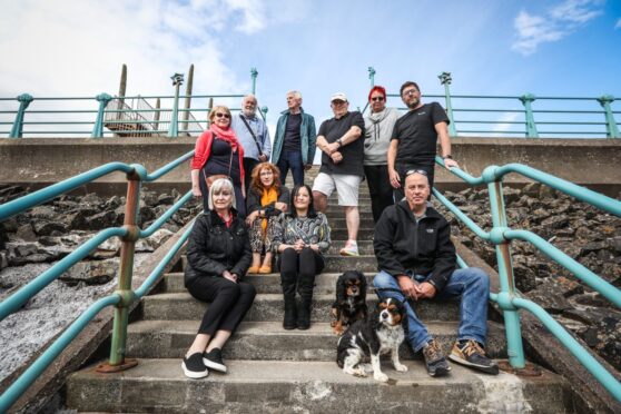
Montrose Community Council is calling for the Scottish Government to step in and help fund the significant effort needed to tackle coastal erosion that threatens the town.
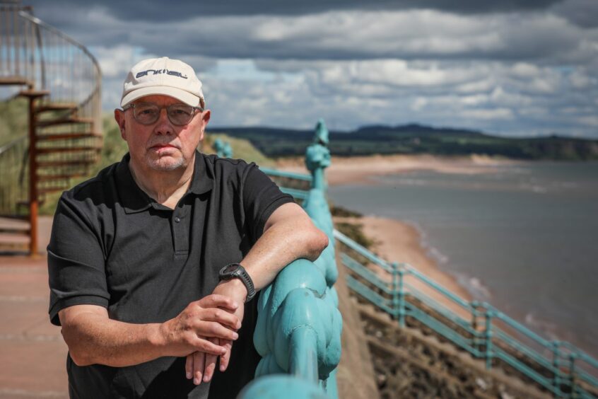
David Brown is the leader of the community council’s sub-group on coastal erosion.
Angus Council have a plan to tackle the erosion, but it is going to prove expensive.
“The short-term project will kick off in April (2025) and you could be looking of upwards of £20 million even for that part of the project”, says David.
“The funding is going to have to come from the Scottish Government.”
The erosion was worsened by last winter’s powerful storms – predominantly Babet and Ciarán.
This comes after experts warned that seawater could travel through flood corridors on the Montrose Golf Links and engulf the nearby town within the next 30-40 years if the erosion continues.
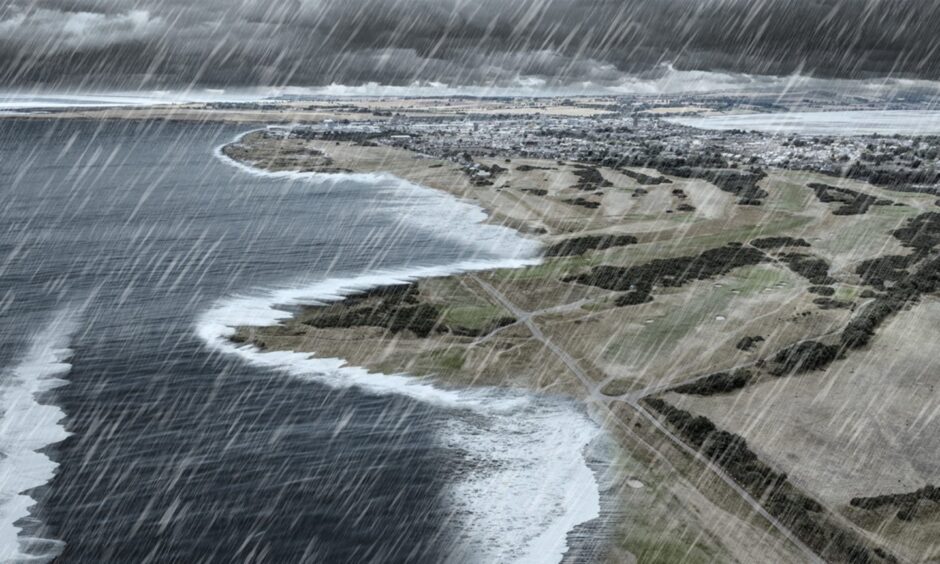
“The storms over Christmas very much brought the issue back into focus”, says David.
“I don’t think any of us have experienced weather like that. And the impact it had on Montrose seafront brought it back into focus again.
“You’re fighting nature here and the storms did create a lot of damage.
“Are those storms going to be regular features now or are they one in 70 years storms?”
In our series, The Courier is highlighting the dangers of rising sea levels and destructive storms, and demanding councils and government act now before it is too late.
What funding has Angus council received to tackle Montrose coastal erosion issues?
Many of Montrose’s 12,000 or so residents are becoming more concerned and the issue is at the top of the community council’s agenda.
Angus Council is also taking steps to fight the erosion. It has started the Montrose Bay Coastal Erosion Project.
The local authority received £440,000 in funding from the Scottish Government to shore-up the most at risk areas by next winter.
This followed a £350,000 allocation of funding from the government’s Nature Restoration Fund to help with its consultation process on the issue.
But funding remains a significant issue and a long-term solution is likely to cost millions – with estimates that a 10-year plan, as discussed by the council, could cost at least £10 million.
And long-term strategies suggest more than one million tonnes of sand could need to be added to Montrose Beach.
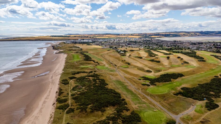
What is happening to the coastline at Montrose?
The historic Montrose Golf Links, dating back to 1562, is bearing the brunt of the problem.
Earlier this year it was revealed that the 462-year-old course had lost seven metres to the sea in a year.
The links team appointed consultants EnviroCentre to conduct a feasibility study into the possible management options for the erosion.
They published their study in December 2023. The paper cites existing concerns about “the future of the golf links due to the pace and extent of ongoing erosion”.
“Key course infrastructure is at imminent risk of collapse”, states the report.
“During higher emissions pathways with corresponding increased impact of storms and greater sea levels rise (increase by 0.92m) the risk of coastal flooding to Montrose is increased.”
It says there could be “flooding” to the south of Montrose by 2100.
EnviroCentre consultants also observe that the vegetation edge “retreated” by up to 23 metres between 2010 and 2019.
It estimates this will retreat by another 170 metres by 2100.
Community council trying to ‘engage’ with people on the ‘facts’
“We try and engage with people because most of the information and opinions seems to flow through social media – which is not necessarily based on facts”, says David.
“People are looking for something to happen quickly, but realistically that’s difficult to do because it’s a huge problem.
“There is particularly bad weather or we lose a part of the dune and it seems to be headline news for a week or two.
“But then goes back to there not being a great deal of interest.
“There has been a feeling in the past that it’s such a long-term and large financial problem that it’s not been dealt with.
“There is no definable short-term solution that would be guaranteed to work.
“It’s difficult and there is frustration amongst the community that nothing is happening.
“We have councillors declaring that we are going to be underwater in three years. But there is no evidence to support that.”
What is the financial cost?
EnviroCentre’s December 2023 report estimates that beach nourishment on the scale needed would cost £2 million.
It estimates this could range from £200,000 to £4.5m.
“Those finances cannot come from the local council and I understand they’ve got a £50 million gap in their budget anyway”, says David.
“It’s a complex issue and is risky for the (Angus) council as well. There is the potential that they spend a lot of money and it might not work.
‘This should have been dealt with 15-20 years ago’
In 2022 The Courier used Dynamic Coast webmaps to visualise a worst case scenario for coastal erosion at Montrose.
This produced dramatic visualisations of what the coastline could look like by 2100. Dorward Road is most at risk, with other areas of Montrose potentially facing catastrophe.
However, the erosion that occurred in the wake of Babet was worse than Dynamic Coast’s estimated annual loses.
This raises questions about the impact future powerful storms and climate change could have.
And EnviroCentre’s report cites that the coastline at the golf links suffered up to three metres of erosion in the days following Storm Babet.
“This should have been dealt with 15-20 years ago or the process should have been started back then”, says David.
“There wasn’t too much happening in the time pre-Dynamic Coast.
“They dumped some rock armour to protect some of the golf tees and there was some baseline studies done.
“But up until Dynamic Coast there were no major investigations, analysis or long-term planning.
“There was definitely a lack of leadership in terms of the problem. Pre-Dynamic Coast it was extremely difficult to find any information on the issue.”
Montrose Beach links is also a popular spot for football, cycling, sea swimming and dog walkers.
“The beach and links area is such a natural asset for the whole community and it’s an area that almost defines the town”, adds David.
“It’s already something that has to be considered for planning in the area. It is happening now.”
What can Montrose learn from St Andrews?
Climate change and Scotland’s moving coastline is also causing issues for the famous St Andrews golf courses.
The St Andrews Links Trust has purchased farmland and has been working with several other local groups to combat the erosion.

“St Andrews is a really good one because you can immediately see there was an immediate effort involving councils, community groups and the golf courses”, says David.
“But what was lacking perhaps 10-15 years ago in Montrose was a united effort.
“It was more save the golf course and not worry about anything else. But that’s changed and we are moving in the right direction now.”
According to David, Montrose Community Council are the main group advocating for action in the town.
“We are trying to get everyone in the one room to answer questions”, he says.
“If we can get 4,000 Montrose residents up in arms about this, then we need the political will to get our funds or what we need.”
A Scottish Government spokesperson said: “Adverse weather and rising sea levels – caused by climate change – are already having an impact on coastal communities such as Montrose.
“The Scottish Government is providing £12m of funding for local authorities to develop Coastal Change Adaptation Plans.
“The Scottish Government continues to work with the local community and stakeholders to address coastal erosion at Montrose.
“Angus Council has responsibility for developing proposals for recharging the Montrose sand dune system, and we have supported them to do so with an additional £440,000 of funding.”


Conversation