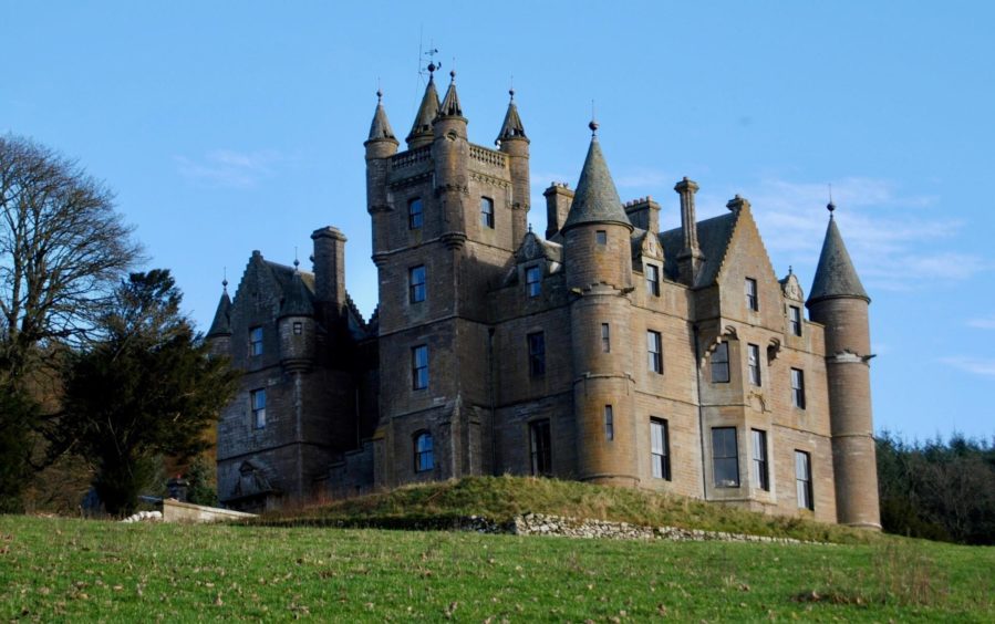
The sky was a flawless blue which accentuated the contours to a sharpness matching the bitter chill of the wind as I headed along the ice-coated road beneath Balintore Castle writes Alan Rowan.
The target was Cat Law, that bare, rounded hill some six miles west of Kirriemuir. Standing at a height of 678 metres (2,201 feet) it’s the lowest of the handful of Angus hills that qualify as Grahams (hills between 2,000-2,500ft), but it still dominates its closest neighbours.
It had been 13 years since I was last on its summit, and on that occasion I had taken the route from Glen Prosen, combining it in a bigger circuit with nearby Corwharn, now stripped of its place on the list after a new survey found that it fell short of the magic mark.
There are a variety of ascent options and this time I was approaching Cat Law from the south, a loop that would bring me out via Glen Quharity. There’s more than one way to skin a cat.
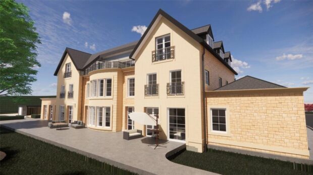
I parked carefully on the grass verge beside a stone bridge on the minor road which then continues uphill before swinging east. I passed farm buildings and then the castle, where work on renovations are in full flow, to reach the somewhat dilapidated entrance where it would be possible to squeeze in another car or two.
Older maps show a path going through the trees here, but if it ever existed, it has long been swallowed by vegetation and barbed wire fencing. There is a grassy track heading straight up the hillside from the entrance but it soon peters out. Better to stay on the road until you are past the trees and then go through a metal farm gate on the left to pick up a track, faint at first, running north-east.
The track soon grows in confidence, crossing the left-hand side of Craig of Auldallan, before cutting a line steadily upwards to the horizon. There is a split at one point, but both branches soon join up again.
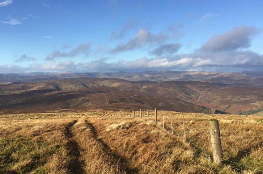
The angle is always gentle, and soon final slopes of Cat Law come into view. The track shrinks to a path and swings round following the line of a fence before reaching the trig point. This is not the summit, however – a few piled white stones a little to the north takes that honour.
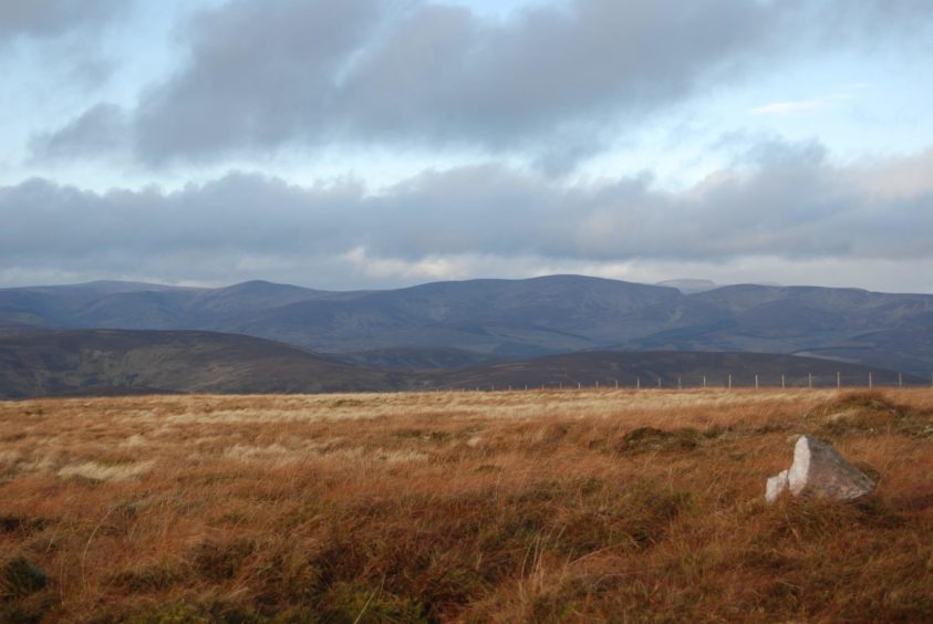
A massive windbreak cairn sits on the other side of the fence, its original purpose, like so many others in this region, long forgotten. It provided handy shelter for a lunch break, and I was able to sit in comfort to enjoy the views west, south and east over the pastoral patchwork which gradually faded away into brilliant white due to the low sun.
The Loch of Lintrathen was a sheet of silver paper, glistening and reflecting like an ancient signal system while Mount Keen stood proud amongst the gathering cloud in the distance. The northern landscape was more subdued, dark layers stretching back through the glens, a vibrant reddy-brown foreground providing the colour.
I stayed with the fence as it ran north-west, crossing to pick up a grassy ATV line which led down to a crossroads and a wooden gate. I spotted movement off to the right; a young deer, trotting towards me before realising its mistake and bouncing off to disappear back into the camouflage of the deep heather.
I ignored the alternative descent track running south over Bodandere Hill and instead made the short climb over Cormaud, pausing en route to gaze down through the deep shadows into the sunlit patches of greenery in Glen Uig.
I kept following the main track as it curved left to meander down the slope of the curiously named Clinking Cauldron to meet the Quharity Burn as it tumbled down the glen.
With Corwharn now in the rear mirror, the next section of track deteriorated into a bit of a mudbath, the result of previous days’ heavy rain and intensive track and fencing work on the slopes to the right in Glen Quharity. Once past the house at Longdrum and the small village of contractors’ caravans, the track becomes a rough, tarred road running alongside the swollen waters of the burn.
The sun was preparing for departure, the result a last golden hurrah lighting the greens and yellows along the flanks of Hill of Stanks and Tombay, a perfect finish to the day. One final stretch of road and I emerged at the bridge.
Route:
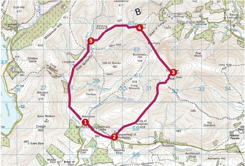
1. Walk uphill (north) for short distance then east past entrance gates to Balintore Castle.
2. Just beyond small wooded area, go through metal gate opposite buildings at Knowehead of Auldallan and follow track, grassy at first then more obvious, which climbs gently north-east over side of Craig Auldallan all the way to summit of Cat Law.
3. Descend north-west on grassy ATV track then cross to right side of fence to reach track junction on Monthrey, go through wooden gate and climb to Cormaud (summit at fence line just off right).
4. Return to main track which swings to the left, dropping over Clinking Cauldron to reach track coming down by the Quharity Burn.
5. Cross the water (bridge) and follow the track down the glen where it becomes a rough road which eventually leads past the buildings at Westerton to emerge at the road junction and bridge.
The Lowdown:
Distance: 13km/8 miles
Ascent: 392m/1285ft
Time: 3-4 hours
Grading: Moorland and farm tracks, minor road sections. For relatively fit walkers, steady climb to Cat Law on gentle gradient. Dogs under close control due to farm livestock.
Start/finish: Parking on verges beside stone bridge south-west of Balintore Castle (Grid ref: NO 285592), accessed from B951. Limited space for careful parking further east near gates of Balintore Castle (NO 295586).
Map: Ordnance Survey 1:50,000 Landranger Maps 44 (Ballater & Glen Clova) and 53 (Blairgowrie & Forest of Alyth); Ordnance Survey 1:25,000 Explorer sheet OL 53.
Tourist Information: VisitScotland, Dundee iCentre, 16 City Square, Dundee, DD1 3BG (Tel 01382 527527).
Public transport: None.
Alan Rowan is a well-known author and walker. You can follow his regular mountain adventures @munromoonwalker.com
• Please observe government coronavirus safety guidelines in all outdoor activities
