Gayle explores the quaint fishing village of Ferryden and strolls along the coast to Scurdie Ness lighthouse.
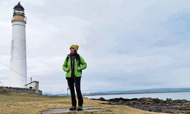
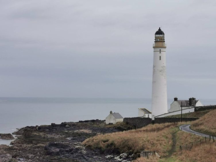
Rising up from the jagged Angus coastline, Scurdie Ness lighthouse is a beacon of hope and light.
Even on a dreich day in early March, it projects a little magic into the atmosphere.
The towering structure has stood strong against the harsh elements for 151 years, its reassuring glow helping to save the lives of countless seafarers since it was first lit on March 1 1870.
It was built after the fishing community of Ferryden, troubled by the vast numbers of shipwrecks and great loss of life along the coast, petitioned to establish a light on the headland, known as Scurdie Ness, or Montrose Point.
Brothers David and Thomas Stevenson, of the famous Stevenson family of lighthouse engineers, were appointed to construct the tower, with bricks brought to the site by ship from Alloa.
Stone for the base came from a quarry in the Benholm area above St Cyrus.
At 39m high and with 170 stairs, the lighthouse, which was once described as “a Tayside signpost on the North Sea”, is an impressive and much-loved landmark.
The light flashes white every 20 seconds and has a range of 23 nautical miles.
During the Second World War, the whitewashed tower was painted black, preventing German bombers from using it as a guide.
The lighthouse was automated in 1987, and the former lighthouse keeper’s cottages are now privately owned.
My very first sighting of Scurdie Ness “in the flesh” (I’d seen photos of it) was just a few weeks ago, on a rather chilly, wet morning.
I’d endured a big hike into the Angus Glens the previous day, and reasoned the short, relatively flat stroll to the lighthouse would do my weary legs the world of good.
I walked there from the quaint fishing village of Ferryden, which sits on the south side of the River South Esk where it meets the sea and is connected to Montrose by a bridge.
Long before the bridge was built, a ferry had been in existence for centuries – the earliest mention of it was in 1178, and it stopped running for good in the 1930s.
Anyway, if you’ve been wondering why the village is called Ferryden when there’s no ferry there, well, now you know.
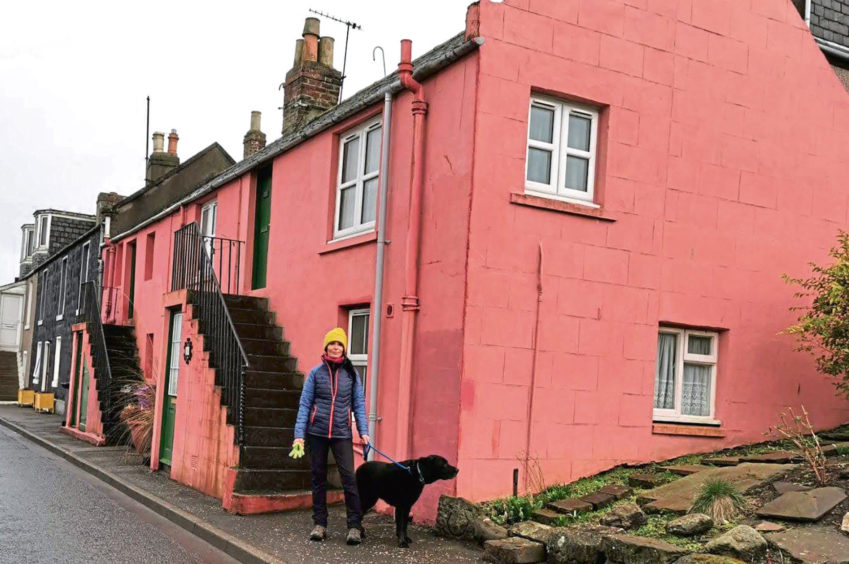
It’s worth spending a while exploring – it’s such a cool wee village, oozing with charm and quirky features.
You’ll find brightly painted houses with colourful tubs of flowers, old boats and sheds repurposed as homes and outbuildings, and all sorts of ramshackle, topsy-turvy buildings, which only adds to the appeal.
Ferryden first started to grow as a fishing settlement in the 1700s when fishermen from across the north-east coast settled in the area, drawn by the fact it offered ideal fishing conditions with a deep anchorage and mussels galore in the tidal basin which could be used as bait.
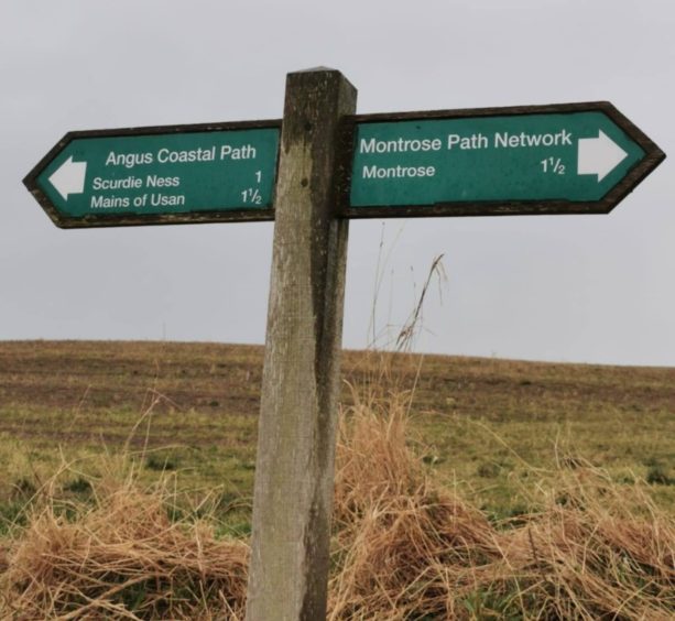
It’s just a mile from Ferryden along the Angus Coastal Path to the lighthouse, and you’re treated to cracking views the whole way.
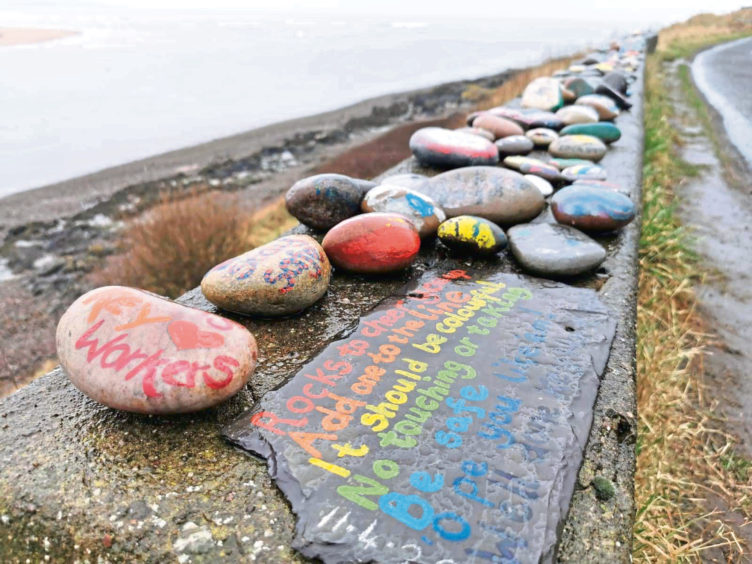
A few hundred metres in, I was delighted to find dozens of painted pebbles on a wall, with all sorts of uplifting messages and pictures. A lovely touch.
Wildlife is in abundance here, too. I spotted three seals close to the shore and a couple further out at sea.
Bottlenose dolphins and porpoises are regular visitors in the area, too, occasionally venturing right up the river. And there have even been some sightings of humpback whales!
In winter, great flocks of eider ducks huddle together on the shore and huge skeins of pink-footed geese fly overhead on their way to and from Montrose Basin.
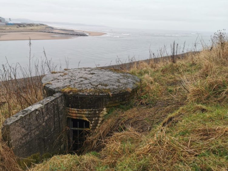
Second World War fortifications galore, which aimed to protect Montrose beach, caught my eye along the way, including concrete pillboxes and brick-built gun shelters which were once manned by the Home Guard.
The old capstan used to rescue ships that ran aground also remains, lying, as it does, unloved and at a jaunty angle a few hundred metres inland. Apparently teams of horses harnessed to the capstan would attempt to pull ships up at high tide.
Long before the lighthouse was built, there were many shipwrecks and lives lost as a result of the dangerous shifting sands of the Annat Bank on the north side of the river – described as “that fatal shore” – and the hidden rocks of Scurdie Ness on the south side.
In 1818, to make the passage safer, the most comprehensive system of navigation aids in Scotland was created.
Two lighthouses, designed by Robert Stevenson, remain, and the higher of the two, the “High Red” is still in use, although it’s tiny compared to Scurdie Ness.
I also spotted two white stone towers known as the Beacons. These supported a signalling device that told helmsmen of approaching ships which course to steer.
The area surrounding Scurdie Ness is a designated Site of Special Scientific Interest, so once you’ve gazed up at the majestic lighthouse and taken a heap of photos, you should check out the flora and fauna.
Look out for the volcanic rock sequence known as the Ferryden Lavas.
And keep your eyes peeled for the Scurdie Ness agates which can be found embedded in the lava or lying on the shoreline and in neighbouring fields.
