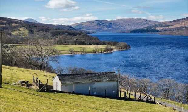
You can’t help but be impressed by the handsome face presented by the western twin of the Paps of Fife on the approach from the west.
The long sweep of its frontal battlements seem to rise up out of nothing, a spectacularly rugged contrast to the gentle farmed fields below, and the rounded summit dome peeking up behind has a true mountainous appeal out of all proportion to its height.
It also has many hidden assets in the shape of eccentric and curious rock formations and there are many approach options but the circuit from Glen Vale offers the opportunity to take them all in.
We caught the hill at its finest, an early spring day of blue skies, and with perfect clarity we reckoned the hardest navigational part would be finding our way around the maze of minor roads to reach the small car park. There’s only room for a few vehicles, but there are other spaces about two kilometres north-east, and the walk can also be started from there.
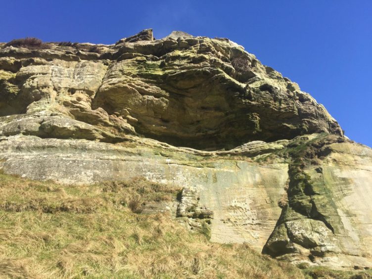
The initial path provides a gentle introduction, meandering through the trees and alongside the burn. When the path split further up, we took the right-hand branch for a closer look at the sandstone rock formation known as John Knox’s Pulpit.
Although the 16th Century church reformer is unlikely to have visited, this outcrop was used as a secret meeting place for services. It would have been even more impressive in those days: a cave at the foot of the cliff was reduced in size by a major rockfall in 2004 which saw the path below closed for public safety while demolition work was carried out. If you intend taking a closer look, mind your step.
The paths meet again at the high point of the glen, and a rougher path climbs up through the heather before a final steeper ascent to the summit. Those looking for more rock curiosities can make an earlier detour left on faint trails to reach The Devil’s Burdens, a chaotic scattering of large boulders strewn across the hillside.
The name comes from the legend that says they were created when the devil threw them at a local witch, Carlin Maggie, who had been taunting him while he was labouring with a great load on his back. He later turned her to stone, a pillar which sits on the lower slopes of Bishop Hill over the glen. There she must remain until wind and weather set her free.
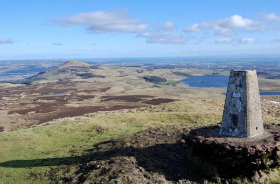
You have to wonder how severe that weather must have to be when you imagine the forces that have undercut the trig point foundations on the summit of West Lomond. On a fine day, though, the views are second to none, a clear line across a patchwork of greens, browns and blues to stately East Lomond, and over Loch Leven to the distant Ochils.
The descent begins one way and quickly switches tack, turning to run back under the summit dome before twisting left again to find the best line down a steep grass gully. This needs care, especially when the cloud is down. If in doubt about when to turn, you can be guided by the first clear sight of East Lomond from this path.
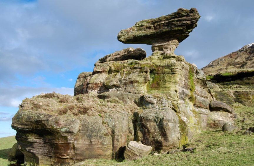
A slanting grass path leads quickly down to The Bunnet Stane, an outrageous balancing act with the look of a rocky mushroom cloud. Erosion seems a better bet than the legends suggesting it was a druids’ altar.
Underneath lies the Maiden’s Bower, a carved cave where it’s said a young woman decided to live for the rest of her life after seeing her lover ambushed and killed there. That’s the romantic version – the more likely story is that it was the first excavation of an early geological survey, or that it was created as a shepherd’s bothy.
Leaving all these rock stars behind, the final stretch is gentle, along the edges of fields and a short road walk to end a satisfying circuit.
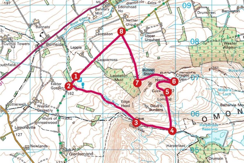
Route:
1. Turn left out of car park, take road south-west for 200m, then turn left again onto woodland path (signed: Glen Vale).
2. Take path east through trees and cross Glen Burn by bridge, when path splits follow left branch on north side of stream to pass below John Knox’s Pulpit.
3. Continue east until paths merge again, and at high point of glen turn left on rougher hill path.
4. This rises through heather at first, then steeper again to summit cairn and trig point.
5. Leave summit on path which goes west at first then takes sharp turn back east.
6. Drop north-west with care along left-hand edge of grassy cut, steeply at first then easing to path slanting west down by old fence line to cross stile and field to reach the Bunnet Stane.
7. Head north along field edges to reach the single-track road.
8. Turn left and walk 2km back to parking.
Lowdown:
Distance: 9km/5.5mls
Ascent: 420m/950ft
Time: 3.5-4.5 hours
Grading: Woodland and hill paths, short distance on minor road. Some steep ascent and one steep descent needing care especially in less than clear conditions, suitable for relatively fit walkers. Can be muddy, good footwear advised. Dogs under close control due to farm livestock.
Start/finish: Glen Vale car park (Grid ref: NO 172069) on Dryside Road (limited free parking – please do not block road).
Map: Ordnance Survey 1:50,000 Landranger Map 58 (Perth & Alloa); Ordnance Survey 1:25,000 Explorer sheet 370.
Tourist Information: VisitScotland, St Andrews iCentre, 70 Market Street, St Andrews, KY16 9NU (Tel 01334 472021).
Public transport: None to start point, nearest bus stop at Gateside (A91) 2km from start.
