Hill of Tarvit, Cupar, Fife
The modest Hill of Tarvit is the high point of a pleasant circuit which meanders along farm lanes and woodland paths and even manages to take in a grand mansion.
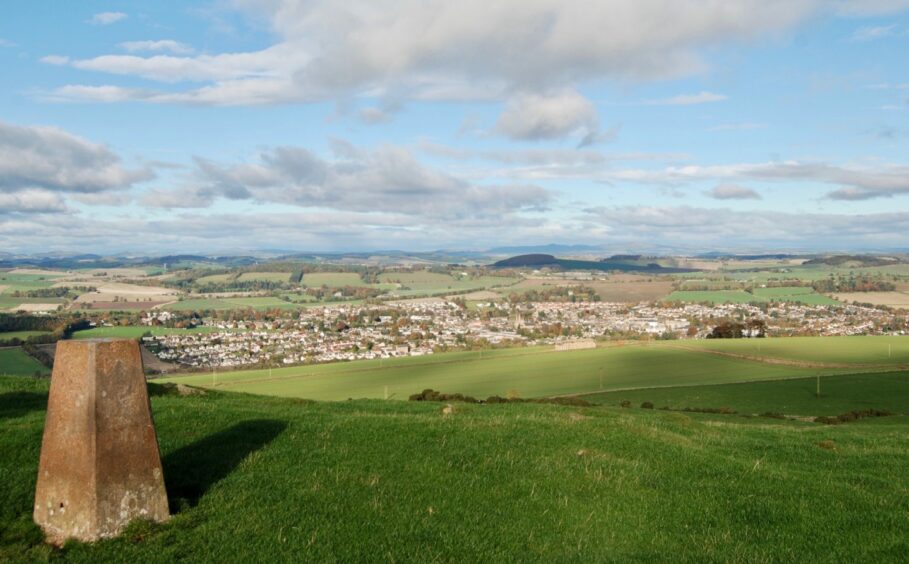
The hill sits to the south of Cupar and provides a sweeping view over the town, but I chose to approach from Ceres, often referred to as the most attractive village in Scotland. On a perfect morning when the landscape was airbrushed with soft, autumnal hues it was easy to agree with that assessment.
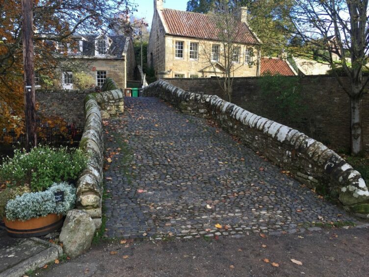
Starting from the Fife Folk Museum, and after a closer examination of the beautiful old cobbled packhorse bridge spanning the burn, I followed a right of way sign for Struthers, heading up a leaf-filled lane. Ceres is on the Fife Pilgrim Way and this was the Waterless Road, which linked the village with Old Kennoway, a regular passage for pilgrims on their journey to St Andrews Cathedral.
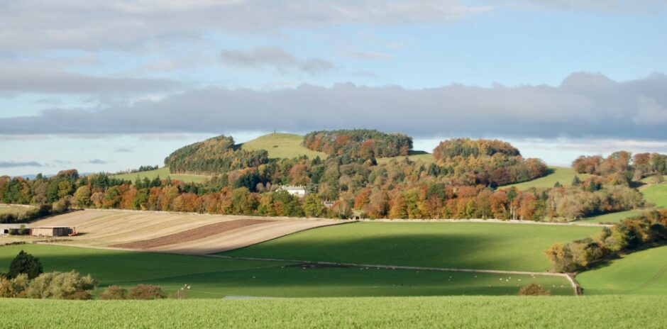
The track quickly turned grassy, a corridor between field walls and fences, lined with birches and rowans and patches of brambles. Hill of Tarvit came into view, the monument standing out on the bald dome among the golds and russets of the tree cover.
There was still a hint of frost on the ground, leaves snapping and crunching underfoot. As I turned down the lane past Denhead Farm I was greeted by the sight and sound of leaves dancing across the surface with the aid of the lively wind.
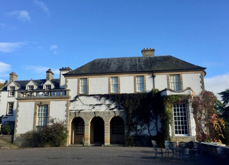
I continued down a tunnel formed by tree and hedge, then twisted and turned along the route to reach a ford with a tiny pedestrian arched bridge before eventually making my way to the entrance of Hill of Tarvit mansion house. This grand building, built in 1696 and originally called Wemyss Hall, was rebuilt in 1904 by the architect Sir Robert Lorimer. It is now in the stewardship of the National Trust for Scotland and is open to the public during the summer months.
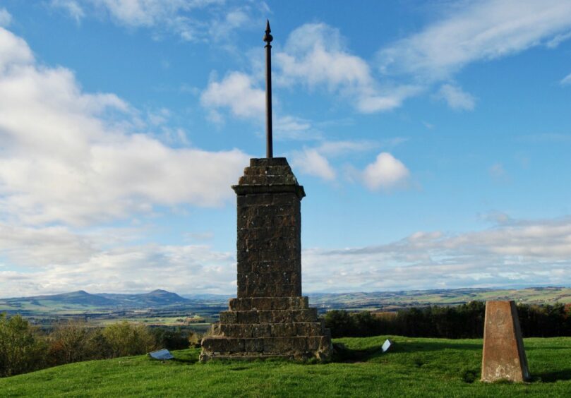
A sign on the wall at the side of the house directed me to iron gates at the top of the garden, beyond which a path drove uphill to a stile where a short push on grassy slopes led to the summit and its impressive monument. There is also a trig point, and four direction identification panels.
Cupar lay stretched out below, the view and the monument symbols of the treaty signed in 1559 in which Queen Mary I’s army agreed not to attack the town.
The descent involved crossing another stile, then heading down by the car park and out to cross the A916 to the lane opposite which led to the 15th Century Scotstarvit Tower.
The route swung left past the farm, heading along the edge of fields, accompanied by the noise of commuting geese and then a mass take-off of wood pigeons, before I emerged at the wonderfully named settlement of Chance Inn.
A couple of left turns led me back out to the A916 and a walk along the hard verge to Craigrothie, where I took the right fork for St Andrews and was treated to yet another bird show, this time an aerial battle as a buzzard was mobbed by crows.
The road was quiet, but there’s a pavement until the end of the houses and then grass verges for the final leg down to the turn for Denhead Farm and the final retracing of steps.
ROUTE
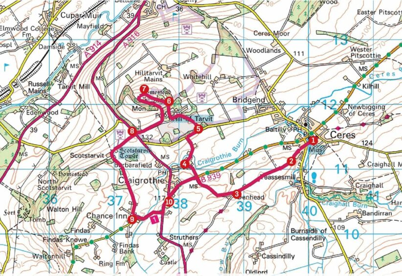
1. Leave car park to W, cross road and head up Woodburn Road (signed: Right of Way to Struthers) between houses.
2. Keep straight on as road becomes track, passing cottages on right to reach Denhead Farm.
3. Follow lane as it swings to right in front of farm, heading down to B939. Cross to footpath between hedges and trees then go left past houses to junction.
4. Turn sharp right along minor road to ford with pedestrian bridge, stay on track uphill past farm to minor road, then turn right (grass verge) for short distance to entrance for Hill of Tarvit mansion house.
5. Follow drive, keep left by cottage to continue parallel with high hedge, then follow hedge round to right and take steps by side of house (signed) to go through iron gates at top of gardens on woodland path.
6. Cross fence by stile at edge of trees for short push uphill, trending left away from belt of trees to reach Hill of Tarvit summit.
7. Descend W at first to outflank small crags then turn back to follow fence to another stile. Take path through wood to car park and turn right on main drive to A916.
8. Cross road and take track ahead. This leads to Scotstarvit Tower, then swings left past farm and down to Chance Inn.
9. Turn left at junction, follow to A916, then go left again to Craigrothie.
10. Take right fork to St Andrews (pavement then grass verges) to reach Denhead Farm entrance on right, then follow inward route back to Ceres.
INFORMATION
Distance: 11km/7miles
Ascent: 228m/750ft
Time: 2.5-4 hours
Grading: Easy circuit for all abilities on mainly farm tracks and lanes and woodland paths, some sections on minor roads plus one short steeper climb on grassy hillside. Very muddy in places, good footwear essential. Route passes through working farms, dogs under close control.
Start/finish: Hope Green car park by Fife Folk Museum, Ceres (Grid ref: NO 400114).
Map: Ordnance Survey 1:50,000 Landranger Map 59 (St Andrews); Ordnance Survey 1:25,000 Explorer sheet 370.
Tourist Information: Tourist Information: VisitScotland, St Andrews iCentre, 70 Market Street, St Andrews, KY16 9NU (Tel 01334 472021).
Public transport: St Andrews-Cupar-Glenrothes bus service (No 64).
