It’s easy to imagine you are stepping back in time when you walk the Minister’s Path between Glen Prosen and Glen Clova.
This “shortcut” route through the hills allowed the same minister to officiate more frequently at both churches during the 19th Century. It’s even said he sometimes travelled by pony and trap.
These days, this track is more used to those travelling by Shanks’ pony, and it offers walkers a variety of routes and circuits of varying length.
Glenprosen Village itself has a timeless feel, a tranquillity which is becoming a rarity even in the neighbouring glens, and autumn is a favourite time to visit.
As I started up the track, red squirrels were leaping along their high trapeze and I caught the flashes of white tails as rabbits scurried for cover amongst the trees. Overhead, a buzzard made lazy circles.
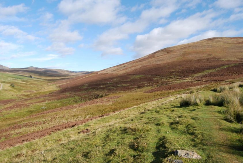
Once past the trees, you can see the path stretching all the way up Glen Tairie along the hillside. Heavy rain in previous days had left some waterlogged sections but the walking was effortless and the rise imperceptible.
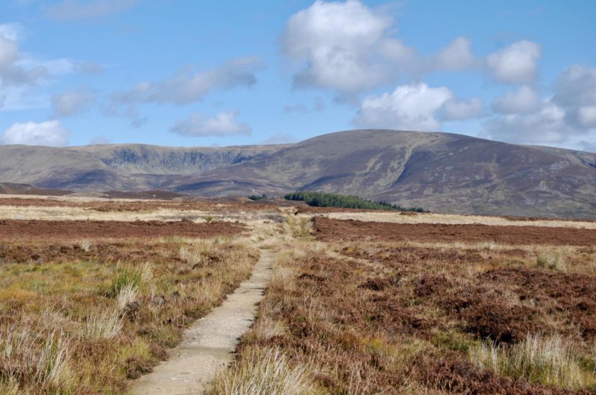
The view ahead to the impressive corries of Clova fills the horizon but that temptation would have to wait for another day. A second option is to carry on to the track junction at Drumwhern and then take the longer route back over the hills above Glen Cally. Instead, I went through the gate in the fence, and just a few metres further on doubled back at the start of a faint track on my right.
It may be hard to find the exact line at first but it soon develops, the cut strip leading gently all the way to the summit cairn of Knachly is obvious from below. This is a fine lunch spot, the views in every direction spacious, the soundtrack provided by stags in full gladiator mode, their roars echoing around the hillsides.
There’s a short, steep drop down south to the col before the rise to Hill of Spott. High fences and plantations have altered the original line of progress, so to continue down the ridge you have to cross over to the right at the junction of the new and old fences and go through a wooden gate.
If you have stayed on the left, you will need to backtrack to this point. Do not be tempted to drop down the fence-line into Glen Cally. The descent is awkward with deep bracken and uneven ground, and despite a good path along the floor of the glen being marked on the map, it seems to now be buried under long grass and boggy ground and the going is tortuous.
Once through the gate, ATV tracks in the heather morph into a better track which rolls down amongst new growth of pine, birch and rowan eventually passing between two rocky, heather-clad knolls. Ignore any thoughts of veering off this track – several suggestions of alternative paths have vanished, and fenced sections and deep vegetation make this a pointless exercise.
The track sweeps downhill to reach a high metal gate, and beyond this continues to emerge at the road at the edge of the treeline for the half-hour or so walk back to the church.
Care needs to be taken – although only two cars passed me during the whole time – and the leafy colour palette decorating both sides of the road provided a satisfying guard of honour.
The bright ochre house at Spott is a vivid sign that the journey is nearly over. A lone roe deer was enjoying the silence as it grazed in the grounds. I reached the car with the impression that everything was in the same place. It seemed time still hadn’t moved on.
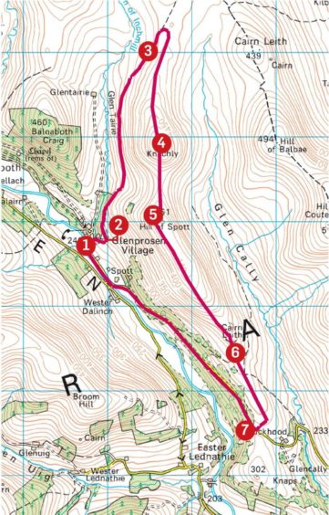
Route:
1. From car park, take track signed The Minister’s Road on east side of burn past cottages to a metal gate. Go through this and follow grassy track curving to the left.
2. The track rises alongside small wood to a wooden gate with pedestrian access, then continues up Glen Taire along the side of Knachly.
3. At the fence over the moor, go through the wooden gate. Soon after, watch for faint beginning of an ATV track on right (more obvious with height gain) which turns sharply back to head directly to top of Knachly.
4. Drop south on fence line and rise again to Hill of Spott. Where old fence meets new higher one, cross over and go through access gate.
5. Continue south-east along ridge on ATV track. This develops into good path which passes through new plantations and fences.
6. After passing between two rocky knolls, the path swings down to a large metal gate and then to the road.
7. Follow the road north-west for 3km back to Glenprosen Church.
The Lowdown:
Distance: 11.5km/7 miles
Ascent: 350m/1150ft
Time: 3-4 hours
Grading: Good path, some boggy sections, ATV tracks on hill. Easy-angle ascent for 1.5km, road walk for 2.5km. Boots and adequate clothing advised. Keep dogs under close control – sheep and ground nesting birds.
Start/finish: Glenprosen Parish Church, Glenprosen Village, signposted from Dykehead on B955 (Grid ref: NO 324658).
Map: Ordnance Survey 1:50,000 Landranger Map 44 (Ballater & Glen Clova); Ordnance Survey 1:25,000 Explorer sheet OL 53.
Tourist Information: VisitScotland, Dundee iCentre, 16 City Square, Dundee, DD1 3BG (Tel 01382 527527).
Public transport: No public transport to Glenprosen, nearest bus service to Kirriemuir.
- You can follow Alan’s regular mountain adventures at munromoonwalker.com or on Facebook (Munro Moonwalker) and Twitter (@munromoonwalker)
