Every so often you stumble across an absolute gem of a hill, one that makes you wonder why you haven’t been there before. Craig Fonvuick is one of those hills. says Alan Rowan.
Located in the Tulach Hill Special Area of Conservation, this little swelling above Killiecrankie is not the most spectacular in the area, but what it lacks in height and boldness is more than compensated for in the form of a truly wonderful summit panorama.
A circuit of the hill would be short and sweet, but it’s better if you have the time to link it with other parts of the Pitlochry Path Network. Besides, this is a place you won’t be in a hurry to leave.
I started from the car park at the western end of the Garry Bridge, exiting to the left of a picnic bench by a muddy path which heads into the trees. I quickly arrived at a break in the moss-covered drystone wall on to the minor road which twists as it climbs to the quaint church at Tenandry.
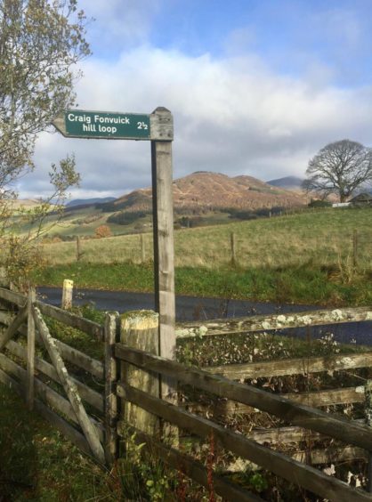
The pyramid of Pitlochry’s Corbett, Ben Vrackie, was prominent off to the east as I kept following the road until it swung left past the entrance of a house to reach a direction post marked “Craig Fonvuick hill loop”.
A grassy track curves round the edge of a field to reach a wooden gate which gives access to the hill path running through mixed woodland. There are occasional markers to keep you right but these are largely redundant as the route is obvious.
After a rusted metal gate, I passed a bench to reach a huge fallen tree where the path took a hairpin turn to the right and started to steepen through a series of twists before reaching another wooden gate.
The tree cover started to thin, but I spotted a couple of red squirrels scampering along the branches of towering Scots pines. The grassy flat to the left is also a good place to spot deer.
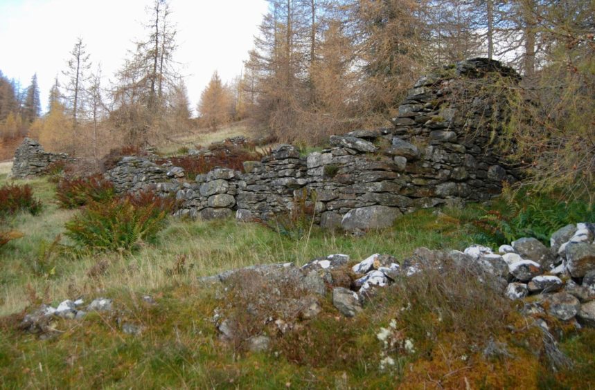
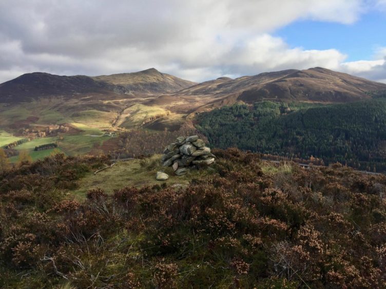
The path widened again to a grassy track as it passed the substantial stony remains of a steading, and a short distance further on as it levelled, I took a narrow muddy path across the heather to the unassuming bump of Craig Fonvuick to enjoy the great reveal. From the small cairn, the depth of view down the A9 was breathtaking. It’s a place to linger, and I decided this was the perfect time for lunch.
Across the divide, Ben Vrackie took centre stage, while the three Munros of its bigger neighbour, Beinn a’ Ghlo, had managed to shrug off their cloud caps.
I returned to the main path and dropped between a straggle of trees to more open ground, then splashed downhill in constant running water to a walled field full of sheep. The scenery stretching ahead was a patchwork of verdant greens, but I turned right along the field edge and, after passing through a couple of gates, dropped to a small wood.
The path was now buried beneath a blanket of copper, the fallen leaves cushioning every step along the fence-line, but the markers provided constant reminders as to its whereabouts.
Another couple of gates led me round Balrobbie Farm and then down to the road, where I veered left at a signpost to head down over the rail and road bridges into Killiecrankie.
I turned right, crossing the road to the path below the hotel, and then re-crossing to drop down a short flight of steps along the path signed Pass of Killiecrankie.
The Soldier’s Leap viewpoint is just a short diversion, and I realised I hadn’t been there since I was a youngster. The wild, narrow chokepoint on the River Garry was where Donald McBean, a government soldier, was said to have leapt across to escape Jacobite forces after the Battle of Killiecrankie in 1689.
I returned to the riverside path, walking in the shadow of the rail viaduct and then along an avenue of shedding trees to reach the pedestrian bridge and the short hop back to the car park.
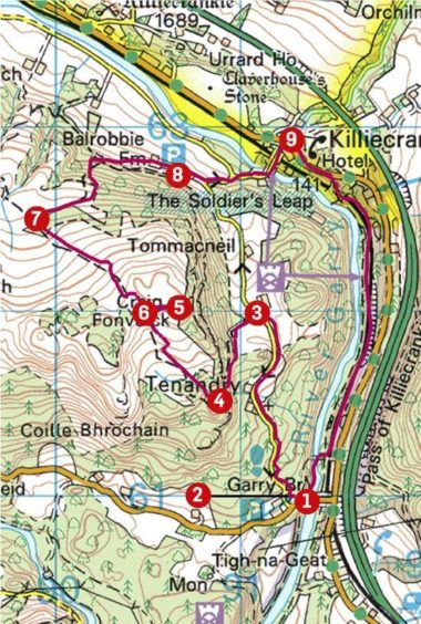
Route:
1. Leave car park by muddy path (left of picnic bench) into wood to reach gap in dyke.
2. Head N on road passing church at Tenandry, then further on entrance to house (Fonvuick) to direction post on left (signed Craig Fonvuick hill loop).
3. Take path S to wooden gate which gives access to wooded hillside.
4. After passing metal gate and wooden bench, the path makes a sharp turn right at a huge fallen tree.
5. The path steepens and zig zags to another gate to emerge on more open ground. Now a wider grass track, it passes steading ruins and steadily rises until a narrow path branches right to summit of Craig Fonvuick.
6. Return to track and go downhill (NW) by regular marker posts until reaching wall.
7. Turn right along the edges of fields and through series of gates before going back into a small wood to come out above Balrobbie Farm.
8. Go E on farm track until it joins the road, and at a fork (signed) go left downhill and over bridges into Killiecrankie
9. Cross main road and follow signs for Pitlochry past hotel before crossing road again and heading down steps to path along side of River Garry (signed Pass of Killiecrankie). Follow the river for around 2km to pedestrian bridge. Cross, then climb steps under road bridge to reach car park.
The Lowdown:
Distance: 8km/5 miles
Ascent: 290m/950ft
Time: 3-4 hours
Grading: Woodland and hill paths, farm tracks and minor roads. Short but fairly steep climb to Craig Fonvuick, suitable for relatively fit walkers. Can be wet underfoot, good footwear advised. Dogs under close control due to farm livestock. Please remember to shut all gates.
Start/finish: Garry Bridge parking (Grid ref: NN 913610), off B8019 near Pitlochry.
Map: Ordnance Survey 1:50,000 Landranger Map 43 (Braemar & Blair Atholl); Ordnance Survey 1:25,000 Explorer sheet OL49.
Tourist Information: VisitScotland, Pitlochry iCentre, 22 Atholl Road, Pitlochry, PH16 5BX (Tel 01796 472215).
Public transport: Buses to Pitlochry, Killiecrankie and Blair Atholl (87) and Tummel Bridge (82), trains to Pitlochry and Blair Atholl.
-
You can follow Alan’s regular mountain adventures at munromoonwalker.com or on Facebook (Munro Moonwalker) and Twitter (@munromoonwalker)
