CREAG CHOINNICH, BRAEMAR, ABERDEENSHIRE
The little pine-clad hill of Creag Choinnich is Braemar’s sentinel, and its prominent position to the east of the village provides sweeping views of the southern approaches to the Cairngorms.
It is very much a local hill, popular with runners, mountain bikers and dog walkers and for primary school nature classes, all making good use of the well-signed network of woodland paths.
It’s also ideal for those looking for a half-day walk, with the circuit being extended to take in the Lion’s Face crag at the eastern edge.
Much of the landscape was cloaked in thick mist on the journey north, the density increasing with the height gained over the Cairnwell Pass.
The car park is on the left, just a few hundred yards in, after making the sharp turn into the village on the road to Linn of Dee. I exited to the east, crossing the A93 and heading up the lane beside the church, passing houses and the school, to reach the gated entrance to the wooded hill.
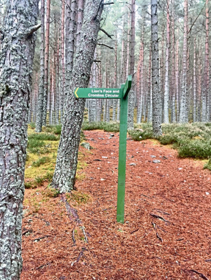
A large notice board spells out your options and points of interest, a helpful guide as the paths start skewing off in all directions. I decided to do my route clockwise, going straight ahead on the lush, copper carpet of pine needles and fallen leaves to reach a signpost directing me left to The Cromlins Viewpoint.
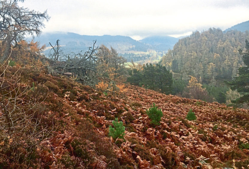
The path goes through a gate and out of the trees along a fence line to reach a comprehensive information board describing the history and flora and fauna of the area. The open aspect affords views over The Cromlins – the crooked fields – to Braemar and the valley of the Dee.
I followed the fence down the stepped path, north at first then curving east, until it dropped to a signpost above the A93 confirming the route to the Lion’s Face.
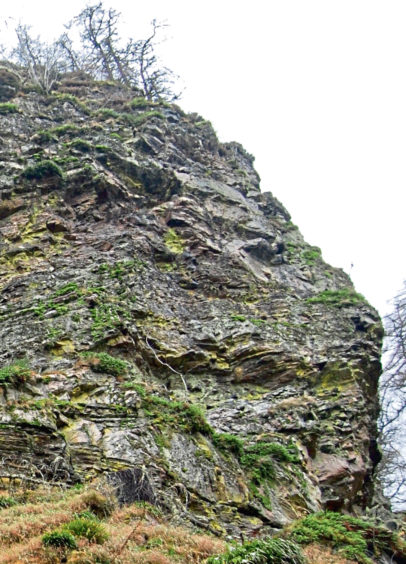
The path continued weaving its way just above the road, over a series of gentle ups and downs under the blaze-red cover of the trees, emerging at a cleared area and then a small quarry, before ducking back into the woods. It soon joined a track along the line of the old military road, and after a hairpin bend which turned west among lichen-smothered growth, I was under the looming crag.
I must admit I was struggling to see any lion profile, but then I wasn’t alone. I had read many reports and spoken to a host of people who had never managed to see any resemblance. One friend whose life is spent in the Cairngorms confessed he had never been able to make it out.
It was only later, when looking through my photos, that I finally spotted it. From most angles, it is just a rock, but this one perspective brought Leo to life. A few feet either way, and the profile vanishes.
Just beyond, I passed a group of pony trekkers taking a break and then swung south on the soft track to reach another signpost. I went right, back into the trees, following the path until a crossroads beside a wooden bench. A hill path now headed steeply right, over rocks and through heather and bracken, getting rougher with height, until it emerged at the huge summit cairn.
I had planned to extend the route to visit the ruins of a cottage often visited by Queen Victoria as relatives of her ghillie, John Brown, had lived there, but the worsening visibility made it a pointless exercise to explore further. I had seen the lion and that would have to suffice for one day.
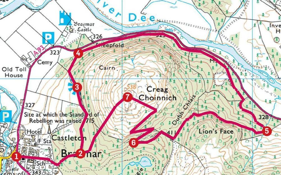
Route
1 Leave car park on east side, cross A93 carefully and follow lane up side of church (signed) past houses and school until it curves right then go through high wooden gate on left.
2 Take main path straight ahead until signpost (Lion’s Face and Cromlins Circular), then go left to reach a viewpoint indicator, passing through another gate en route.
3 Continue north down stepped path by fence line and then east parallel with the road to drop to another sign (Lion’s Face).
4 Go through gate on right and follow undulating path through trees until it emerges at a small quarry. The path goes left into the trees to connect with a track which is followed to hairpin turn.
5 The track now heads west under the crag known as the Lion’s Face before trending south down Queen’s Drive track until another sign, where you head right, back into the trees.
6 At another path junction by wooden bench, turn sharply right on rough hill path which twists up to summit of Creag Choinnich.
7 Drop south-west on obvious path, rocky at first, then more gently into the trees, until you reach main gate.
The Lowdown
Distance: 8km/5 miles
Ascent: 290m/950ft
Time: 3-4 hours
Grading: Woodland paths, couple of steady ascents, one on rough hill path. Can be wet underfoot, and slippery on rocks and exposed tree roots. Suitable for relatively fit walkers, sturdy footwear advised.
Start/finish: Balnellan Road car park, Braemar (Grid ref: NO152912).
Map: Ordnance Survey 1:50,000 Landranger Map 43 (Braemar & Blair Atholl); Ordnance Survey 1:25,000 Explorer sheet OL49.
Tourist Information: VisitScotland, Ballater iCentre, Station Square, Ballater, AB35 5QB (Tel 01339 755306).
Public transport: No public transport to Braemar from south, buses from Aberdeen.
