The light was just rising as I left the car, an early start to ensure a parking spot and make the short border crossing for a wander up to the escarpment of Lundie Craigs.
The boundary between Perthshire and Angus has a bit of fun here, twisting between the trees to allocate the two sections of woodland, Pitcur and Drumsuldry, to different counties.
It was third time lucky for me as I had attempted to do this walk twice in previous days only to find the car park filled to overflowing. Arriving just before dawn seemed the best solution.
Even at this time, however, the main road was busy and had to be crossed with care. I took the track up to the farm and then swung left round the buildings to the edge of the treeline where it curved right to head into Angus and reach Ledcrieff Loch. This stocked loch is popular with anglers, but the only angler I saw was a heron, trying its luck in the still waters.
The line of crags was revealed dead ahead, and I followed the frosted track up the right-hand side of the loch, continuing on a path which led out of the trees to open ground. A short distance ahead, the path split and I took a left-hand branch which climbed steeply up to the treeline.
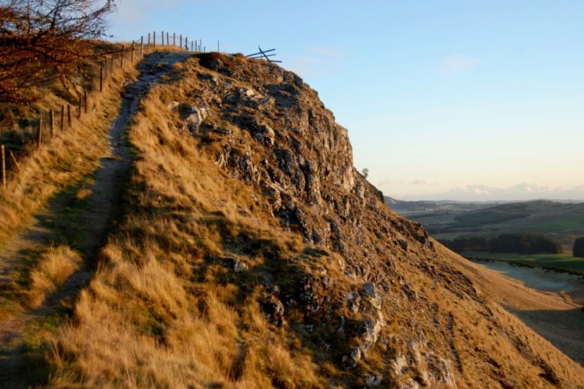
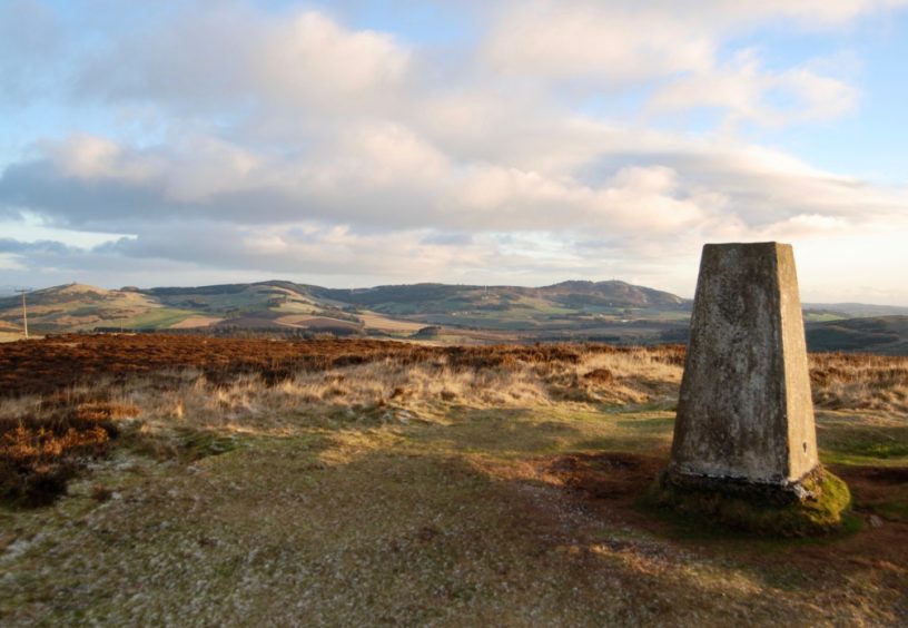
It felt surprisingly surreal to be walking along the top of the crags with not another soul around, the crunch of frozen grass and leaves echoing with every step. This approach will not suit everyone, and you need to be mindful of the drops to the right, but there is no real problem and I was soon at the trig pillar which marks the summit, enjoying wide views of the Sidlaws.
Those feeling a little less adventurous can reach the same point by taking the track which swings left in front of the loch and follow it up through the trees until it swings right to emerge beside the transmitter mast.
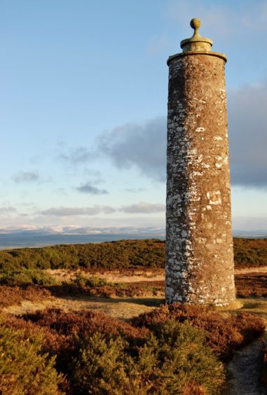
The onward route to Keillor Hill involved crossing boggy terrain and then deep heather to follow a fence along the boundary line. I went through a gate back into Perthshire and strolled to the Mackenzie Meridian. This stone tower is the work of astronomer James Stuart-Mackenzie, who is also linked with the observatory tower on nearby Kinpurney Hill. It sat on the same line as his former home of Belmont Castle, near Meigle.
A metal gate to the right led down to Long Loch where there was a choice of rough paths running along the shore to its end. Staying to the right of a fenced field of cattle, I took a vague rising line through the gorse to emerge at a wooden gate and the path below the crags.
Instead of heading back towards Ledcrieff Loch, I turned left and climbed through the heather by the treeline to pick up a path running south-west along the edge of Pitcur Wood. I crossed the stile over the high fence and turned right, dropping on a path which became a stony track.
The final descent was enlivened by the colourful flashes of goldcrests flitting among the foliage on their hunt for breakfast. I emerged at the high metal gate passed near the start for the short hop back to the now full lay-by.
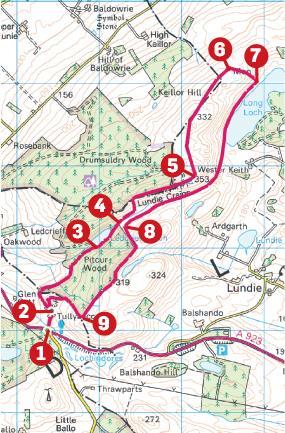
Route
- From car park, cross road carefully and head up track (signed for Ledcrieff Fisheries and Tullybaccart Farm) passing to right of farm buildings.
2. Ignore gated track on right, stick with main track running left which then curves north-east, rising through trees to reach Ledcrieff Loch.
3. Keep going north-east along right edge of loch then continue on path to emerge from trees (Alternative route: take track going left of loch and follow as it twists all the way to summit trig pillar on Lundie Craigs).
4. Once out of trees, follow path by stream for short distance then take path on left rising steeply to treeline running along top of crags and climb to summit.
5. Drop over boggy ground north then trending north-east to Keillor Hill, go through metal gate on left and continue to stone Mackenzie tower.
6. Start descent by going through metal gate on right and taking boggy path east towards Long Loch.
7. Follow rough paths south along shoreline and at end of loch climb slightly above fenced field to emerge at gate. Go through gate and take path running below crags towards Ledcrieff Loch.
8. Do not go back into trees. Instead turn left to climb south-east beside treeline then turn south-west to follow path beside trees to high fence with stile.
9. Cross stile and head right, at first on path then track which twists down to reach high metal gate and join incoming track.
Lowdown:
Distance: 8km/5 miles
Ascent: 290m/950ft
Time: 3-4 hours
Grading: Farm tracks and hill paths. Moderate walk, suitable for most levels, some steeper sections and care needed on path along top of crags, not advised for young children or in poor conditions. NB: There is an alternative route which avoids this section. Some boggy sections, good footwear advised. Dogs under close control.
Start/finish: Car park on south side of A923 Dundee – Coupar Angus road at Tullybaccart (Grid ref: NO 263359).
Map: Ordnance Survey 1:50,000 Landranger Map 53 (Blairgowrie & Forest of Alyth); Ordnance Survey 1:25,000 Explorer sheet 380.
Tourist Information: VisitScotland, Dundee iCentre, 16 City Square, Dundee, DD1 3BG (Tel 01382 527527).
Public transport: None to start. It’s on Dundee to Coupar Angus bus (No 59) route but no stop nearby.
- You can follow Alan’s regular mountain adventures at munromoonwalker.com or on Facebook (Munro Moonwalker) and Twitter (@munromoonwalker)
- Please observe government coronavirus safety guidelines in all outdoor activities.
