Corwharn, Glen Prosen, Angus
THERE’S always a child-like sense of excitement when you follow a path without being exactly sure where it will take you.
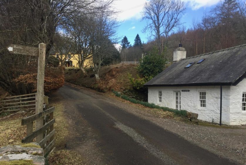
The path signed by the old, weathered wooden post with the faded lettering across from Glen Prosen Church isn’t marked on some maps, but it promised a passage to Cormuir from where I could do a short hill circuit on the western side of the glen.
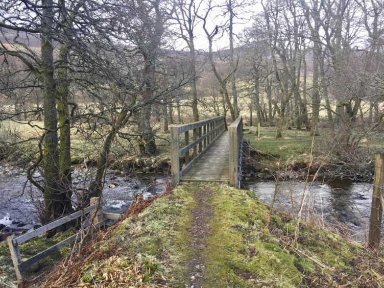
Once through the pedestrian gate, I crossed the wooden bridge over the lively Prosen Water to turn right into the trees. The neglected feel of the path was emphasised as it ran alongside the water with a bit of dodging about, a combination of collapsed fence posts due to embankment erosion and fallen trees and branches.
There were occasional arrows showing the correct line, one in particular proving handy when the path took a sharp dip to follow the bend in the river. This led round the outskirts of a field, and over a series of stiles past the house at Dalairn before turning west back into a wood.
This section was overgrown and the path faint, but sticking with the fence brought me out at the road for the short walk up to the farm at Cormuir, and then just beyond, the right of way through to Glen Markie and Glen Isla.
Hill of Strone lies dead ahead and the easy-angled track led quickly to a levelling across its slopes. Once through a metal farm gate, I broke off right to make the short ascent of this hill by an obvious grass ramp. There were glimpses of the Glen Doll high tops as they were swallowed by roiling waves of grey.
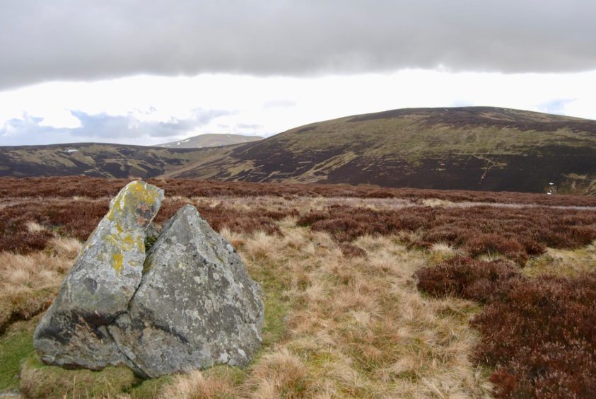
There is no summit cairn, but just off the highest point there is a curious rock which has been neatly sliced in two by exposure to the elements.
I dropped to regain the track further along as the hail bulleted in head-on from the west, and I was happy to split off left at the track junction and take the assault from the side despite the impending bog trot up by the fence.
There were traces of paths through the glaur and I was soon at the wooden gate which allows entrance to the summit area of Corwharn.
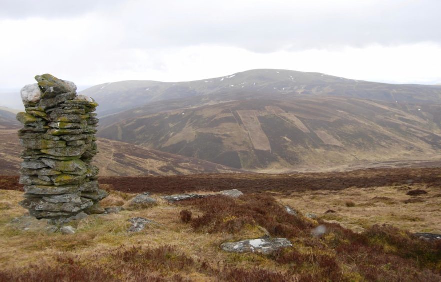
The prominent pencil-slim cairn is not the highest point; that remains unmarked a little further on.
The name Corwharn comes from the Gaelic Corr an fhuarain and means ‘pointed hill of the springs’. It was formerly on the Grahams list at one metre above the 610m mark, but was recently struck off when re-measurement showed it to be just 609m. It is often climbed in conjunction with its higher neighbour Cat Law on a longer round from further east.
The simplest way ahead is to return to the gate and follow the fence east as it curves down and then round over Hill of Adenaich, but in clear weather it’s quicker to take a direct line to the fence.
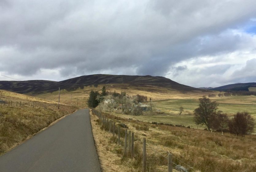
Beyond the high point of this hill, the fence took a turn right to reach a new section of bulldozed track which then joined an older, grassier line swinging gently down through a few twists and turns to reach the road.
The skies had now cleared and I walked down into a rainbow with the white buildings of Prosen shining through the three cover below, a perfect ending to a short day.
ROUTE
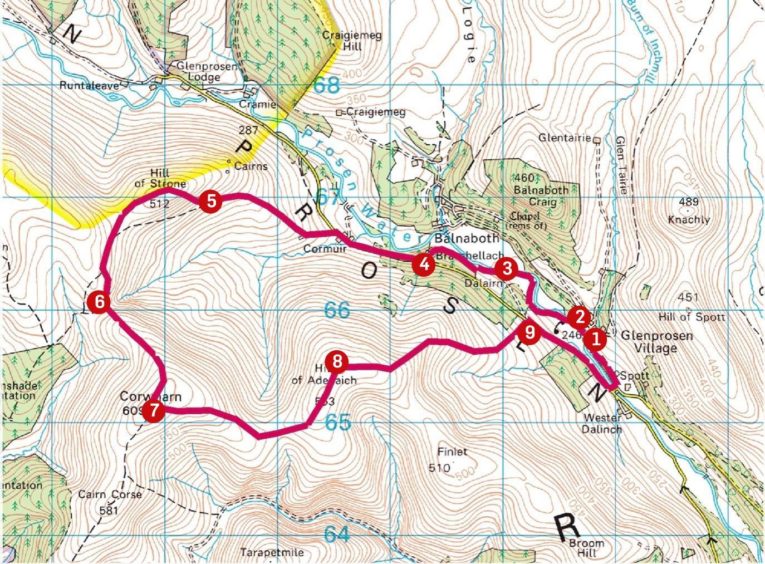
1. From parking, turn right on road and cross stone bridge over Burn of Inchmill then turn left through pedestrian gate on path signed for Cormuir and Backwater (opposite white cottage – Burnmouth) to cross wooden bridge and turn right into wood.
2. Follow path along side of Water of Prosen by fence line. Drop down at bend in river (marker post) and keep following over series of stiles round edge of field and house (Dalairn).
3. Once over last two stiles (either side of farm track) turn right and head through trees by fence to emerge on road at sign for Cormuir.
4. Walk west and immediately past farm go through gate on left on track (signed: public path to Glen Markie and Glen Isla).
5. When track levels out at metal farm gate, make short diversion to ascend Hill of Strone, otherwise continue on track until junction.
6. Turn left to follow fence rising south-east to Corwharn over rough ground (faint path traces) to reach wooden gate, go through this and head south-west to tall cairn. Note: this is not the summit, highest point is unmarked.
7. Retrace steps to gate or take more direct line east across open ground to pick up fence and follow as it drops then rises again over Hill of Adenaich.
8. Keep following fence as it turns right to join new section of track which drops to join older grassy line twisting down to metal farm gate and road.
9. Go right until reaching stone bridge near Spott, cross and turn left back to parking.
INFORMATION
Distance: 12.5km/8 miles
Ascent: 540m/1,770ft
Time: 3.5-4.5 hours
Grading: Woodland path, farm and estate tracks, minor roads. Pathless ascent to Corwharn over rough, boggy ground, suitable for walkers with good degree of fitness and experience, especially in less than clear conditions. Can be very wet underfoot. Dogs under close control due to farm livestock.
Start/finish: Glenprosen Parish Church, Glenprosen Village, signposted from Dykehead on B955 (Grid ref: NO 324658).
Map: Ordnance Survey 1:50,000 Landranger Map 44 (Ballater & Glen Clova); Ordnance Survey 1:25,000 Explorer sheet OL 53.
Tourist Information: VisitScotland, Dundee iCentre, 16 City Square, Dundee, DD1 3BG (Tel 01382 527527).
Public transport: No public transport to Glenprosen, nearest bus service to Kirriemuir.
