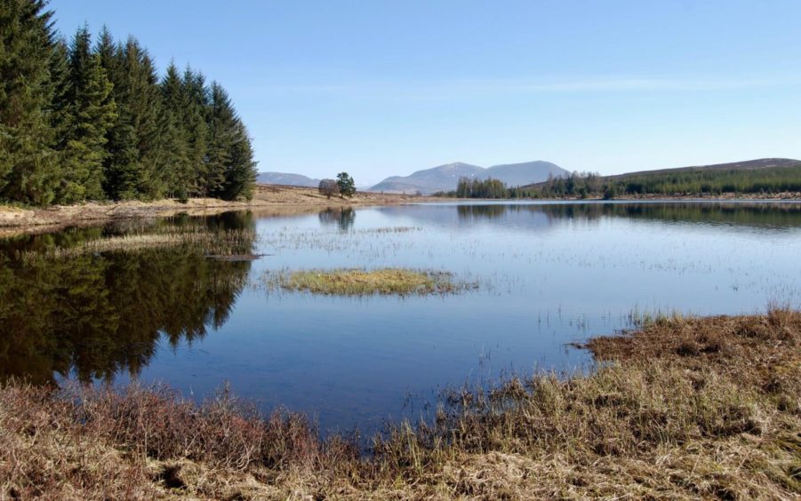
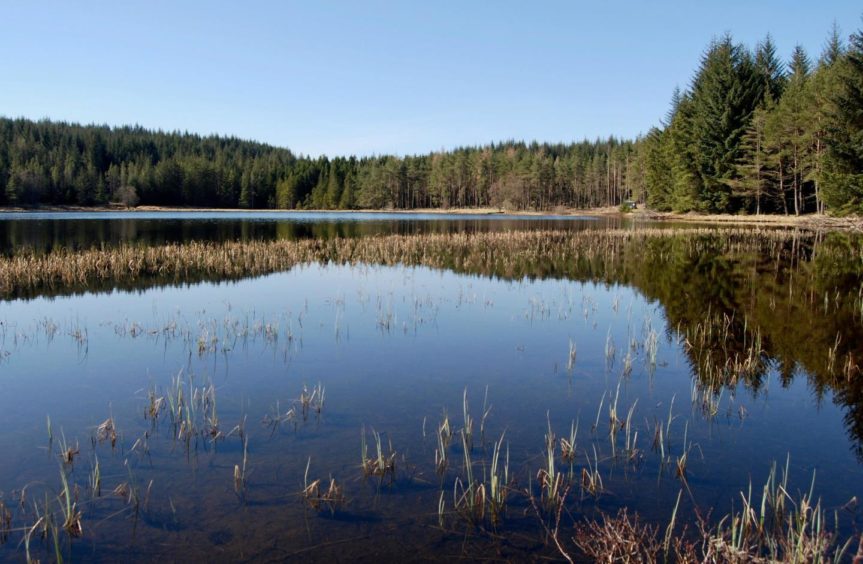
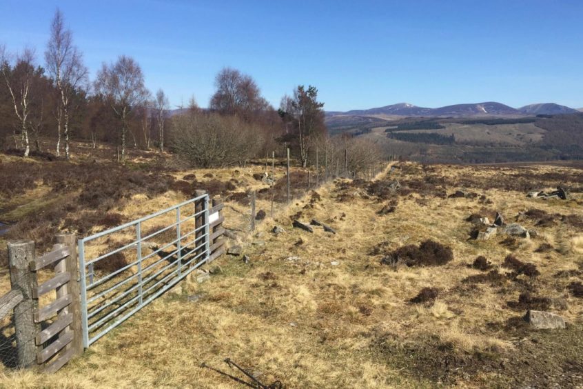
Loch Bhac lies unruffled in the Allean Forest between the River Garry and Loch Tummel, sheltered by a horseshoe fringe of trees which reflect perfectly in its mirror-like waters.
The rights of way coming in from the north converge to form a Y-shape as the moorland yields to forest cover and provide an ideal circuit of this lovely little loch.
The western branch is an old coffin road, used for centuries to carry the deceased from settlements in the Tummel Valley over to the medieval St Fillan’s Church at Old Struan. You can’t help but admire the endurance and tenacity of those who made these journeys.
The freshwater loch is well known to members of the Pitlochry Angling Club who access it from the south, but the northern approach gives a longer – and finer – day out that won’t prove too taxing. However, this is a walk best kept for good weather: the trek over open moorland may prove disheartening in wind and rain or when the cloud is down.
The starting point from a layby on the A9 meant a short walk along the side of the busy road but this was fleeting, the track to Invervack just a few hundred metres away. A quick turn left at the sign for Balnastuartach Farm and the traffic noise had already been replaced by the sound of bleating lambs and their attentive mothers.
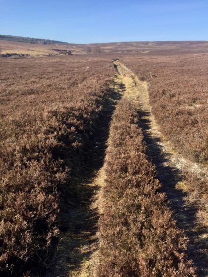
Leaving the track by a grassy branch on the right, I climbed through the scattered birch wood. The bulk of Beinn a’ Ghlo filled the horizon behind, and the land opened out with the tree cover growing ever more sparse as the path trailed its way on a gentle upward angle through the heather.
The first sighting of Loch Bhac was a welcome one amidst this continuous auburn blanket, sunlight sparking silver flashes on the water down to the left.
Just before the path heads back into trees for the final turn down to the loch shore, it crosses the Allt Ghreamaich, a small burn with natural rock shelters and sinister connections. This is where the assassins of King James I were found hiding as they attempted to escape after his murder in Perth in 1437.
I lingered a while at the lochside in the sunshine, a perfect lunch seat, not another soul around. Somewhat reluctantly, I got back on the track to head south-east at first through the trees to reach a gate, then followed the signs for the return, right, then right again. This next section was a bit of a quagmire and needed some fancy footwork to avoid the worst of the glaur, but it eased at the fenceline where I crossed back out to open ground.
The path followed the fence by the plantation for about a kilometre then went back into an older section of wood to drop all the way, keeping right at a marked junction, to emerge on the farm road running parallel to the Garry.
The short diversion west to Old Struan and its kirk is worthwhile, otherwise keep going east to the underpass and a path through a sheep field which turns into a track until it narrows and presents an easy step-over to your parking place.
Route
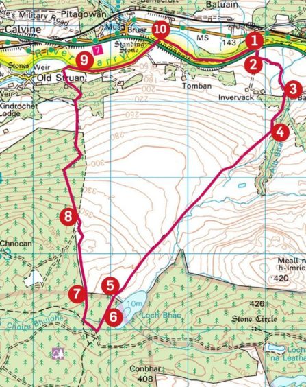
1. Start from Layby 53 on A9 (if heading North: 52 South), walk back east few hundred metres on wide grass verge and turn right into entrance track for Invervack.
2. Turn first left to Balnastuartach Farm. After track swings right, go through gate and just beyond take grassy track on right to metal gate giving access to wood.
3. Stay on main line of this track as it rises through trees to open moorland heading south-west.
4. Follow track to horizon, ignoring any side branches, then drop gently with Loch Bhac now in view down to left. Cross burn to reach fence and high gate with pedestrian side gate giving access to wood.
5. Follow track through trees until it curves left to the shore where there is locked hut and wooden seat.
6. For the return, get back on track heading SE for short distance until gate leading to wide gravel area, turn right (marked Public Footpath), then right again soon after by another marker post (yellow arrow) on muddy track through trees to reach fence.
7. Go through high metal gate in fence and take path along edge of plantation and after about 1km, use another gate on left to head back into trees.
8. Follow this track gently downhill out of trees and keep heading north until reaching marker post at junction. Take right-hand option which leads downhill and across field to stile and minor road.
9. Walk east by the River Garry past couple of farm entrances, keeping left to reach A9 underpass via wooden gate.
10. Follow grass path east along edge of field, continuing on track to fence across from layby.
Information
Distance: 12km/7.5miles
Ascent: 265m/870ft
Time: 3.5-4.5 hours
Grading: Quiet circuit that should be fine for all ages, mostly on moor and woodland paths, farm tracks. Some walking on minor road and short section by side of busy A9 to start. Can be muddy in parts, decent footwear advised. Dogs under close control – farm livestock and ground nesting birds.
Start/finish: Layby 53 heading north on A9 (Grid ref: NN 836657).
Map: Ordnance Survey 1:50,000 Landranger Map 43 (Braemar & Blair Atholl); Ordnance Survey 1:25,000 Explorer sheet OL49.
Tourist Information: VisitScotland, Pitlochry iCentre, 22 Atholl Road, Pitlochry, PH16 5BX (Tel 01796 472215).
Public transport: None to start, buses and trains to Blair Atholl (3km from starting point).
