Loch Glow is a shining jewel in the midst of the Cleish Hills, a modest range a few miles south-west of Loch Leven, and its circuit provides a quiet, satisfying tour of lochans and hill forts.
There is some rough ground to negotiate and one sharp but short-lived ascent, but there are always strands of paths to follow, even if they can be faint at times.
In fact, the most strenuous part of the day could be the drive from the B914 west of Kelty. The single-track road is badly potholed, and needs care if you would prefer your car to arrive in one piece.
The starting point is a couple of miles up the road, a layby at the mouth of a forestry track (signed: Loch Glow) with space for five or six vehicles. If full, there is further parking available nearby.
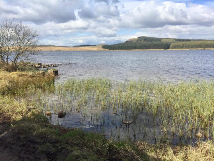
There has been a lot of recent clear felling, and the wall of pine that once crowded the left-hand side of the stony track heading west is no more. After a short distance, I branched right to the anglers’ car park and the shoreline.
The loch is a popular spot for fishing, and there were numerous rods and bivvies set up along the southern shoreline as the anglers patiently waiting for their catch. There were also a few trying their luck in the water along the north shore.
The path along this stretch was muddy in parts, the waters being driven along by a lively breeze to lap over the boundaries.
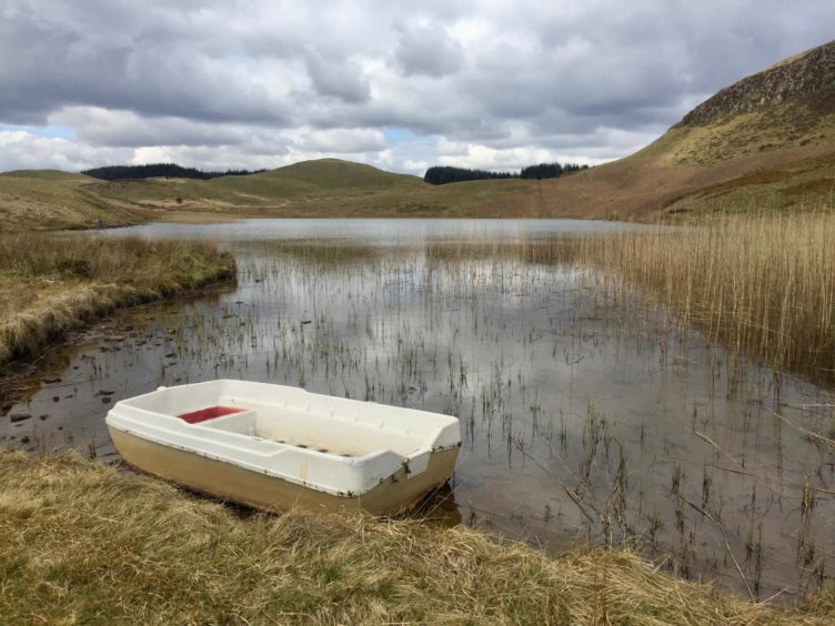
At the end of the treeline, I climbed a wooden stile on to the open spaces of Tipperton Moss and followed fainter lines close to the shore until I reached a drystone wall running west to Black Loch. The rocky ramparts of Dumglow, the next objective, rose impressively to the right of this body of water.
It’s possible to go along either side of this little loch but the sticking to the south is probably the better bet. There’s a old barbed wire fence to squeeze through (no real problem) and then a broken wall to cross before the short steep ascent by an old fenceline to the top of this old hill fort.
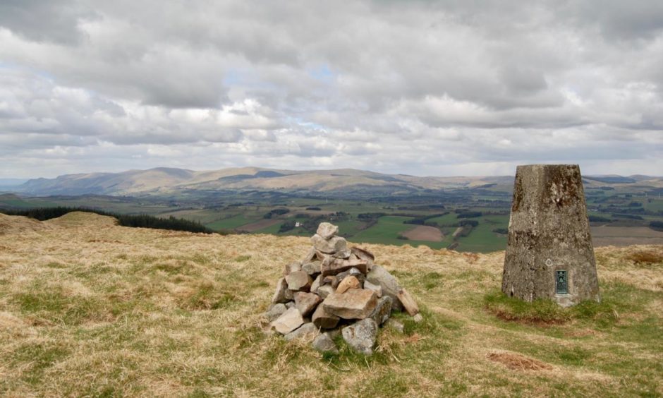
The summit cairn and trig point lie to the right of the fence and provide wonderful views to the Ochils strung out along the western horizon. There’s also a fine line of sight to Loch Leven, and, closer to home, Knock Hill and Saline Hill.
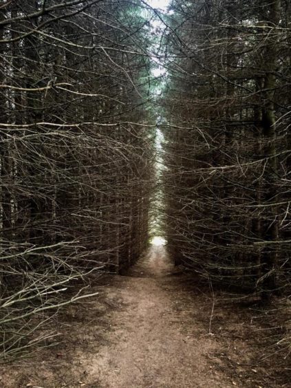
An obvious path led down to a stile over the fence above the next swathe of forestry, continuing to a dark cave-like entrance in the trees. The second I entered, every sound seemed to be snuffed out, blocked by this gloomy but dry corridor which dropped down to a firebreak crossroads before continuing through a wider passage of more boggy ground.
Beyond a signpost and another wall and stile loomed the middle peak of three grassy mounds known as The Inneans. (The meaning is often suggested as ‘onions’ and that may come from a version of ‘uinnean’, whereas ‘innean’ can mean anvil or rock, hill.)
I made a short diversion to the furthest right triplet for the view down to Loch Glow, then made my way back over to the middle summit, descending off the other side to a good path.
This winds its way round to the most impressive of the three, Dummiefarline, a shapely mountain in miniature with a fine cairn on its crest. From the summit, the path could be seen running all the way back to the road with the twin blue specks of Lurg Loch and Dow Loch lying in almost perfect symmetry below.
I skirted the shore of the former to emerge at a metal farm gate leading on to the single-track road. The walk back up to the car took around ten minutes.
Route
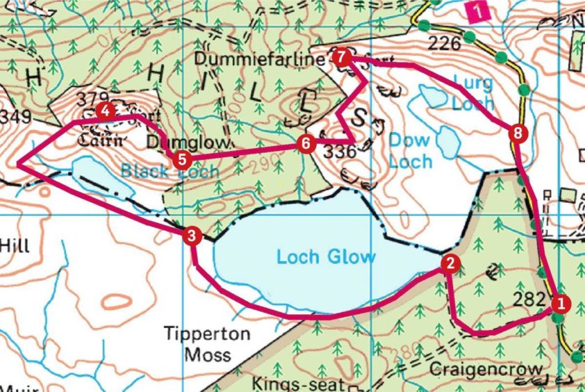
1. Take forestry track west from parking, then first right leading to angling club car park and Loch Glow shoreline.
2. Follow path along southern shore to stile, continue round to right on vague paths to drystone wall.
3. Stick with line of wall to Black Loch. Continue above left shore over rougher, pathless ground, cross fence and turn right to head uphill before crossing wall and following fence line steeper up slopes of Dumglow. Summit to right of fence.
4. Head east from summit downhill to fence, cross wooden stile and stay on path until it enters obvious gap in forestry.
5. Descend dark corridor through trees, crossing firebreak, and continue down boggier section. Pass signpost to emerge on open ground with middle mound of The Inneans looming ahead.
6. Cross wall by stile, then make short push to summit. Drop north to pick up path curving round to hill fort of Dummiefarline (cairned summit).
7. Follow good path heading east which then curves south-east past Lurg Loch and down to metal gate giving access to road.
8. Walk south along road for about 10mins to parking.
Information
Distance: 7km/4.5 miles
Ascent: 250m/820ft
Time: 2.5-3.5 hours
Grading: Forestry road and tracks, varying degrees of paths, some rough ground with short section of minor road walking to finish. Short but steep climb to Dumglow. Can be very wet underfoot, good footwear a must. Sheep and cattle grazing beyond Loch Glow, please keep dogs under close control.
Start/finish: Parking area at entrance track to Loch Glow (Grid ref: NN 100955) on Cleish Hills single-track road heading north from A909.
Map: Ordnance Survey 1:50,000 Landranger Map 58 (Perth & Alloa); Ordnance Survey 1:25,000 Explorer sheet 367.
Tourist Information: VisitScotland, St Andrews iCentre, 70 Market Street, St Andrews, KY16 9NU (Tel 01334 472021).
Public transport: None to start point.
