Craig Maskeldie, Glen Esk, Angus
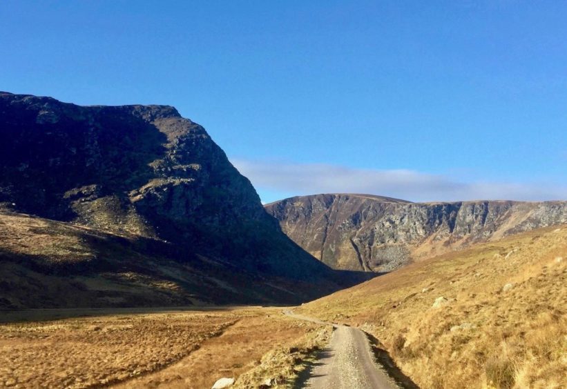
The dark, imposing crag of Craig Maskeldie is a familiar presence to those who regularly walk the routes around the Water of Lee.
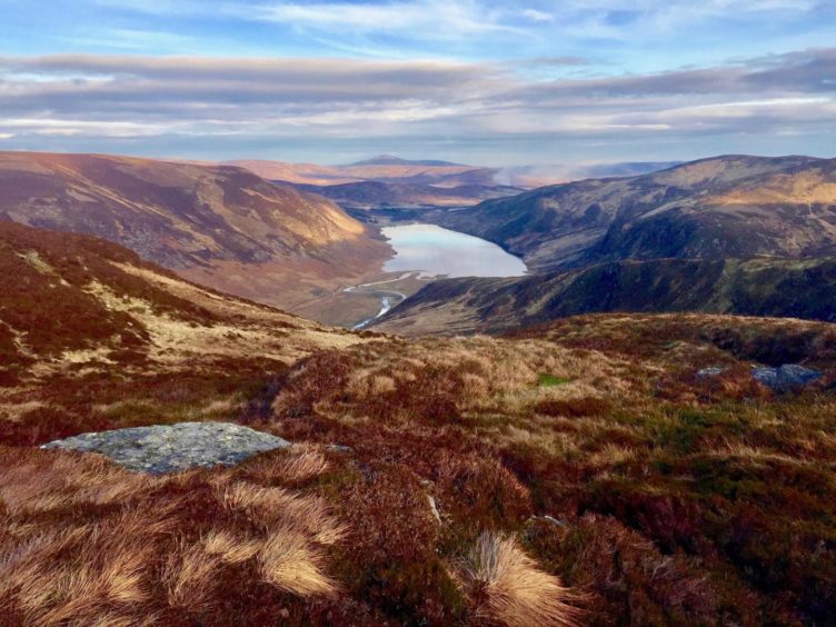
It is a superb viewpoint, one of the finest in the Angus glens, an unbroken line of sight right down the length of beautiful Loch Lee.
Reaching this stance requires a bit of effort, but it’s never as hard as you imagine, and there are plenty welcome distractions round every corner.
From the busy car park at Invermark, the initial walking is easy. After crossing the stone bridge, the track passes Invermark Castle and passes through a tree-lined section before reaching the ruins of Glenesk Old Parish Church.
The castle originally dates from the 1300s, but the tower that stands today is the result of a rebuild in 1526 and further work in 1605. Some 200 years later, it stood in ruins but some of the stonework and roof slates were used in the building of nearby Lochlee Parish Church.
Beyond the trees are the remains of another church, Glenesk. During harsh winter days, I find the small, rectangular graveyard has a special poignancy, the thought that the souls of the long-departed are gazing down the loch for eternity.
The track along the northern shore makes for speedy walking. It’s a bit of an adder hotspot in the warmer weather and they can often be seen basking at the fringes of the vegetation. Watch out as well for slow worms, their smooth, rainbow skins shimmering in the sunlight.
By the time the head of the loch has been reached, the bold Maskeldie is starting to take control, its shadow dominating the landscape. Just as the track starts turning north, break off left to cross a small wooden bridge and then follow a fainter path round to the Falls of Unich.
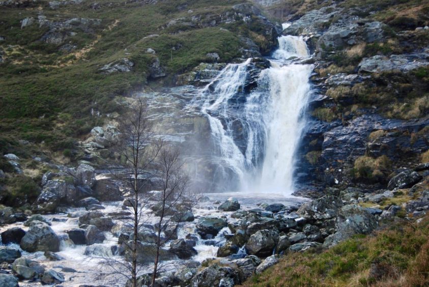
Even on the calmest days, the water flow is spectacular, and it’s a fine spot to take a break before starting the main climb. Always keeping an eye out for any adders in the heather, of course.
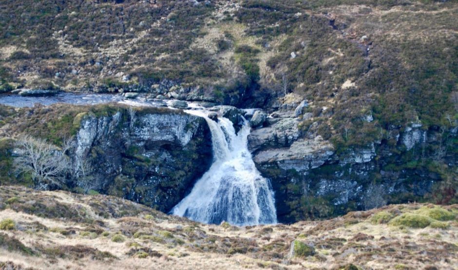
The path twists its way steeply up by the right of the water into a rock-cluttered gully. It’s rough and the way ahead often looks adventurous, but it is never difficult, its bark far worse than its bite, and the angle soon relents, the ground levelling out above the next impressive waterfall, the Falls of Damff.
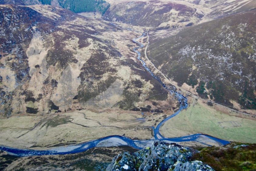
Just beyond is a pedestrian bridge, and once across there’s a short, push up through pathless heathery terrain to the twin tops of Craig Maskeldie. The northern one is the higher and gives a vertiginous view of the long, blue snake of the Water of Lee as it slithers along the floor of the glen.
The Falls of Damff are best seen from here as well, with Hunt Hill to the right and Lochnagar further back on the horizon. To the north, the most easterly Munro, Mount Keen, stands proud. Maskeldie’s southern summit, however, just 500m away, provides the better perspective of Loch Lee.
A little further on, an imperceptible rise leads to Carn Lick. From its southern flanks you can pick up the rough, boulder estate track heading steeply downhill along the line of the Shank of Invergrundle. About halfway down, the crags of Maskeldie are shown as an unbroken wall, the ink well of Carlochy cradled below.
As I made my way down the track, an estate vehicle passed, followed by a stalker’s pony trotting after it. My appearance seemed to confuse it a little, and it held back a little to walk with me, probably in the hope of some free food. Eventually, it decided the best bet was to follow the truck home.
The final zig-zags brought me out at the farm buildings and a left turn over the bridge to the inward track for the final leg.
As I headed back along the shore, the waters of the loch lit up with a final flourish as the sun began its slow dip beneath the surrounding hilltop silhouettes.
Route
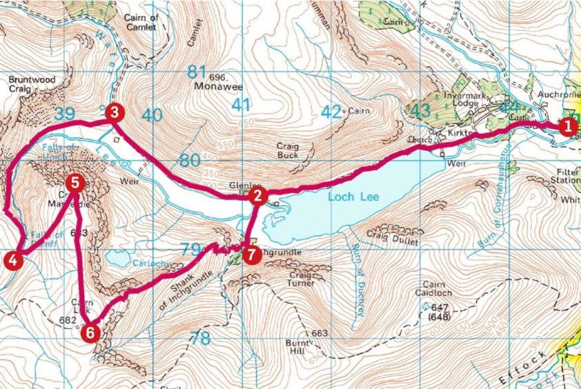
1. From Invermark parking, head west past Lochlee Church, cross bridge and take track passing Invermark Castle then Glenesk Old Parish Church ruins and graveyard and continue to end of Loch Lee.
2. Ignore left turn and keep following main track as it curves north-west to reach small wooden bridge on left over Water of Lee.
3. Cross bridge and follow path to Falls of Unich, then continue on rougher path up gorge on right side of water until you reach Falls of Damff.
4. Cross footbridge on left above the falls and make short heathery ascent north-east to summit of Craig Maskeldie (687m).
5. Return south over lower top (683m), continue on same line to top of Cairn Lick.
6. Drop to pick up rough track running north-east along line of Shank of Inchgrundie to reach farm buildings at Inchgrundle.
7. Turn left to track crossing vehicle bridge over Water of Lee, then turn right and follow track back to Invermark.
Information
Distance: 13.5km/8.5miles
Ascent: 635m/2,100ft
Time: 4-5 hours
Grading: Vehicle and farm tracks, hill paths, some pathless terrain. Fairly steep, sustained climb, suitable for walkers with good level of fitness. Dogs under close control – farm livestock and ground nesting birds.
Start/finish: Car park at Invermark, 6km west of Tarfside, Glen Esk (Grid ref: NO 446804).
Map: Ordnance Survey 1:50,000 Landranger Map 44 (Ballater & Glen Clova); Ordnance Survey 1:25,000 Explorer sheet 395.
Tourist Information: Dundee iCentre, 16 City Square, Dundee DD1 3BG (Tel 01382 527527)
Public transport: None.
