Clais Fhearnaig, Forest of Mar, Cairngorms
The sky was a curious mix of threat and promise, the river lively and loud, as I drove round by Linn of Dee between showers. There was even a rainbow to greet me.
The Cairngorms are at their verdant best in a confused mix of weather, revelling in a light that constantly changes. High or low, they always deliver.
I was taking the low road this time, a circuit that links the glens of Quoich and Lui and the waters of the Quoich and the Dee, using the Clais Fhearnaig, a beautiful pass that affords an easy connection. The name means narrow hollow of the alders (clais, pronounced clash, is ditch or furrow), and it is one of many ‘hidden’ gems of the Cairngorms.
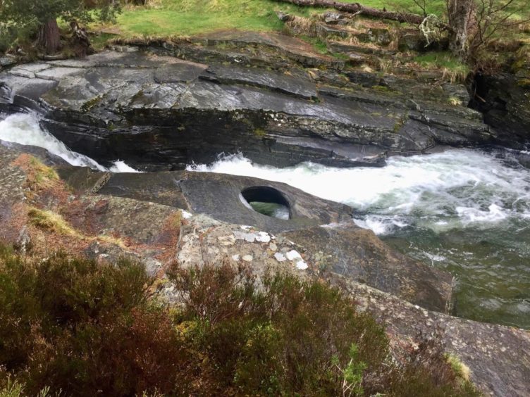
I set off in sunshine but within minutes the rain was back on. Perfect timing – it’s always better to visit water features when it’s wet and I was making the small detour to see The Punch Bowl. This round hole carved into the rock acts like a mini-whirlpool as the waters pour over the slabs.
There’s no need to retrace your steps – a path going right into the trees gets you back on course further on. The track used to closely follow the line of the river, but severe erosion caused by floods a few years back mean a higher line is now recommended.
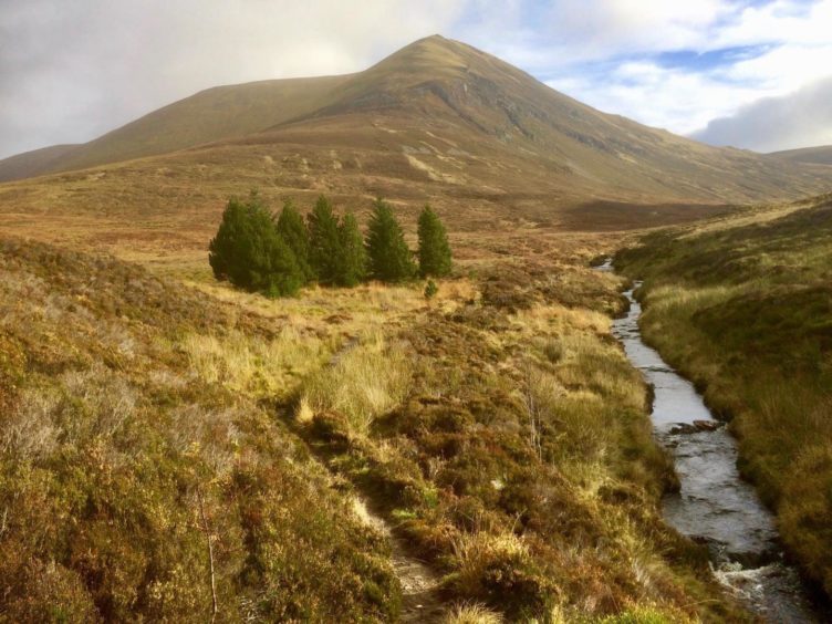
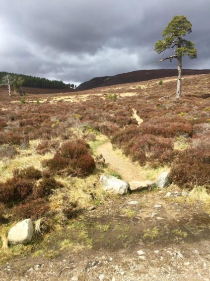
It’s rough and stony, and there a few steeper gradients, but the gnarled and twisted Scots pines lining the route keep the mind occupied. This is a favourite route to Beinn a’ Bhuird, and the vast, bulky Munro starts to dominate the landscape to the right.
The track starts to drop to rejoin the original line, and after crossing a small stream, I found the path on the left and said my goodbyes to Beinn a’ Bhuird. This wriggles its way gently over the moorland to the obvious V-shape looming ahead.
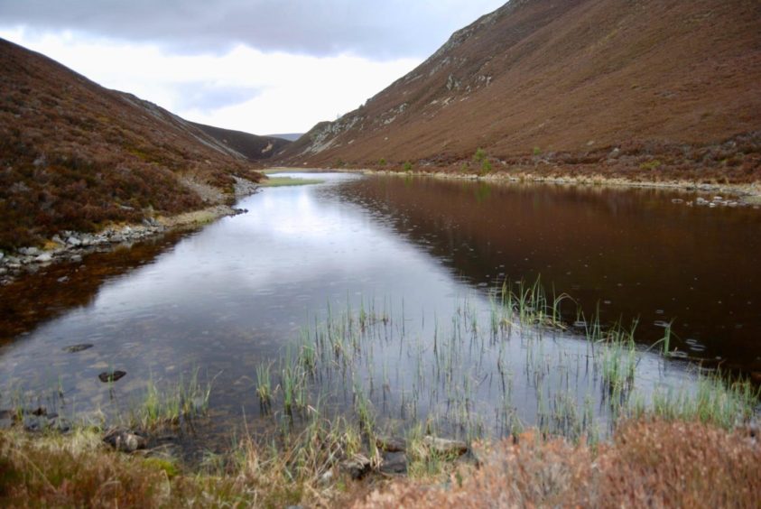
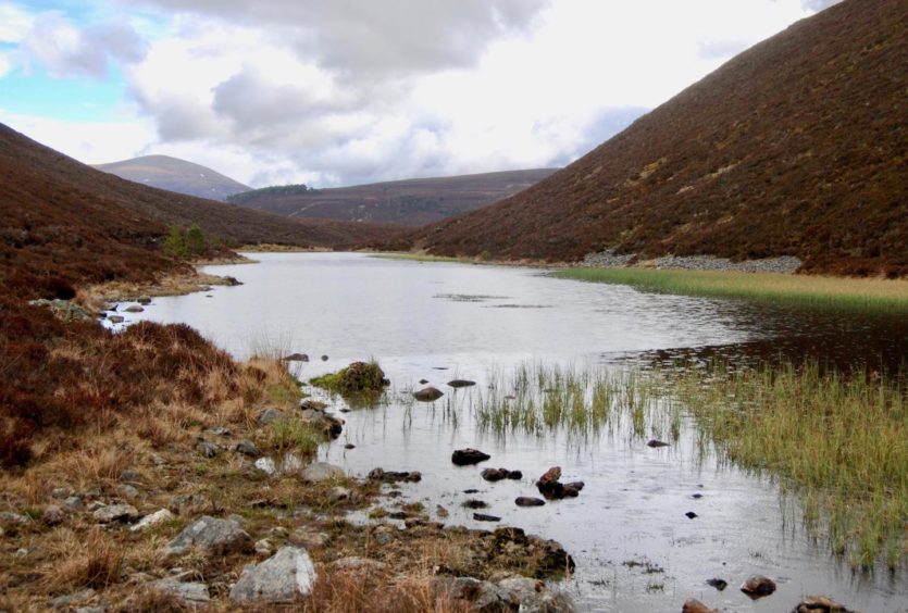
The little lochan cradled in the narrows is something of an oasis, a lovely place to spend some down time. The path continues along its edge and then past another, smaller, pool before twisting its way out of the confines on to more open slopes.
The rain came on as I dropped down into Glen Lui, the consolation being another rainbow over the distant high peaks to my right. By the time I reached the bridge, the sun was out again, and the walk through the trees of the Doire Bhraghad in full waterproofs had the same effect as being in a sauna.
A short section of road walking and you reach the entrance to Mar Lodge. There are plenty of direction signposts to escort you right then along the banks of the Dee towards Victoria Bridge.
Another waymarker pointed through a wooden gate and out of the trees. A right turn led to a crossroads: I kept straight ahead on a darker, muddier tree-lined track, which opened out to a grassier line round a fence line.
There was a gate, then an old stone bridge and another gate, before I passed a house, keeping right to take the muddy lane leading out to the road. The rain came on to accompany me on the short walk back to the car. It felt like I had come full circle.
Route
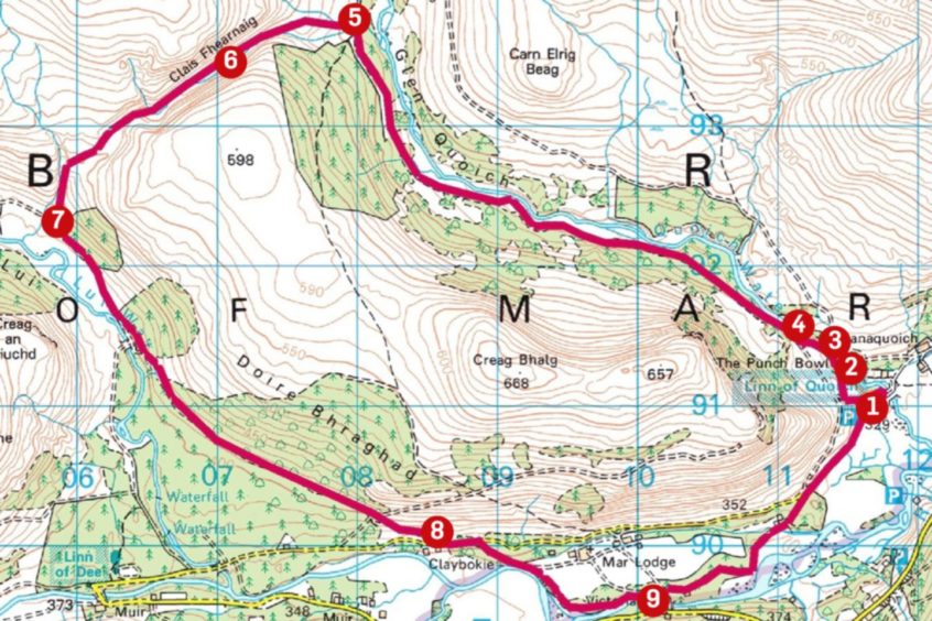
1. Walk east from parking and almost immediately turn sharp left on path into trees which soon joins track heading west up Glen Quoich.
2. Turn right at first junction and follow path to bridge at Linn of Quoich to see The Punch Bowl, a round hole carved out of the rock.
3. Retrace your steps a short distance but where path turns sharp left, head right on another path and follow this to main track.
4. Stick with main track for 4km as it becomes rougher and climbs through trees. After crossing stream, watch for path on left.
5. Follow this gently uphill over open moorland to reach the lochan in the narrow gap of Clais Fhearnaig.
6. Stay with path on right side of water, pass another smaller pool, and follow out other side and down open slope to Glen Lui.
7. Turn left on track to reach Black Bridge but don’t cross. Instead, go left into trees and follow main track for 2km dropping to minor road at Claybokie.
8. Walk short distance east along road and head right down tarmac towards Mar Lodge. After a bend, go through gate in fence on right (signs) and follow path along raised grass bank by the line of the River Dee.
9. Just before Victoria Bridge, follow signs to go through gate on left. Pick up road and continue east, going straight ahead at crossroads, and follow past old stone bridge and house at Cragan along lane before emerging on road for short walk to parking.
Information
Distance: 16km/10mls
Ascent: 285m/935ft
Time: 4-5 hours
Grading: Woodland and hill paths, estate tracks and minor roads. Gentle ascents, suitable for most ages. Can be wet in places, good footwear recommended. Dogs under close control – some farm livestock and ground nesting birds.
Start/finish: Linn of Quoich parking (Grid ref: NO 117910) 6km east from Linn of Dee, reached by minor road from Braemar. Parking charge £3 per vehicle.
Map: Ordnance Survey 1:50,000 Landranger Map 43 (Braemar & Blair Atholl); Ordnance Survey 1:25,000 Explorer sheet OL58.
Tourist Information: VisitScotland, Ballater iCentre, Station Square, Ballater, AB35 5QB (Tel 01339 755306).
Public transport: None to start of walk.

