Hare Cairn, Glen Isla, Angus
It’s always preferable to do a circular walk but on some hills it’s simply not practical or desirable. The heavily-forested Hare Cairn is one such example.
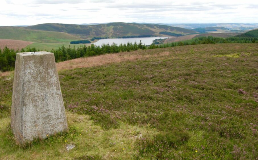
Sitting above Backwater Reservoir at an elevation of 516 metres, this modest summit provides fine views but only one small gap in its arboreal defences allows uncomplicated access.
Just like its near neighbour Crock to the west, there are invariably ways to be picked through the tree cover but they can be troublesome, often time-consuming and the terrain is not walker friendly. As I had left my machete at home, I was quite happy to take the easier option for a pleasant afternoon leg stretch in the sunshine.
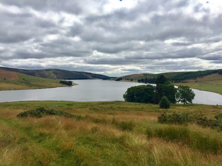
The three-kilometre long reservoir which supplies Angus, Dundee and parts of Perth and Kinross is a popular spot for picnickers, families, cyclists and dog walkers, and there was plenty of activity as I set off from the large parking area just below the dam.
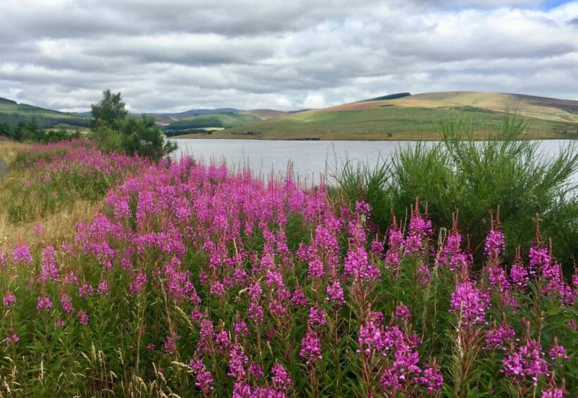
The verges were a riot of wildflowers, the resplendent yellow ragwort and the fuschia pink of the swathes of willowherb in particular proving irresistible to a bustle of butterflies and bees and providing a stark contrast to the flat silver calm of the water.
Once through a high metal gate, the track changed to a rougher surface as it passed through a busy field of sheep and then swung round above the contours of the shoreline to reach a decaying wooden gate.
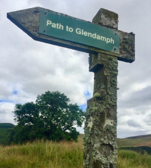
The rough track continued uphill where a lichen-encrusted signpost pointed the way to Glendamph. I ignored the grass track heading left and instead stayed on a path which led to a high metal gate with a wooden pedestrian entrance to the left opening into the trees.
All of a sudden the light seemed to vanish; there was silence and a slight feeling of claustrophobia. No bird calls, only the merest sigh of the wind and the occasional cracking underfoot as I followed the path through so much dead and dying wood. As I exited the gate at the other side, it felt as though a switch was flicked, the senses resetting. Normal service had been resumed.
The path drives on north through Glen Damff and over into the rounded summits of Glen Prosen, but I parted company with it and turned left, pushing uphill over grass then heather, following the treeline fence, the farm of Glenhead growing smaller with every step. Beyond the treeline, I reached a drystone wall at a junction on the skyline.
There’s a sizeable gap in the fencing atop the wall here, and I squeezed through for the short push across wet and uneven ground to the trig pillar on Hare Cairn. It may seem a bit pedantic, but this is not actually the summit of the hill. For those who worry about such things, a knoll three metres north-north-east of the trig is the highest point by a whopping 0.1m.
There’s no dubiety about the views, though. Despite the extensive forestry, there’s a good line of sight in every direction; south across the reservoir and up to Creigh Hill, north to the rolling high land formed by the Glen Doll Munro twins Mayar and Driesh which fills the horizon. Even the summit of Crock makes an appearance, its bare top rising above the great surrounding wall of trees and seeming to mock and tease from afar.
I had a good look at the slopes to the east and west hoping to uncover a simple alternative descent but only finding pines so closely packed that even the light was struggling to break through. There is a way down via a firebreak to the south but the tangle of fallen trees and the undergrowth makes this far from pleasant.
In the end, I accepted the inevitable and retraced my footsteps. Some days the simple routes are the best.
ROUTE
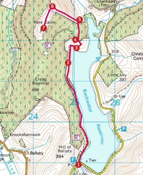
1. From parking area, walk past the dam taking tarmac track up west side of reservoir.
2. After about 2.5km, go through high metal gate into sheep field. Keep following track north then round to right to rickety wooden gate.
3. Go through gate to take rougher farm track uphill for path to Glendamph (signed). Ignore track going left and instead stay on rough path to reach high metal gate with wooden pedestrian entrance at side leading into wood.
4. Follow path north through trees until another high gate provides exit to open ground.
5. Leave path here and strike left up grassy slope alongside treeline and high deer fence (faint path in places).
6. Beyond treeline and at drystone wall junction, squeeze through gap in fence and head south to trig point. The actual hill summit is a knoll nearby.
7. From trig point, the only sensible option is to retrace your steps all the way back to the start.
INFORMATION
Distance: 10.5km/6.5miles
Ascent: 255m/836ft
Time: 3-4 hours
Grading: Moderate walk well within fitness levels of most on tarmac track, woodland path, farm tracks and open hill. One short climb, rough, pathless ground for final 500 metres. Can be muddy, good footwear recommended. Dogs under close control near farm livestock.
Start/finish: Large parking area below Backwater Dam (Grid ref: NO 251590) access by minor road (signed) off B951 from Kirriemuir.
Map: Ordnance Survey 1:50,000 Landranger Map 44 (Ballater & Glen Clova) and 53 (Blairgowrie & Forest of Alyth); Ordnance Survey 1:25,000 Explorer sheet 53.
VisitScotland, Dundee iCentre, 16 City Square, Dundee, DD1 3BG (Tel 01382 527527).
Public transport: None.
