Conachcraig, Glen Muick, Deeside
The bulk of the snow cover had vanished from the hills but the low ground was still sheathed in ice and a fierce wind was whipping across the grey waters of Loch Muick.
Every so often a particularly strong gust made it necessary to stand still with poles planted to avoid being knocked off your feet. This was definitely not a day to be tempted by the charms of Lochnagar.
Luckily, there is always Conachcraig, the lower and quieter neighbour, which provides a more than adequate consolation with a gentle circuit of three tops, especially as the direction of travel would make sure my ascent was wind-assisted and the rest of the walk better protected.
Despite the wild weather, there were plenty of walkers around, albeit most of them sticking to the path circuit around the loch. As soon as I turned right just past the information centre, I was on my own.
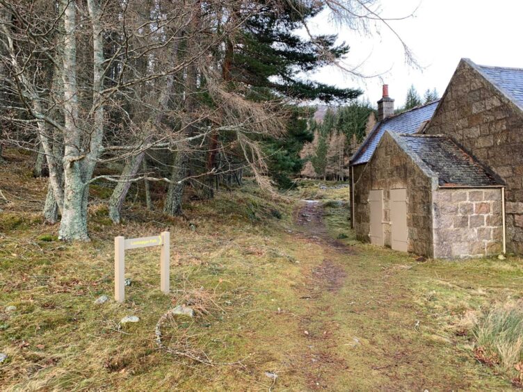
The short passage across the windswept flats brought me to a boarded-up cottage where a sign for the Lochnagar path led through the trees and back out into the open.
The track follows the south side of the burn at first then switches to the north, a crossing which proved a little more tricky than I had expected with the heavy flow. In times of spate, it may be prudent to head upstream a bit to find a convenient rock grouping before attempting to cross.
As the track rises, it changes from soft and sandy to a more boulder-strewn surface. Higher up, it was also covered by stubborn, solid banks of old snow.
The high point of the track sits at 700 metres where there’s a huge cairn marking the start of the route up Lochnagar. Just before this, a small cairn to the right points out a path to Conachcraig, faint at first then growing more substantial as it is joined by a couple of other lines merging for the final push.
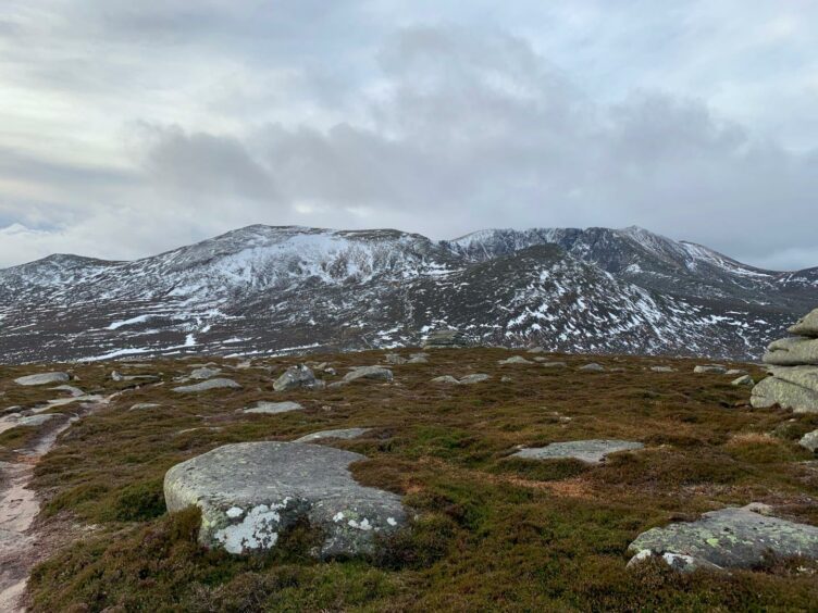
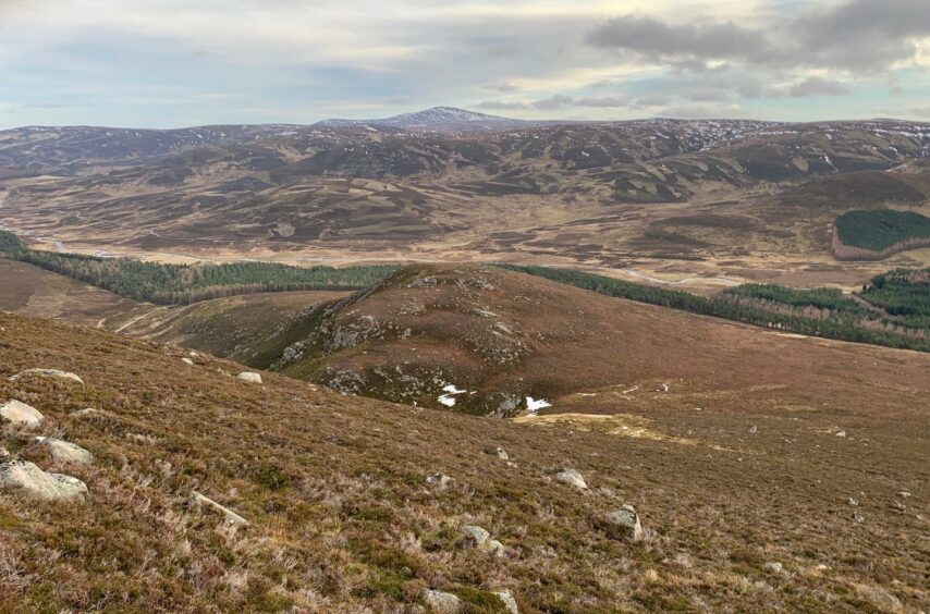
The wind was helping push me ahead, but it was more difficult trying to stop and take photos of the stark snow-streaked faces behind me.
Conachcraig, which is a Corbett, can be taken to mean either high rocks, or jumble or combination of rocks, and the several slabby piles which decorate the summit area back that suggestion. ‘Con’ also suggests a conjoined or linking hill, in this case the link with Lochnagar.
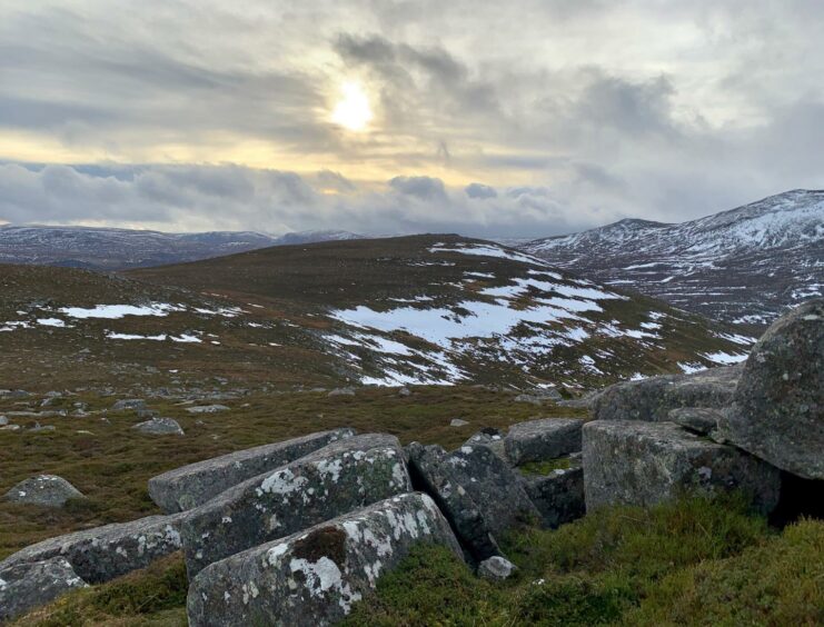
In any case, these rock piles provided handy relief from the constant gusts as I dodged in and out of their shelter while trying to get shots of dark Lochnagar.
You can retrace your steps from here, but just one kilometre over the plateau is the second, and in many ways superior, summit, Caisteal na Caillich (the witch’s castle). Besides, it seemed wise not to have to head straight back into the wind.
The path cuts across the side of another, unnamed, top before snaking up into the piles of rocks that are scattered across the skyline. The views down into Glen Gelder are wonderful.
The descent goes over the unnamed top and then drops down the east ridge until reaching a col below the rugged little swelling of Carn an Daimh. You can either go over this top or drop to its right on open slopes, aiming for an old wall which runs parallel with the treeline.
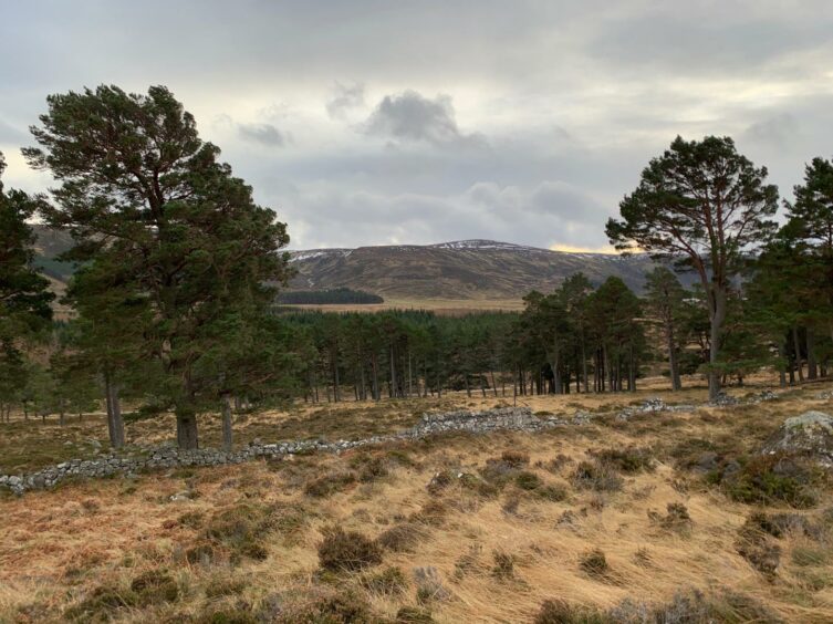
There are plenty of gaps and tumbled-down sections making crossing simpler, and then it was just a case of strolling a short distance through the old pines to hit the track which was followed back to the old cottage and then back to the start.
ROUTE
1. Exit car park on track heading left over bridge and follow past toilets and information centre to metal vehicle gate.
2. Just beyond the gate where track splits, turn right heading north-west to locked cottage sitting below house (Allt-na-giubhsaich).
3. Go through trees following signs for Lochnagar path to emerge on to more open terrain where rough, wider track climbs gradually, with one stream crossing, to high point at junction marked by large cairn.
4. Before reaching this cairn, look to right for small cairn marking start of path which heads directly at gentle angle to summit rocks of Conachcraig.
5. Continue north-east on path for about one kilometre to summit of Caisteal na Caillich, passing over side of 850m top.
6. To descend, return over 850m top and continue east then south-east towards minor top of Carn an Daimh. This can be crossed or passed on the right over open slopes to reach old wall running parallel with treeline.
7. Step over wall and through trees to pick up track running back to old cottage, and from there retrace steps to start.
INFORMATION
Distance: 11.2km/6.5miles
Ascent: 520m/1705ft
Time: 3.5-5 hours
Grading: Moderate hill route for relatively fit and well-equipped walkers with relevant navigation skills on estate tracks and hill paths. One stream crossing may be difficult in spate. Dogs under close control outwith marked exercise areas.
Start/finish: Spittal of Glenmuick car park (Grid ref: NO 309851). Charges apply (£5 per car).
Map: Ordnance Survey 1:50,000 Landranger Map 44 (Ballater & Glen Clova); Ordnance Survey 1:25,000 Explorer sheet 395.
Tourist Information: VisitScotland, Ballater iCentre, Station Square, Ballater, AB35 5QB (Tel 01339 755306).
Public transport: No public transport to Spittal of Glenmuick, but buses to Ballater, with taxi service an option.
