Rumbling Bridge Gorge, Perth & Kinross
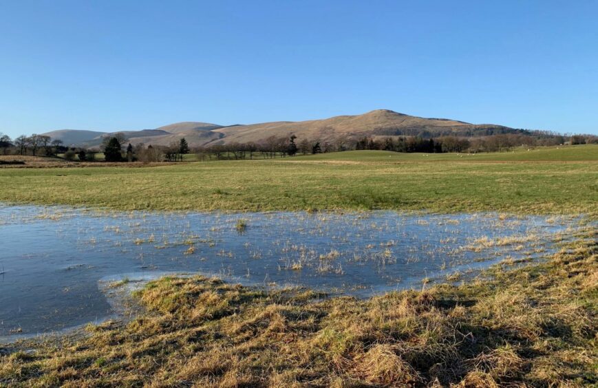
We had the sunshine after the rain – and there had been a lot of rain the previous day – the perfect conditions for spending time around waterfalls and turbulent water.
It was also icy underfoot and there was a bitter, lively wind, so a low-level circuit around the spectacular Rumbling Bridge Gorge was a good choice for a leg stretch during this brief weather window.
It seemed many others had the same idea. When we arrived at Rumbling Bridge, the popular starting point layby to the south of the bridge was full. Not to worry, though: there’s a decent size car park in the village itself, and the walk can also be started a couple of miles along the road at Crook of Devon.
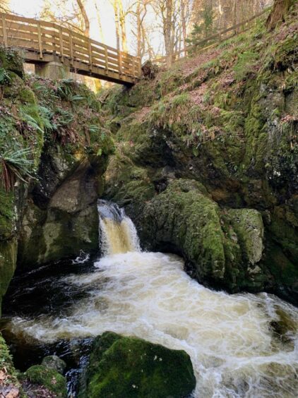
There’s a wooden entrance gate beside the layby, the path then running high along the east side of the gorge, the thundering waters below mostly heard but not seen.
We ignored a turn to the left, staying on the main drag until dropping down a set of steps and following the curve of the River Devon round to the right. After passing a weir, part of a community hydro scheme, we climbed more steps leading up to the A977.
This can be a busy road, but the verge footway means the passing traffic is a minor irritant as you quickly arrive in Crook of Devon. The name comes from the turn in the River Devon said to resemble the shape of a shepherd’s crook.
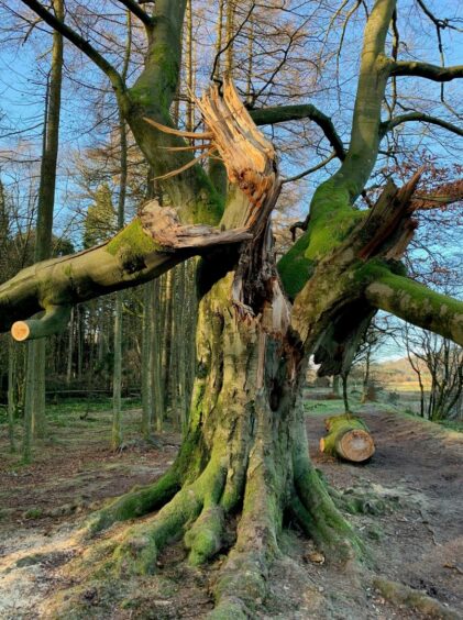
We turned left down narrow Naemoor Road, and once across the stone bridge a signpost directed us to the right along a fenced grassy lane which led down to the river again. We turned left in front of the bridge, following the woodland path by the water. Along the way, we came across some dramatic evidence of fallen trees, giants split apart or ripped from the ground by the recent storms.
Regular signposts kept us updated as the route turned left into the wood then continued round to a junction where there is a notice board for Lendrick Muir, an activity centre for youngsters. Our track went right to emerge at a minor road, a left turn taking us down to another junction and a right turn along to a sign pointing back into the woodland path along the gorge. The roar of the water left us in no doubt where we were.
There are three fenced viewpoints to visit. The first is for the Devil’s Mill waterfall, so-called because the violent motion of the water beating against the side of the rock walls was said to sound like the machinery of a mill.
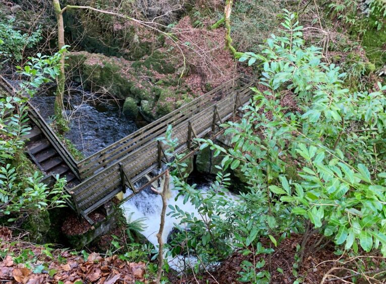
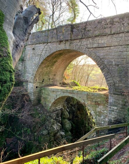
A little further on, wooden steps lead steeply down to a platform built out over the gorge. The final viewpoint is under the stone road bridge, where there is the curious sight of the remains of another bridge some ten metres directly underneath.
This lower bridge was built in 1713. The second, higher bridge was constructed in 1816 in a bid to ease the gradient of the steep slope leading down to the bridge. It must have been a formidable task as Kinross was said to have suffered a great flood that year, and later an earthquake.
The view down into this narrow part of the gorge seems bottomless from here, its dark rock walls sheer and dripping, while the constant rumbling seems to emanate from way beneath the earth, a fitting finish to a dramatic walk.
ROUTE
1. Go through wooden gate for path on south side of river signed for Crook of Devon. Keep straight on at first path junction, ignoring steps leading down to left, until reaching gate.
2. Pass left of gate and descend wooden steps, then turn left, passing viewing area, and follow riverside path as it curves round to right. After passing weir, climb flight of stairs to A977.
3. Turn left at top and walk along pavement into Crook of Devon until reaching Naemoor Road where there are signs for Rumbling Bridge and Yetts of Muckhart.
4. Follow this minor road over bridge and shortly after take footpath (signed) on right which runs between fences and down to bridge over River Devon.
5. Don’t cross bridge – turn left to follow riverside path at edge of woods and shortly after passing through metal gate, watch for sign for Rumbling Bridge Gorge where path goes left.
6. Stay on main track until reaching junction with Lendrick Muir information board, keep right along track to reach minor road.
7. Turn left and head down to next road junction, then go right until reaching a signpost on left for Rumbling Bridge Gorge.
8. Follow path through woods, passing footbridge on left to reach three viewpoints, each requiring short detour to viewing platforms, before passing through gate to emerge at road bridge.
INFORMATION
Distance: 5.75km/3.5miles
Ascent: 65m/215ft
Time: 2-3 hours
Grading: Easy walking for all abilities on woodland paths and tracks, some walking on minor roads and one section along verge footway on busy A977. Take care along sides of gorge, it is fenced but there are precipitous drops. Can be very muddy in places, exposed tree roots slippery, sturdy footwear recommended. Farmland route, please keep dogs under close control.
Start/finish: Layby at Rumbling Bridge on A823 (Grid ref: NT 016994) west of Crook of Devon. Larger parking area on north side of river in Rumbling Bridge village.
Map: Ordnance Survey 1:50,000 Landranger Map 58 (Perth & Alloa); Ordnance Survey 1:25,000 Explorer sheet 369.
Tourist Information: VisitScotland, Perth iCentre, 45 High Street, Perth, PH1 5TJ (Tel 01738 450600).
Public transport: Buses to Crook of Devon on Stirling-Kinross route (X53).
