Largo Law, Fife
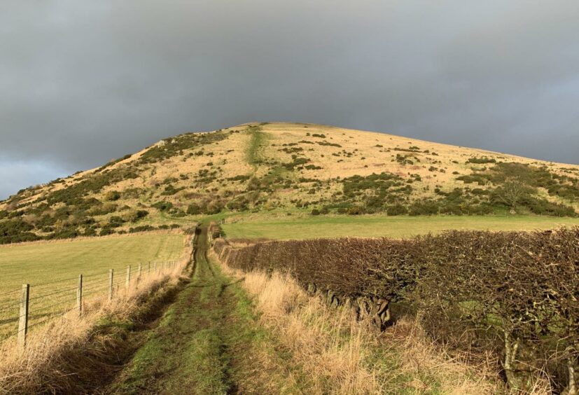
Largo Law provides a short but very sharp ascent on an unrelenting slope where progress often falls into the two-steps-forward-one-step-back routine.
It may take little more than half an hour to reach the top, but you’ll certainly feel every one of those 30 minutes as your feet struggle to find traction on the slippery mud steps. Some may even be reduced to moving upwards on all fours at points.
Despite being just 290 metres (965ft) high, this ancient remnant of a much larger, active volcano certainly packs a punch.
The route passes through farmland and there is only one way up and down. Dogs are not allowed on the hill from March to November when cattle and calves are present, and must be kept under tight control at other times when sheep are grazing.
The shortest outing is from the parking area between the cemetery and the primary school above the village of Upper Largo, but if you are looking to extend the day, you can take a more circuitous wander through the tranquil woodland of Keil’s Den to the west.
I started from The Temple car park on the shore of Largo Bay which allowed a meander through the tight and colourful streets of Lower Largo, its white-washed walls festooned with decorative sea-going ornaments, beautifully carved gates and statues.
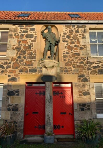
Passing the statue and plaque of Alexander Selkirk – the seafaring castaway that the writer Daniel Defoe used as his inspiration for Robinson Crusoe – I turned right under the railway viaduct and headed up to a crossroads, then went straight over to the minor road opposite.
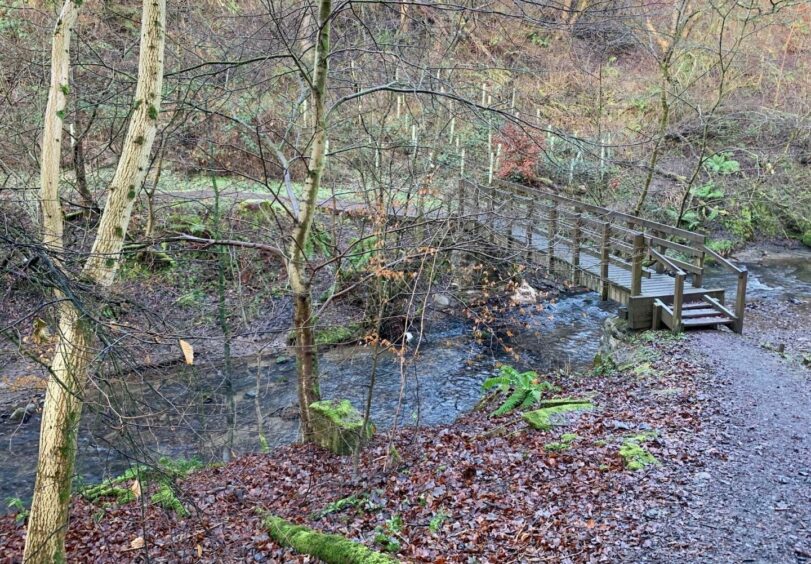
After around 500 metres, a sign on the left pointed to the entrance to Keil’s Den. I stayed high at the first path option, sticking by a fenced field. Further on, a ramp to the left led down to a wooden bridge over the stream, with height quickly regained again on the other side.
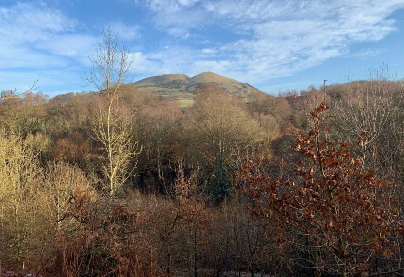
There were fine views of Largo Law above the treetops of the little gorge and glimpses of the ruined towers of Pitcruvie Castle. Eventually the path dropped to meet the road. If you don’t fancy the stream crossing, you can go briefly on to the tarmac at a bridge before ducking back into the woods to follow the path until spotting a farm track which goes across fields to reach the road.
A grassy track directly across the road provides a passage – with several gates – through more fields before coming out at the cemetery and the beginning of the climb.
The route is well sign-posted and you are unlikely to be on your own on the ascent. There are plenty of gorse defences to make you think about going off-line.
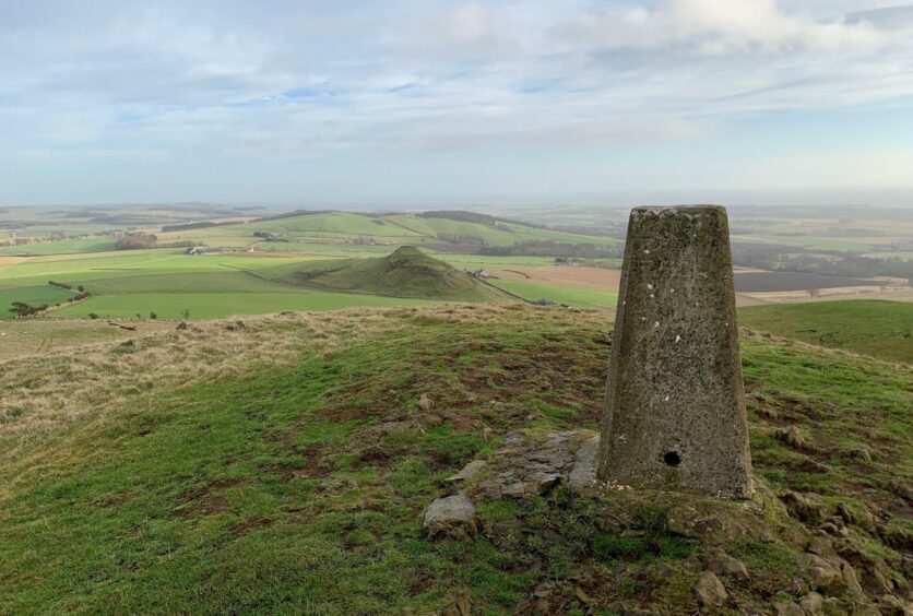
The angle eased slightly as I reached the first crest. A short drop to a stile and then another brief push led to the cairn and trig point of the summit and the 360-degree views you would expect from a solitary hill.
There were a few people reluctant to leave the top, some I reckon just taking a few more minutes before braving the descent on the mudslide. I found it prudent at times to keep to the left to avoid building up too much momentum and made it down without any pratfalls.
The last leg followed the main road out of Upper Largo until reaching chevrons on a bend where a signed path went left into a strip of woodland to emerge in Lower Largo.
ROUTE
1. Walk west from car park along shore road, turning up on to Main Street which should be followed to bridge over burn.
2. Turn right, passing under rail viaduct and keep heading uphill on pavement to crossroads, go straight over past war memorial and continue until sign for Keil’s Den on left.
3. Pass through wooden gate and follow path, staying high (right) at first until split in path. Head downhill to wooden bridge over burn and then climb again to high path on west side.
4. Follow this path down and just before exit to road, turn sharp right along path. Either ford burn or walk over bridge before going back into wood and continue south until meeting track on left.
5. Follow track across field to road, then cross and take grass track directly opposite heading between fields to reach minor road at cemetery.
6. Turn left between cemetery and primary school to gate for hill access and follow signed track round farm buildings, and up fenced lane to pick up hill path all way to the south top of Largo Law.
7. Drop to col and cross wooden stile before final push to main summit.
8. Retrace steps back to cemetery, then turn left to head into Upper Largo.
9. Follow main road (pavement) until chevrons at sharp bend on left where concrete steps lead to woodland path which is followed back to car park.
INFORMATION
Distance: 9km/5.5miles
Ascent: 345m/1130ft
Time: 3-4 hours
Grading: Moderate route for relatively fit walkers on woodland paths, farm tracks and minor roads, with one very steep and often slippery ascent. Very muddy in places, good footwear essential. Farmland route: No dogs permitted on hill between March and November, must be under close control at all other times.
Start/finish: The Temple car park at shorefront in Lower Largo (Grid ref: NT 423027).
Map: Ordnance Survey 1:50,000 Landranger Map 59 (St Andrews); Ordnance Survey 1:25,000 Explorer sheet 370.
Tourist Information: VisitScotland, St Andrews iCentre, 70 Market Street, St Andrews, KY16 9NU (Tel 01334 472021).
Public transport: Regular bus service on St Andrews-Leven route (No 95).
