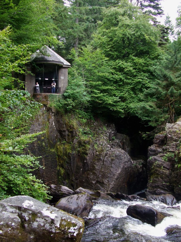
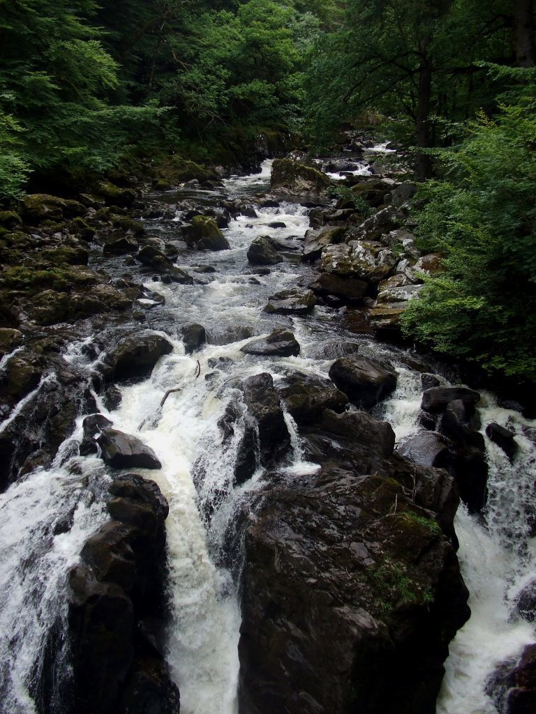
The Hermitage, near Dunkeld, is a good barometer of the changing seasons. Golden leaves on oak, beech and horse chestnut confirmed the arrival of autumn as I hiked by the River Braan to Ossian’s Hall, an 18th century look-out perched above the tumbling white water of Black Linn falls.
Refurbished in 2007 by the National Trust for Scotland, this most decorative of summer houses was the first of a number of follies I would visit on my travels through the leafy countryside west of Dunkeld.
Marvelling at the mirrored panels within, I enjoyed brief shelter from the cold morning air before pushing on up river, a red squirrel scampering across the marked trail leading to Ossian’s Cave.
At first glance this rocky retreat conjures the notion of a hermit residing in the forest. In reality, however, it was just another folly, part of an ambitious landscaping project commissioned by John Murray, the 3rd Duke of Atholl, in the mid-18th century for the policies of his home, Dunkeld House.
It is said that when guests visited, the duke would dress a member of his household in a long beard and animal skins and deploy him to the cave to add an air of authenticity to their hermitage experience.
The path swings by the front door of the gloomy cavern before setting off back down the valley and I followed it only as far as the next junction where I turned north into Craigvinean Forest.
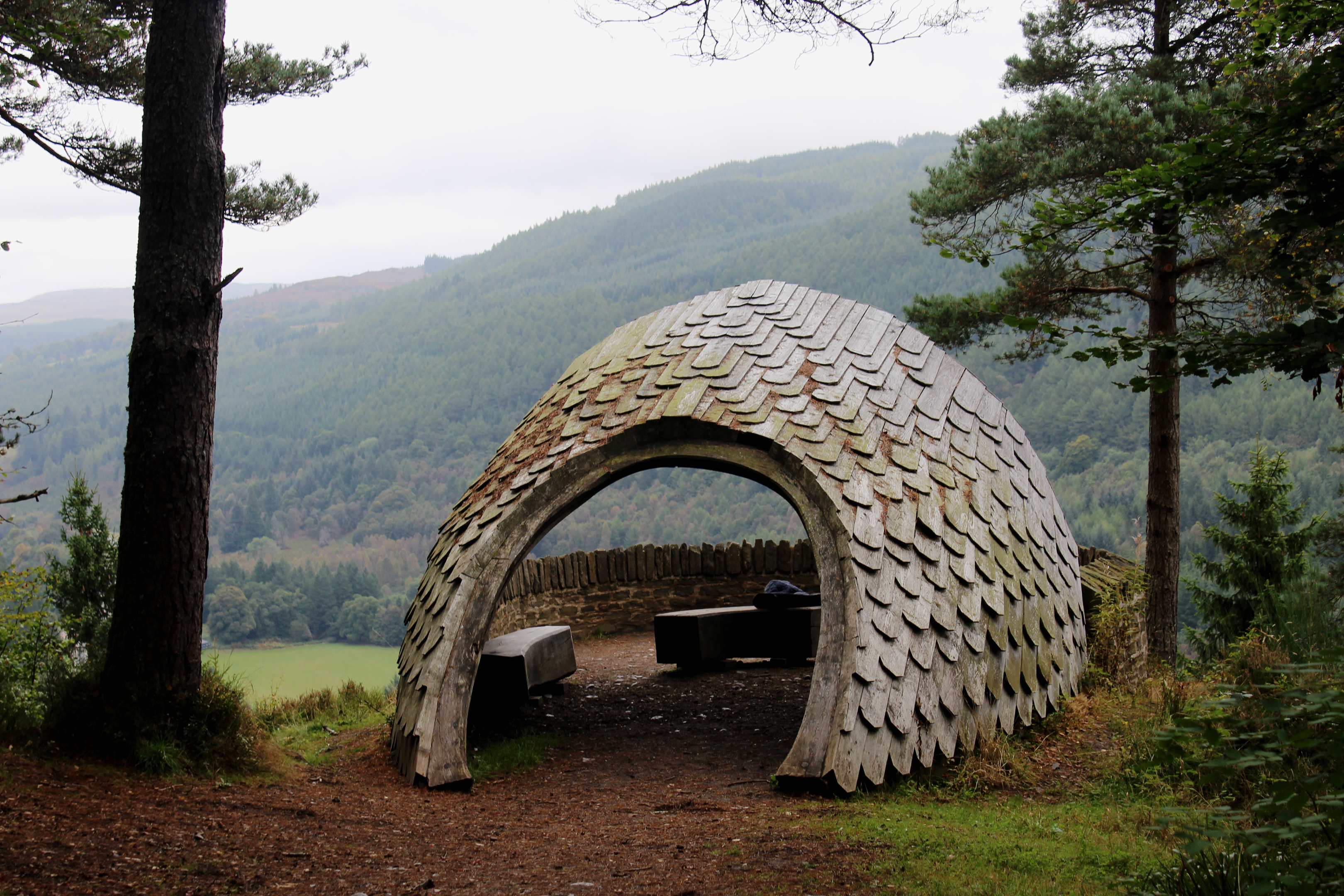
High in this plantation of larch is Pine Cone Point, a more recent folly. The path up branches off the forest road and it is a fairly long but well-graded ascent, the way snaking over the slope to meet a track that leads north, crossing perilously steep mountain bike trails, before eventually emerging from the trees at the cone-inspired shelter.
An airy viewpoint offering a superb outlook over the valley of the River Tay to the mountains of Highland Perthshire, it is definitely worth the climb.
Back on the forest track, I wandered north through Craigvinean, lavender coloured waymarkers and signs for Dunkeld delivering me on to the less peaceful verges of the A9.
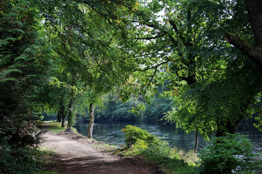
My onward route required negotiation of this thundering highway and thankfully, after crossing the Tay, the roadside footpath curved down to a track that passed below the carriageway before heading south through silver birch, the Tay to my right.
Entering the grounds of Dunkeld House, the way runs above a waterside folly, the start of a very pleasant walk down river to Dunkeld and its cathedral, passing salmon pools, and yet another stone folly, this one built into the bank.
Detouring away from the water, I rounded the periphery of the cathedral grounds, entering at a gate on the north-east corner, adjacent to a wooden shed.
An important religious site as far back as the ninth century, the oldest parts of the present structure date from 1318 and while much of the complex now lies in ruin, part of the building remains in use as a parish church.
After a quiet, contemplative stroll through the grounds (open all year), I headed into Dunkeld, grabbing some swift refreshment before crossing Dunkeld Bridge. A well signed underpass adjacent to the outflow of the River Braan guided me below the A9 and, once across a footbridge spanning the river, path and road took me through the hamlet of Inver, back to the autumnal hues of The Hermitage.
ROUTE
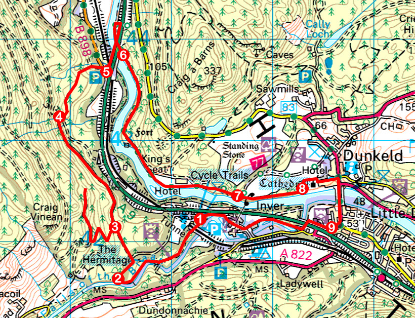
1. Follow signs for The Hermitage to Ossian’s Hall and continue on riverside path to Ossian’s Cave.
2. Bear right and follow path north-east to junction. Turn left, then go straight ahead at track junction on signed Inver Path.
3. Detour left to Pine Cone Point before continuing north on forest track.
4. Turn right then left on grassy track (signed Dunkeld) to car park on B898.
5. Turn right on B898 to A9. Go left over River Tay and continue on A9 footpath to meet track. Turn left, passing under A9.
6. Follow cycle route 77 south.
7. Branch right off cycle route, continuing on riverside path.
8. Follow path clockwise around cathedral to enter grounds at gate on right. Go left through main gate and follow Cathedral Street to Atholl Street. Turn right, crossing Dunkeld Bridge.
9. Turn right on road signed for Inver via underpass. Branch left on path descending to underpass. Cross bridge beyond and follow signs for Inver then The Hermitage.
INFORMATION
Distance: 12.8km/8 miles
Ascent: 390m/1280ft
Time: 3-4 hours
Grading: Moderate, low level route following well signed tracks and paths through woodland and along riverside with a well graded but prolonged ascent to Pine Cone Point
Start/finish: The Hermitage car park, a mile west of Dunkeld on A9 (Grid ref: NO 012422). £2 parking charge
Map: Ordnance Survey 1:50,000 Landranger sheet 52 or 53; Ordnance Survey 1:25,000 Explorer sheet 379
Tourist Information: Dunkeld Information Centre, The Cross, Dunkeld PH8 0AN (Tel 01350 727688)
Public transport: Stagecoach bus services 23, 24 and 27 link Perth and Dunkeld
