Dumyat, Ochils, Stirling
Dumyat is the rocky little outlier to the west of the main Ochils range which packs more character into its modest height than many hills more than twice its size.
As you would expect from its relatively urban positioning, the views are superb, with an expansive outlook over Stirling and Bridge of Allan and right along the winding ribbon of the Forth.
And also unsurprisingly, it’s usually very busy, a real local hotspot. It always reminds me of Arthur’s Seat in Edinburgh, a peaceful, natural haven high above bustling streets offering a refuge for those wishing to escape the stress of daily life for an hour or two.
There are a number of possible approaches; those tackling the southern flanks from Blairlogie with find quieter and more rugged ways up, but the simpler route from Pendreich to the west is ideal for families, more relaxed for those less confident in their hill skills.
The forest car park is reached by the narrow, winding minor road to Sheriffmuir which pushes steeply uphill from Bridge of Allan. There are a few picnic tables from which to enjoy the scenery with your breakfast while contemplating the walk. There is also a series of signs pointing to a wider path network around the woodlands.
We were greeted by frosted ground, puddles with an icy crust and brilliant sunshine, the hillside vegetation in auburn garb more suited to autumn than early winter. Already we could see a line of figures heading up the hill despite the chill wind.
The signed track led us north-east through the trees until we emerged on the road at a layby filled with cars disgorging walkers, dogs and cyclists. Once through the pedestrian gate, we quickly left the main drag heading right along a more level grassy path. A little further on at another fork, we went right again, over a small dip and then gently up beside an old stone wall.
Where the wall turned, we took a small detour right to a perfectly placed memorial bench on a grassy knoll with grand views over to the Wallace Monument. Another bump nearby held a memorial plaque, this time to a lady who had lived in Australia.
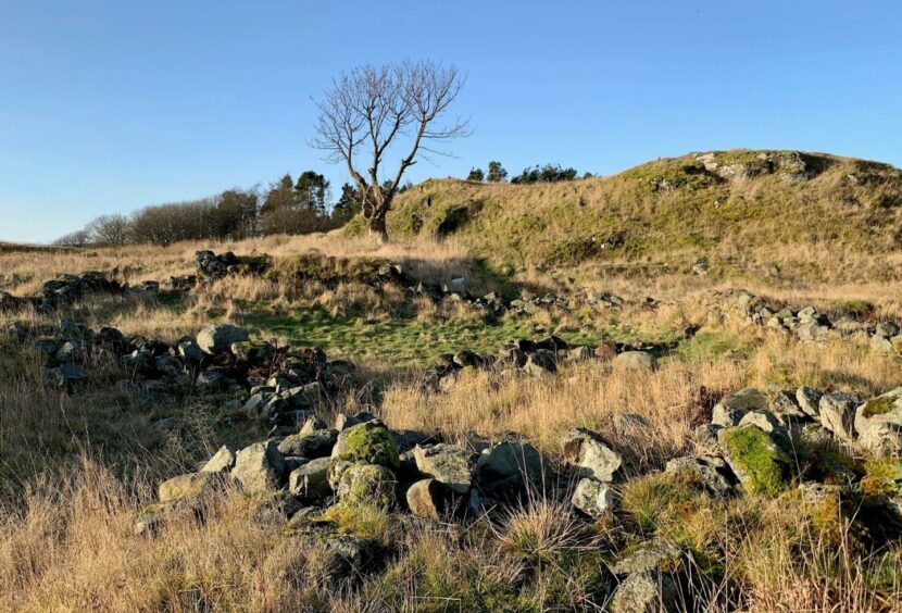
We returned to the path and the remains of an old settlement, a scattering of rocks long colonised by mosses and grasses and watched over by a magnificent lone tree, a centuries-old sentinel.
The main summit of Dumyat now lay dead ahead, the path snaking across a boggier area to a gate, then rising steeper but never too strenuously. It didn’t take long to rejoin the throng.
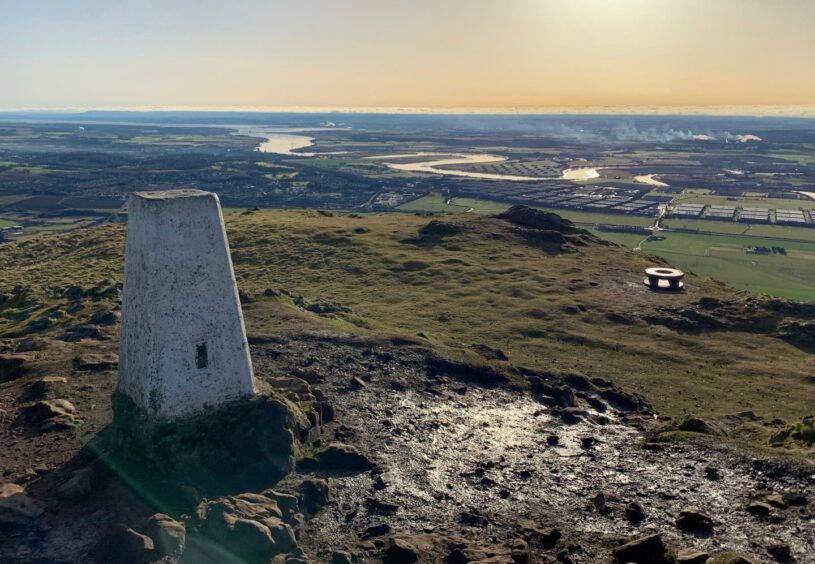
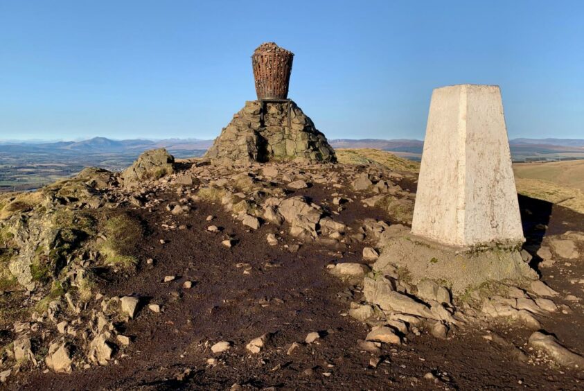
The top is crowned by a trig point, an impressive memorial to the Argyll and Sutherland Highlanders and a cairn holding a large metal beacon. This is filled with stones, each said to represent a goodwill wish. It was commissioned for the Queen’s Silver Jubilee in 1977.
The steepness of this little hill is accentuated here: the gentle slopes of the Ochils roll over the skyline across a deep divide, the miniature buildings of Alva below your feet, the snaking trail of the river lit up silver by the sunlight cutting through the industrial landscape to the estuary.
There was a familiar line-up off to the west as well, with Ben Ledi the foremost peak in the snow-capped mountain line across the horizon.
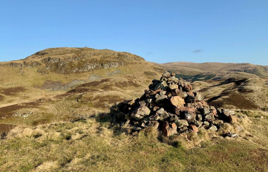
To the south-west there was another prominent summit. This is Castle Law, Dumyat’s slightly lower sibling which houses the remains an ancient hill fort, reached by a detour off the main path. Again the views are grand.
We returned to the main path for the fast run down to the road, going against the pedestrian flow as the upward procession continued.
ROUTE
1. Leave car park on track signed for Dumyat which runs through woods parallel with road, go right at t-junction and follow until track emerges on road at layby.
2. Cross road and go through pedestrian gate on right. Leave main hill path after short distance and take grassier branch on right, then at next fork go right across a slight dip and then climb again alongside stone wall and trees.
3. When path reaches top of wall it turns left to reach remains of old settlement.
4. Continue on path with Dumyat dead ahead; go through gate and then climb steadily to main summit where there is a trig point, metal beacon and prominent memorial.
5. Return to gate and then watch for a branch path on left. This leads to secondary top of Dumyat, also known as Castle Law, which is the site of an ancient hillfort. There is also a summit cairn.
6. Retrace steps to main path and follow back down to road, cross and take woodland track back to parking.
INFORMATION
Distance: 7.5km/4.75miles
Ascent: 300m/985ft
Time: 2.5-3.5 hours
Grading: Short walk on rocky little hill with plenty of character, easy route which avoids steep and craggy sections, ideal for all ages in fine weather. Steady ascent on good path, can be muddy, rocks near summit can be slippery, good footwear advised.
Start/finish: Pendreich forestry car park (Grid ref: NS 810975) on Sheriffmuir road from Bridge of Allan.
Map: Ordnance Survey 1:50,000 Landranger Map 57 (Stirling & The Trossachs); Ordnance Survey 1:25,000 Explorer sheet 366.
Tourist Information: VisitScotland, Stirling iCentre, Old Town Jail, St John Street, FK8 1EA (Tel 0131 472 2222).
Public transport: None to start point, regular bus and train services to Bridge of Allan.


