Clunie trail, Pitlochry, Perth & Kinross
It was a fine afternoon for a walk in the woods, sunny and breezy with the random dark-sky threat of heavy showers which thankfully never materialised.
Pitlochry is a favourite jumping-off point for so many half-day strolls: having just completed one walk in the morning, I was now heading out again after deciding which of the town’s many coffee shops would serve as a lunchtime refuelling station.
Suitably refreshed, I decided to head over the River Tummel for the woodlands to the south, a circuit through Fonab Woods and Clunie Wood with a short detour to a small hill offering big views.
The route started from the car park on Ferry Road. I crossed the road and took the waymarked path (Clunie Walk) left up a lane and then through a short section of woodland before dropping out the other side to once again cross the road as it looped round.
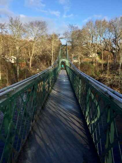
The path opposite is signed for the Festival Theatre and Fish Ladder and crosses the Port-na-Craig suspension bridge over the dark waters of the Tummel and thereafter up to the A9. Great care is needed crossing here, but it’s a single-track section and traffic was fairly light, and once on the other side and heading up the farm road the traffic noise was soon out of earshot.
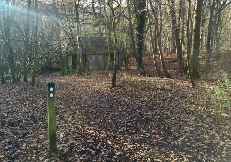
I left the track a little after it curved right, going through a metal gate on my left (signed) and then climbing gently uphill on a delightful path through the trees, part of a brief encounter with the Rob Roy Way.
Higher up, the path joined a forestry track which I followed to a crossroads, then turned right (the Rob Roy Way continues straight on over to Strathtay) to reach a high fence.
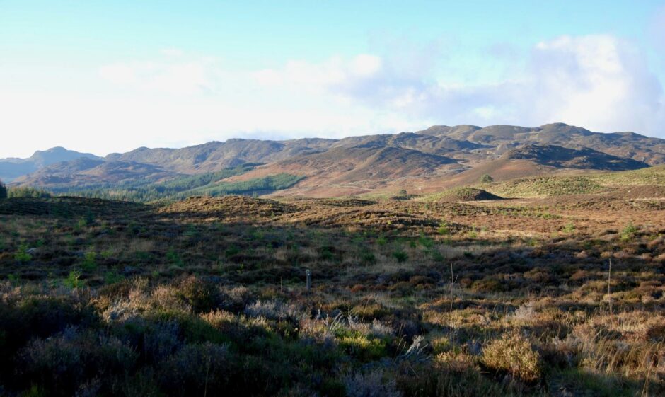
Once through the gate, the views opened out, Ben Vrackie supreme on the skyline to my right while to the left there was a long, undulating line of rolling summits stretching all the way across the horizon to Farragon Hill.
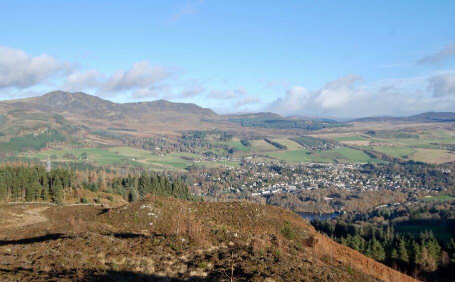
The narrow path cutting across the heather made for easy progress. A marker post on the right pointed the way to a viewpoint, a short diversion which provides an eagle’s eye perspective of Pitlochry.
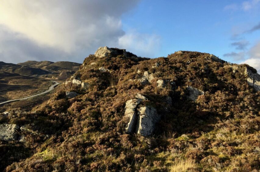
Returning to the path, I soon reached a wooden gate where the route takes a sharp right down the line of an ancient Pictish way to head back into the trees. Just off to my left, however, was an optional extra, the craggy little summit of Creag a’ Choire. There was a bit of heather bashing in the final stages of ascent but it only took 20 minutes to get to the top and the reward was fine 360-degree views.
Back on course, I passed through a rickety gate to pick up a track through the trees. There’s a lot of path and track switching on the way back out so don’t worry if you think you’ve gone wrong, most join up at some point. And as with any woodland walk at the moment, there’s also the possibility of diversions because of fallen trees or from forestry clean-up work.
Ben Vrackie was a constant presence in the gaps between the trees on the final stretch before the main track took a sharp turn left and dropped down the hill to reach the entrance gate to Fonab Woods.
Beyond that lay the incoming track and a retracing of steps down the farm lane and over the A9 then back to Pitlochry.
ROUTE
1. Exit parking to south, cross road and take marked path up lane to left then through small wooded area, exit to cross road and take path opposite signed for Festival Theatre and Fish Ladder.
2. After crossing Port-na-Craig suspension bridge, turn left to cross road and continue uphill following signs for Clunie Walk (marker posts – brown route) to reach gate leading to A9 and cross with care.
3. Follow minor road uphill past farm, continue straight on as it becomes track. After it curves right, go through high metal gate on left and take path straight uphill through wood until it emerges at forestry track.
4. Cross track and follow grassy path uphill on other side to reach crossroads. Turn right on forestry track, passing mast to right, to reach fence.
5. Go through gate and follow path through heather with optional detour to hill viewpoint on right. When path eventually turns right at gate, you can make easy detour across heather (pathless) to summit of Creag a’ Choire.
6. Return to path and follow downhill to gate then into forest. Turn right at next junction, heading slightly uphill.
7. When path forks at bend keep right, then right again at another fork climbing uphill. At next track meeting turn right uphill to go through gate and continue to junction, then left to follow main track as it curves downhill.
8. Go through Fonab Woods gate and retrace steps downhill past farm and over A9 and cross suspension bridge back to Pitlochry.
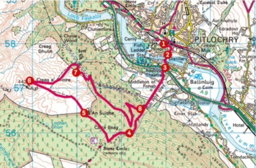
INFORMATION
Distance: 12.5km/8mls
Ascent: 470m/1540ft
Time: 3-5 hours (add 40mins if including Creag a’ Choire)
Grading: Gentle ascents to suit most abilities and ages on waymarked woodland paths, estate and farm tracks, minor roads, also involves crossing busy A9. Wet and muddy in places, also exposed tree roots: good footwear recommended. Note: May be some diversions in place due to storm damage. Dogs under close control near farmland.
Start/finish: Ferry Road car park, Pitlochry (Grid ref: NN 939579) charges apply.
Map: Ordnance Survey 1:50,000 Landranger 52 (Pitlochry & Crieff); 1:25,000 Explorer sheet OL49.
Tourist Information: VisitScotland, Pitlochry iCentre, 22 Atholl Road, Pitlochry, PH16 5BX (Tel 01796 472215).
Public transport: Regular bus and train services to Pitlochry.
