Meall Uaine, Glenshee, Perth & Kinross
The long, undulating ridge which runs north-west above Glen Lochsie from the Spittal of Glenshee comprises a number of summits linked to the Munro Glas Tulaichean.
Despite the accumulative height gain and distance from the parent peak, none has a big enough drop to be regarded as a separate mountain and therefore they are listed as Corbett Tops.
The highest point is Meall Ruigh Mor Thearlaich, but the better known is probably Ben Earb, which can be reached from a start at the ruined Spittal hotel. But there is one other outlier of this ridge lying to the south-east, Meall Uaine, a prominent sight on the journey north.
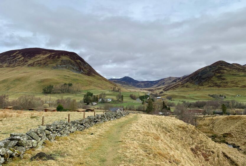
This lone summit is often ignored, but it provides the focus for a fine short round into a quiet and secluded glen which you will likely have to yourself, with a return making use of the Cateran Trail.
I parked beside the fenced-off hotel ruin. The building has been an eyesore since being destroyed by fire a few years ago but it was bought last year with grand plans for a restaurant and bar plus holiday lodges. A chat with someone on site confirmed that work was underway, if rather slowly at the moment.
There has also been recent extensive tree planting on the lower slopes of Meall Uaine with a surrounding high deer fence. There are, however, metal gates allowing access and exit.
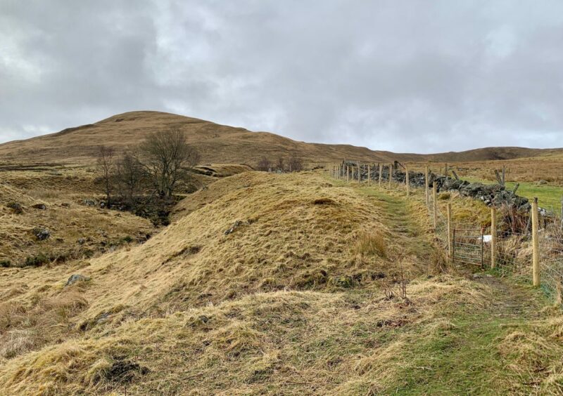
I started on the grassy Cateran Trail heading up Coire Lairige but quickly went left and crossed the stream to reach the gate. The ground is boggy at first, but it’s simple to carefully walk the channels and eventually there is a faint grass track which weaves its way upward. If you prefer, you can stick with the wall until the end of the deer fence before turning left, but it can be hard going.
After passing over a drystone wall, a short pull brought me to the exit gate and the open hill. The threatening early sky finally let loose here with sleet being whipped across the hillside, but it was short-lived, just like the ascent.
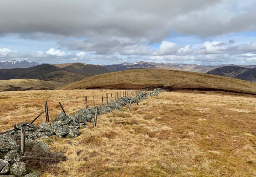
I emerged at another wall running along the horizon, and followed it left to a boggy dip and then up to the summit cairn of Meall Uaine, the sound of plovers and curlew ringing in my ears.
The sky had cleared and the views were panoramic in every direction. I headed to a gap in the wall and dropped south-west down the ridge before rising again to the modest top of Meall a’ Mhuilt. From here, it was a pathless wander west, crossing the Allt Coire an Laoigh and joining the track on the opposite side.
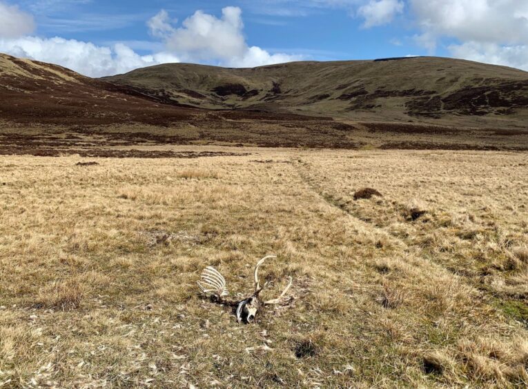
The temperature had risen fast and the empty floor of the glen was now a sun trap, the bleached bones of a deer in the washed-out light giving the place a curious Death Valley vibe.
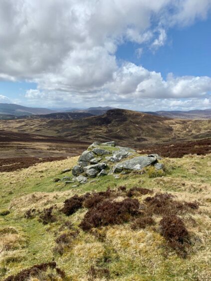
The track climbed towards Uchd nan Carn – there are some handy outcrops along the way with a picturesque long-distance sight of Ben Vrackie – before dropping west again over the waters of the Allt Doire nan Eun to hit the Cateran Trail.
There’s a handy open shelter to aim for. This is known as the Lunch Hut and Queen Victoria is said to have rested here with her gillie, John Brown, during one of her pony excursions from Balmoral.
The track climbs again into the heart of a hilly horseshoe to reach the high pass, An Lairig. If you fancy avoiding the drop and subsequent reclimb, you can always reach this point with a pathless traverse across the heathery flank of Uchd nan Carn.
Once through the gate at An Lairig, it’s all downhill on the Cateran Trail.
ROUTE
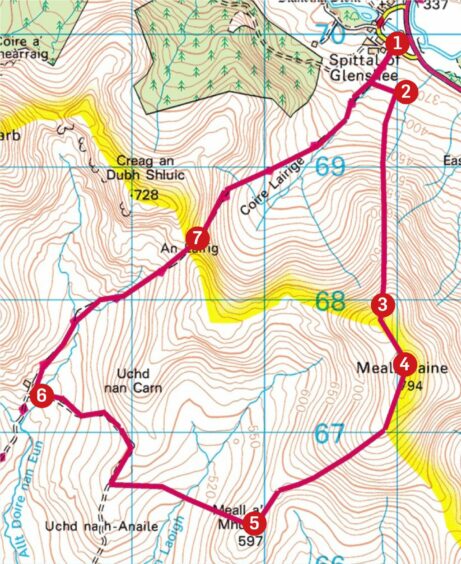
1. Take Cateran Trail (signed for Enochdu and Strathardle) opposite ruined Spittal of Glenshee Hotel for short distance then cross stream and head east to high metal gate in deer fence.
2. Go through gate and pick way across rough, muddy ground at first, then by faint track steadily rising to reach another high gate. Exit and head uphill to meet drystone wall.
3. Turn left along line of wall to slight dip then rise again to cairned summit of Meall Uaine.
4. Follow wall south-west for short distance and continue alongside fence (faint path) down to col then make short rise to Meall a’ Mhuilt.
5. Drop west over pathless terrain to cross Allt Coire nan Laoigh, then climb again to pick up track which heads round hill slopes, aiming for hut on Cateran Trail on west side of Allt Doire nan Eun.
6. Head north-east on track, climbing to high pass of An Lairig. You can also reach this point by contouring along pathless side of Uchd nan Cam, saving some re-ascent.
7. Go through gate at An Lairig and follow Cateran path back to Spittal.
INFORMATION
Distance: 11km/6.5miles
Ascent: 688m/2260ft
Time: 4-5 hours
Grading: Quiet route over rough terrain, mostly on hill tracks and paths, sometimes faint, and some pathless sections. One sustained ascent, decent degree of fitness required. Walkers should be well-equipped with relevant and navigation skills. Dogs under close control – sheep may be encountered and there are ground nesting birds.
Start/finish: Spittal of Glenshee (Grid ref: NO 105701).
Map: Ordnance Survey 1:50,000 Landranger Map 43 (Braemar & Blair Atholl); Ordnance Survey 1:25,000 Explorer sheet 52.
Tourist Information: VisitScotland, Perth iCentre, 45 High Street, Perth, PH1 5TJ (Tel 01738 450600). Or: VisitScotland, Ballater iCentre, Station Square, Ballater, AB35 5QB (Tel 01339 755306).
Public transport: Limited bus service (No 71) to Spittal from Blairgowrie.
