Drumcarrow Craig, North-east Fife
Lying just a few kilometres south-west of St Andrews, Cameron Reservoir was once an important water source for the town. Now it is better known as a haven for wetland birds and as a popular trout fishery.
It also offers a pleasant circuit which takes little more than an hour, but it’s simple enough to use the core path system to loop round further and take in nearby Drumcarrow Craig.
It seemed an ideal short walk option for a lazy Sunday morning as the mist clung on stubbornly, creating an eerie distortion of the nuance of sound, long periods of cloaked silence punctured periodically by the swans’ machine-like drumming of wings on water.
The small parking area lies at the east end of the reservoir and is reached by a potholed track off the A915 which needs a gentle approach. Had it not been for the information boards, I would have assumed I was pulling into someone’s driveway.
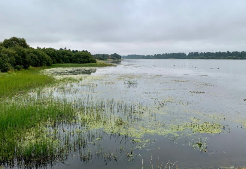
I walked back down the lane a short distance before turning left on to the track above the north shore. The tree cover meant there was only glimpses of the water until the first corner was reached but the walk south across the dam wall opened up fine views over the flat grey sheet with its plethora of birdlife.
A bank of swans were bottoms up in the reeds like stubs of cotton wool. It was either feeding time or a statement of their displeasure at my intrusion, but I didn’t take it personally.
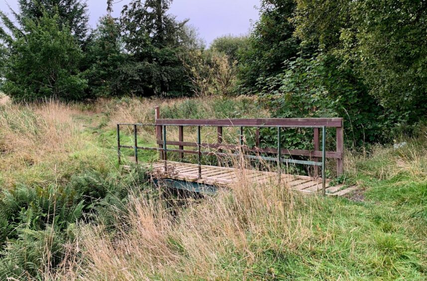
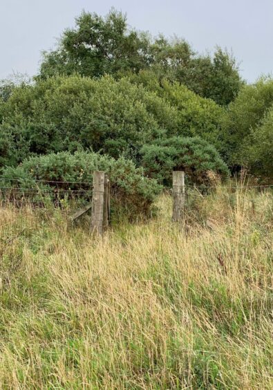
I turned west just before a small bridge – cross and turn left if you wish to complete the reservoir circuit – heading along a path to a metal farm gate. I continued straight ahead along the field edge to a rickety wooden gate, then a bigger farm one. This opened into another field which I walked round to pick up a track heading north.
There was a bovine roadblock ahead before the improving track swung by Cassindonald Farm and out to first one road, and then, with a sharp left, to another, this one part of the Fife Pilgrim Way.
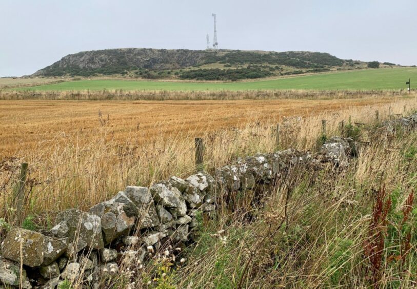
The squat rocky frame of Drumcarrow Craig rose ahead, a signpost pointed the way up a track to my right. There are two metal gates – the first was locked but easy to squeeze around, the second opened. The ascent was short and enlivened by seeing a kestrel taking to the air.
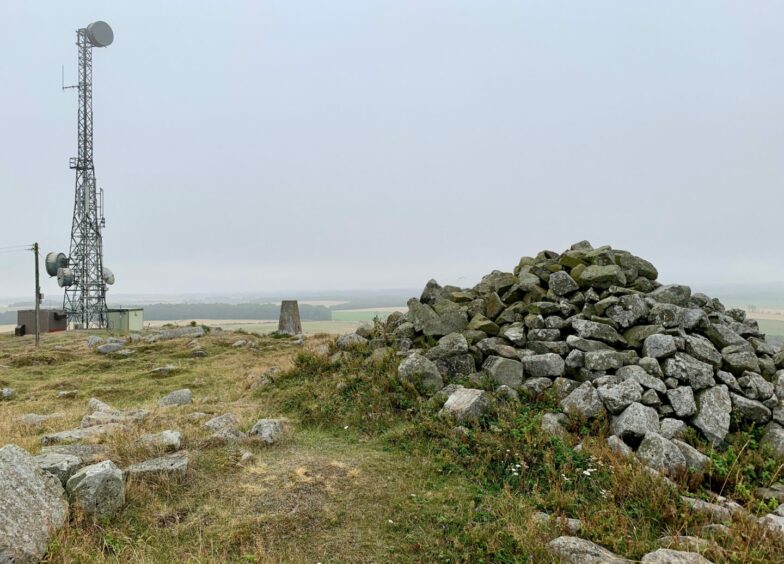
The summit area is surprisingly rough and also cluttered, a few communications towers and a trig point alongside the massive cairn and remains of an Iron Age fort. There’s also an electric fence to crawl under, commando-style.
I wandered over to the lower west top where there were a few hut circles but stopped short of being tempted to continue north to Denork, another hill fort site. Instead, with swallows swooping around my head, I retraced my steps to the road and continued down to Denhead.
A signed track to the right led between fields, then on a muddier section through a dark tree corridor before emerging into the open again. So far, so good, but the final section came as a bit of a shock to the system, the undergrowth putting a good fight.
The first half heads into increasingly thick gorse, so its better to walk out left along the field edge. The second was on a neglected path cutting through nettles and the skeletal remains of a car in the trees gave it a lost world feel, but I survived to reach the car park.
ROUTE
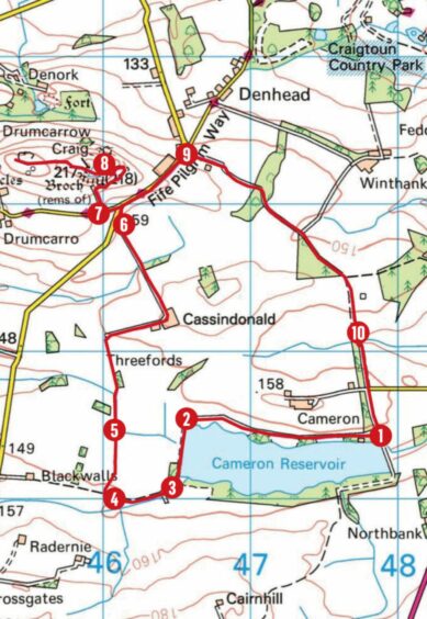
1. Head back out of car park, turn left (core path sign) on track above north shore.
2. Pass through wooden gate and follow path as it turns south over dam wall to reach footbridge.
3. Don’t cross – this is for circuit trail east round reservoir. Instead, head right to reach metal field gate (signed: Footpath to Radernie) and follow field edge to wooden gate then metal one.
4. Go through and walk west along field edge before turning north to gated farm track.
5. Track heads north then east. Go left at Cassindonald Farm on surfaced track out to road.
6. Turn right, then almost immediately left on to another minor road and walk west until reaching gated track on right signed for Drumcarrow Craig.
7. Squeeze round first gate and follow track through next then right as it twists up to summit. You can also make the short walk to western top.
8. Retrace steps to road and head north-east before turning right past entrance to Drumcarrow Equestrian on to farm track (Footpath to Cameron).
9. Follow between fields then through woodland. When track eventually heads right into field, go straight ahead (green arrow).
10. Way onwards is dense with gorse so better to stick to field edge on left for first section before heading back into woods on overgrown path to reach gate. Go straight over back to parking.
INFORMATION
Distance: 11km/6.75miles
Ascent: 180m/590ft
Time: 2.5-4 hours
Grading: Generally easy half-day circuit for most abilities on woodland tracks and paths, farm tracks, field edges and on minor roads. Paths can be vague at times, muddy and overgrown. Farmland route with lots of cattle and sheep, dogs must be under close control and there may be restrictions at times. There are lots of gates – please remember to close them all.
Start/finish: Parking area at east end of Cameron Reservoir (Grid ref: NO 479113), reached by minor road off A915 about 5km south-east of St Andrews.
Map: Ordnance Survey 1:50,000 Landranger Map 58 (Perth & Alloa); Ordnance Survey 1:25,000 Explorer sheet 367.
Tourist Information: VisitScotland, St Andrews iCentre, 70 Market Street, St Andrews, KY16 9NU (Tel 01334 472021).
Public transport: None to start point.



Conversation