In life, there is an easy way to do something, and a hard way. The easiest way to reach the top of Kinnoull Hill is from the Forestry Commission’s Jubilee Car park, which lies to the east. The hard way is from Perth, in the west, ascending along the top of a dramatic, craggy escarpment.
Embarking upon the latter approach, I set out across Tay Viaduct, steps climbing from Tay Street to a slender metal walkway that accompanies the railway line over the river.
On the far bank, a surfaced path and steps lead up to Dundee Road and, a little to the right, a side road branches off to the National Trust for Scotland’s Branklyn Garden, a magnificent horticultural collection that includes many rare and unusual plants.
Approaching the entrance, a sign for Kinnoull Hill ushered me up a lane on the left to a cluster of information boards and, wandering along Fairmount Terrace and a path beyond, I left the city behind and entered Kinnoull Hill Woodland Park.
Under a canopy of beech, oak and silver birch, I made a beeline for the edge of the scarp and immediately began to climb, the path rising in fits and starts.
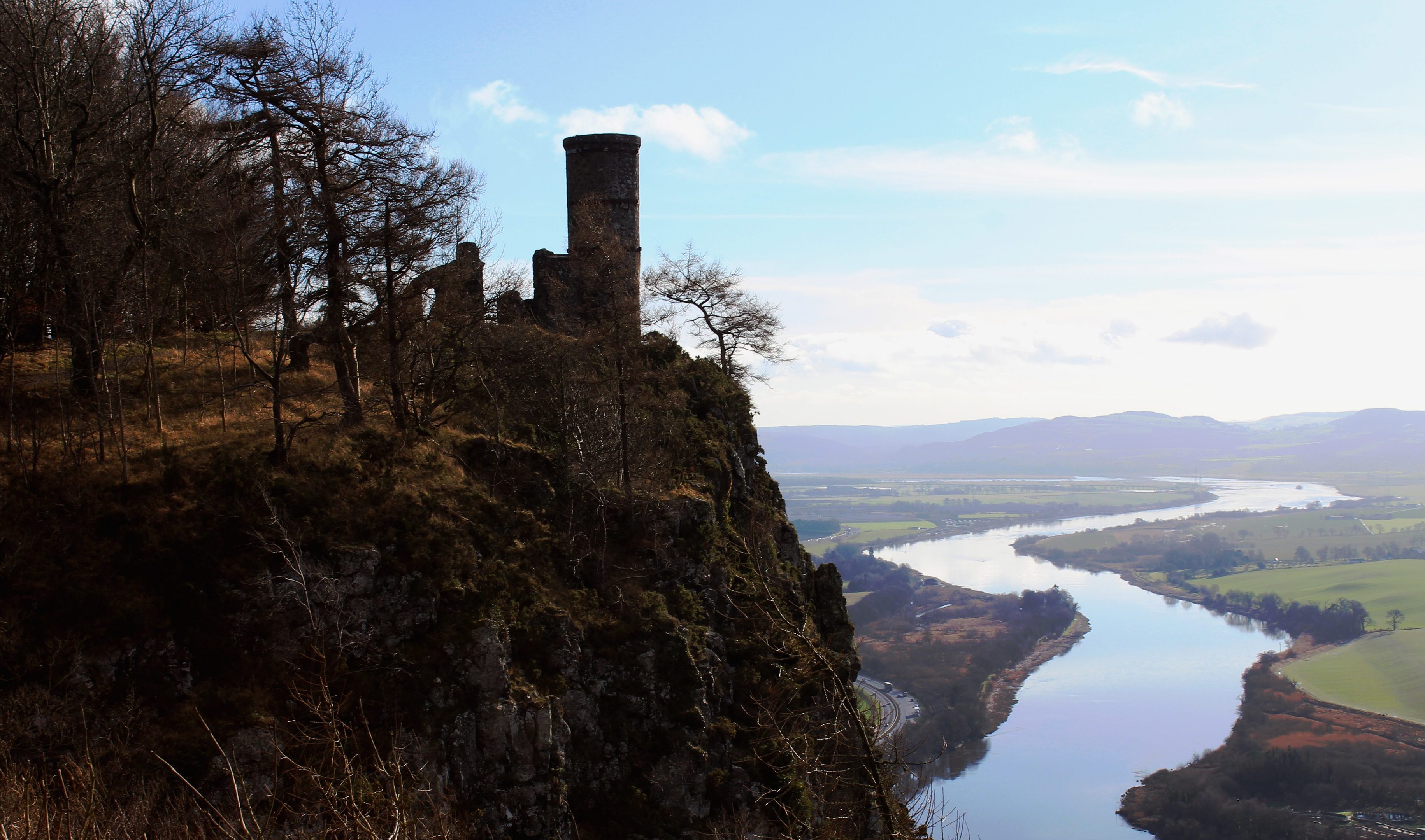
A viewpoint with a well-appointed bench offered brief respite and here I spied Kinnoull Hill’s cylindrical cliff-top folly, a landmark tower that will be familiar to anyone who has passed below the peak on the dual carriageway linking Perth and Dundee.
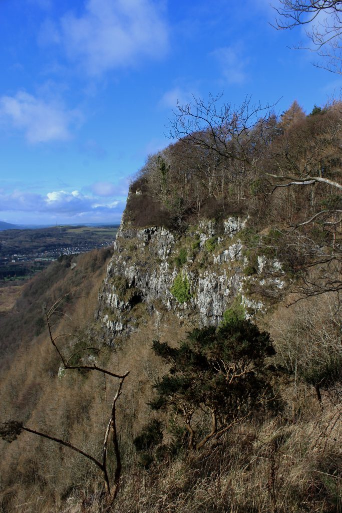
Spurred on by its proximity, I hiked on up through the trees, the path a little muddy and a little slippery in places, cliffs to my right plunging ever higher and ever steeper beyond a protective barrier of vegetation.
Eventually emerging from the woodland, I stepped on to the summit of Kinnoull Hill, a stone plinth offering a good spot from which to admire the vista over the River Tay as it snakes east towards the sea.
The hill’s trig point sits back from the edge of the cliff and, after making a brief detour to the concrete pillar, I followed the path down through a cleft in the slope and up to the tower.
Modelled on the fairy-tale castles of the Rhine valley in Germany, the folly was built in 1829 by Francis Gray, 14th Lord Gray of Kinfauns. He also commissioned Kinfauns Castle, which can be seen in the valley below, and erected a second tower on neighbouring Binn Hill.
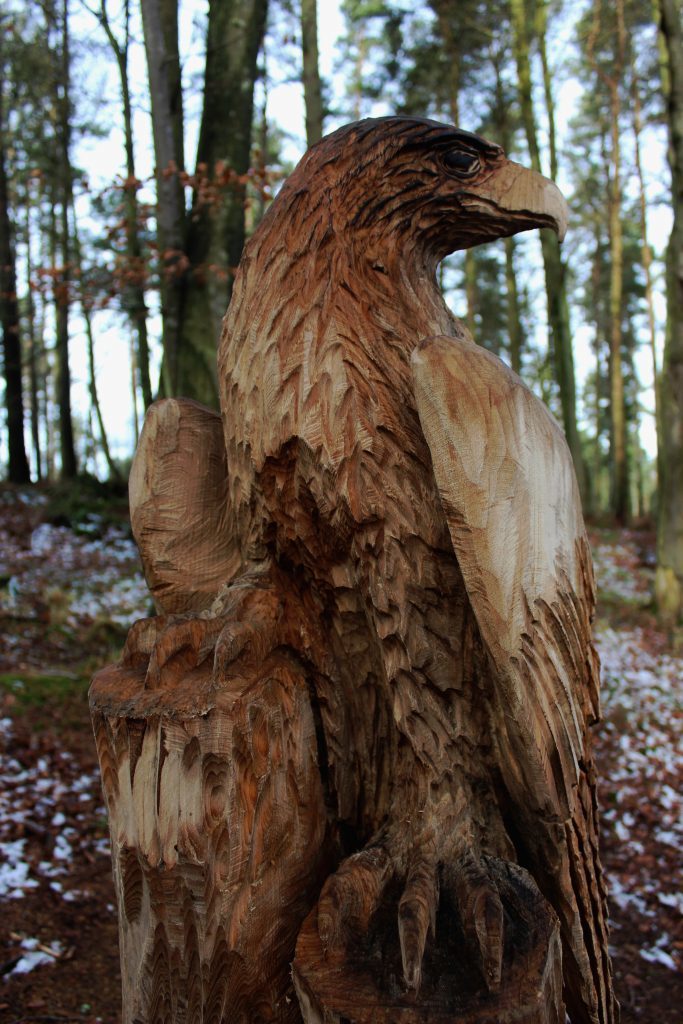
Below the folly, the footpath to the Jubilee Car Park sweeps down through mature beeches and, along the way, there are bird carvings to spot in the trees to the left of the trail.
Skirting the edge of fields, I branched off the Jubilee path, picking up a well signed route to Corsiehill Car Park where I left the woodland park and headed down into Perth on the Geddes Way, re-joining Dundee Road by the Isle of Skye Hotel.
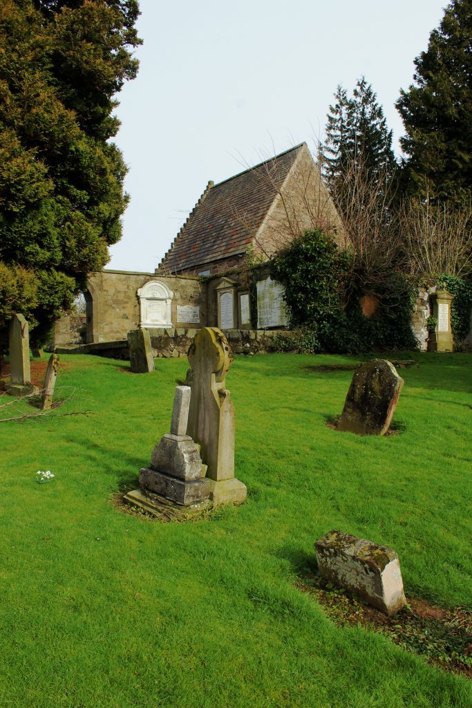
This is not an easy bit of road to negotiate safely so I made a short deviation right to pedestrian crossings near the eastern end of Queen’s Bridge before progressing down a wee lane to Kinnoull Burial Ground.
Surrounded by city life, some of the great and good from Perth’s past rest peacefully in this quiet, concealed kirkyard. Overlooking the river, I too rested awhile after a hard morning on the hill.
ROUTE
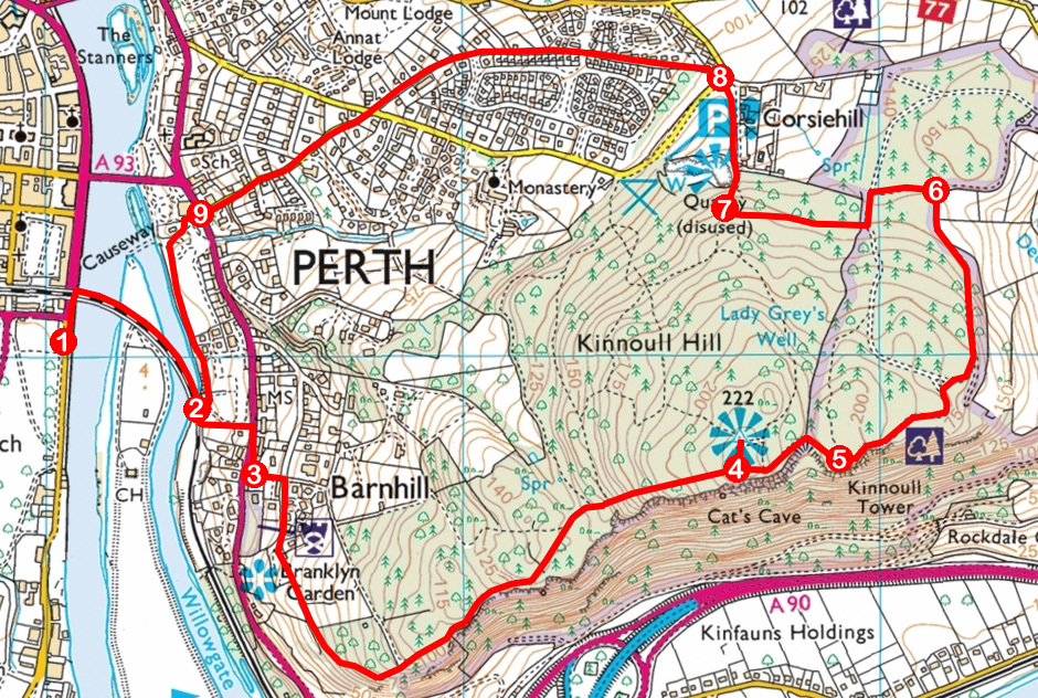
1. Cross Tay Street at zebra crossing and cross railway bridge.
2. Continue past 20mph sign then go left, ascending path to Dundee Road. Cross and go right, bearing left up to Branklyn Garden.
3. Turn left (signed Kinnoull Hill) up lane then go right, along Fairmount Terrace then path, to Kinnoull Hill Woodland Park. Continue ahead, ascending path to summit of Kinnoull Hill. Ignore all paths branching left.
4. Continue east on path (signed Jubilee Car Park) to tower.
5. Continue east then north on path, bearing right at next junction.
6. Go left and follow signs for Corsiehill Car Park.
7. At junction above footbridge, turn right, descending past quarry. Stay to right of stone plinth and descend to road.
8. Descend path (signed City Centre) then Mount Tabor Road and Manse Road.
9. Cross Dundee Road and continue ahead on lane, bearing left at Kinnoull Burial Ground on path through Riverside Park to railway bridge.
INFORMATION
Distance: 7km/4¼ miles
Ascent: 250m/825ft
Time: 2-3 hours
Grading: A moderate route, primarily following woodland and urban paths with some strenuous ascent. Part of the route runs along the top of steep cliffs where great care should be taken
Start/finish: Fergusson Gallery at junction of Tay Street and Marshall Place, Perth (Grid ref: NO 120230). Parking available in South Inch Car Park (50p/hour, Mon-Sat)
Map: Ordnance Survey 1:50,000 Landranger sheet 58; Ordnance Survey 1:25,000 Explorer sheet 369
Tourist Information: Perth iCentre, 45 High Street, Perth PH1 5TJ (Tel 01738 450600)
Public transport: Perth is well served by buses and trains
