Hill of Cat and Gannoch, Glen Esk, Angus
The historic roads of the Fungle and the Firmounth were once a vital link for drovers, traders and smugglers, providing passage through the desolate high ground between Glen Esk and Deeside.
These rough hill highways are still busy, but the travellers making use of the network these days are walkers and cyclists heading for the stretch of rounded summits across the horizon.
No matter whether you start from the north or south, there are a multitude of route options, from gentle strolls to strenuous hikes, from circuits to through walks, something for every ability.
This is prime grouse country and the heather-coated moorland can feel sterile with the lack of trees and criss-crossing tracks running everywhere. But it also offers a mood of rugged isolation, especially in early spring or later in the year as winter approaches and the tracks make for fast walking.
Having sampled several variations from either side, my choice this time out was to head north from Tarfside in Glen Esk, a hamlet that always awakens vivid memories from childhood days of Scout camps.
I took the track heading through a band of trees which quickly emerged into open country with long views in all directions, the Maule Monument on nearby Hill of Rowan particularly prominent. It’s also feasible to take a lower track running parallel before joining the main drag about a kilometre in.
The hills directly in front of me looked a long way off at this point, each identifiable individually by the vein system of the pale, snaking tracks standing out on their dark slopes.
The track split shortly after passing the lonely house at Shinfur, and I took the left-hand branch leaving the drove road for the return journey. When it started to twist away to the left further on, I decided to head up the obvious shoulder of Red Shank on a beeline towards Hill of Cat.
This wasn’t quite as direct as I had hoped. The short vegetation meant I gained height steadily without expending too much effort and soon I was joining yet another track crossing the crest. But this took a fairly convoluted line, twisting and turning over a short distance before I broke off to the right for the short climb to Hill of Cat.
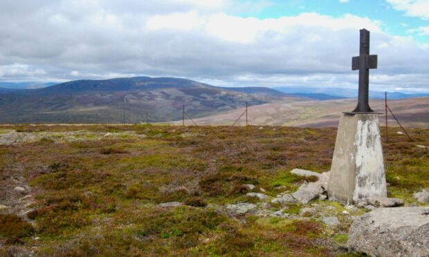
The flat summit was crowned with a trig pillar with a heavy metal cross sitting atop. Despite the relative ease of ascent and the benign conditions, I had neither met or seen anyone else so far. I had the place to myself, a fine, peaceful spot for lunch with distant Mount Keen a welcome companion.
I left the summit following a line of rusted old fence posts north-east, where they ran alongside a newer fence and then dropped to cross a boggy area. I was pleasantly surprised to find this dry enough for easy walking: in wetter times it would be case of trying to find the best line to hop across the stones.
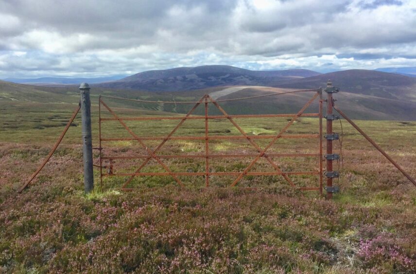
I linked briefly with the Firmounth Road, heading down to the col below Hill of St Colm to search for the natural spring of St Colm’s Well, marked by a couple of boulders. The more impressive sight was the solitary rusted gate still standing in the heather.
This hill was also the site of tragedy in June 1963, when a Vulcan aircraft practising low-level flying crashed killing all five crew but any remaining fragments of wreckage are difficult to pinpoint to locate these days.
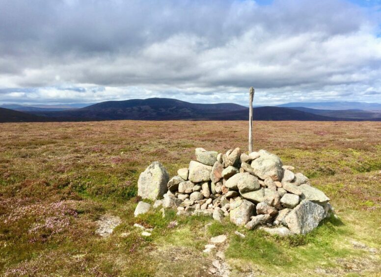
I retraced my steps and took the short track offshoot which led to the pile of rocks marking the top of Gannoch. One more short rise on the way back south led across Tampie, its cairn sitting just over the fence, and then it was simply a case of switching on the autopilot for the gentle downward stroll back to Tarfside.
ROUTE
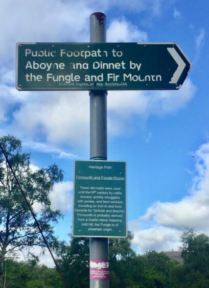
1. Cross the road and take the track opposite through trees (signed to Aboyne and Dinnet via the Fungle and Fir Mounth) then on to the open moor heading north to the house at Shinfur. You can also take a parallel track by the river – they meet up after a kilometre.
2. Follow the track between the outbuilding and house and at the next junction where there is a metal gate take the left branch.
3. Ignore the next branch going off right and when the track starts to turn left after crossing Burn of Keddloch leave it and head directly up Red Shank to reach another track higher up.
4. Follow the track left at first then leave it to reach the Hill of Cat summit.
5. Head east following old fence posts then north-east over boggy section then cross the Firmounth track on a short detour loop to the summit of Gannoch.
6. Follow the track south as it rejoins the Firmounth to dip then rise again to the cairn on Tampie.
7. Continue heading downhill where the track merges with Fungle Road.
8. Stay on track for 2.5km until reaching the inward route at gate, then retrace steps back past Shinfur to start.
INFORMATION
Distance: 18.5km/11.5miles
Ascent: 663m/2175ft
Time: 5-7 hours
Grading: Estate tracks, hill paths, some pathless terrain. Fairly steep, sustained climb, suitable for walkers with good level of fitness. Dogs under close control – farm livestock and ground-nesting birds.
Start/finish: Car park at Tarfside, Glen Esk (Grid ref: NO 492796).
Map: Ordnance Survey 1:50,000 Landranger Map 44 (Ballater & Glen Clova); Ordnance Survey 1:25,000 Explorer sheet 395.
Tourist Information: Dundee iCentre, 16 City Square, Dundee DD1 3BG (Tel 01382 527527)
Public transport: None.




Conversation