Scolty Hill, Aberdeenshire
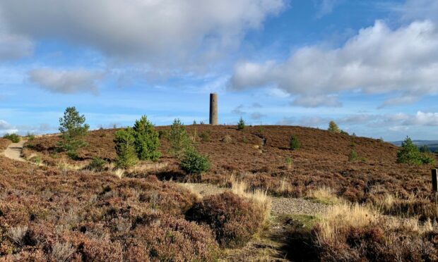
Scolty Hill is Banchory’s hill, and its popularity with local walkers and cyclists means you are unlikely ever to have the summit and its impressive tower to yourself.
However, by taking the quiet southern approach from the village of Strachan you can enjoy a lovely ascent through farmland and woodland often in splendid isolation.
This route is particularly recommended at the moment due to the results of the devastation wrought on the northern side of the hill by last year’s brutal storms which flattened huge sections of woodland all over the country.
The north-east seemed to bear the brunt of their winds’ ferocity, and the early part of the route up from the car park above Banchory has been rendered a bit of wasteland by a combination of the storms and the need to clear the damage. And with so many options shut off, it means the current chance of making a circuit is negligible.
I had hoped to complete the Ardlair Trail, a loop that leads from Strachan and then drops off the other side before returning through the forest via the Auchattie link but found this way barred. So apologies that this is basically an out-and-back exercise, but it’s still the best option at the moment.
That’s not exactly what I ended up doing. I took a slightly meandering final approach to the summit, then dropped left to eventually join the northern path to climb the hill again.
If you are in no hurry, or simply find the Strachan option too short, then it’s easy enough to prolong the walk. A heavier workout or more of a circuit is possible by heading to the left round the hill from the junction and then climbing again on the stepped northern path. On a fine day you may just fancy sitting at the summit enjoying the panorama or climbing the spiral staircase inside the tower for a fine view over Banchory.
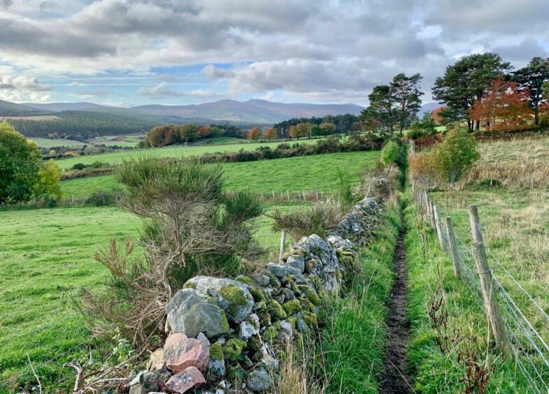
The walk up from Strachan is a delight, core paths through green field corridors then into a variety of woodland, mixed at first then conifer, before closing in to dark passages by mossy walls along soft pine ‘pavements’ which cushion every footfall.
There were one or two trees down but they had little impact on progress. The consolation for having to emerge from the silence was the fabulous long view to knobbly Clachnaben and its acolytes stretched over the horizon above a carpet of autumn shades.
Suddenly, I had company, a slightly strange feeling after an hour or so of seeing no one. The summit had constant visitors, the inevitable comings and goings of a popular local hill.
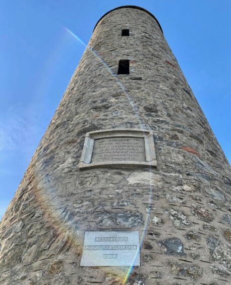
The tower was built in 1840 as a memorial to General William Burnett, who campaigned with Lord Wellington during the Napoleonic Wars. It was restored in 1992 and the viewing platform was added. There are also two view indicators nearby to help you identify distant hills.
The immediate view north was dominated by the huge belt of emptiness where the forestry had been removed. It’s a massive job and it’s likely there will be restrictions for some time to come.
Once above the devastation though, the main path is still a pleasure, the steps higher up passing through a curious cluster of silver birch standing like ghostly sentinels.
The return to Strachan was as pleasant as the inward leg, a solo descent through peaceful terrain providing the affirmation that this was definitely the best route at this moment in time.
ROUTE
1. Head west along B974 from village hall and turn right up Bowbutts Brae. As road starts to curve round to right, go left on surfaced path between trees and houses and follow to reach track.
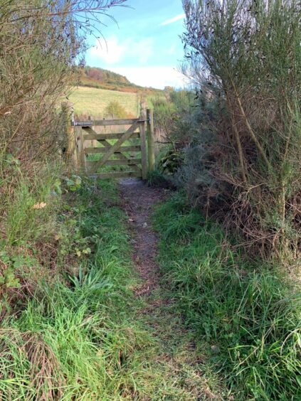
2. Turn right on rougher surface and head uphill. Shortly after track swings left, watch for faded wooden signpost for Scolty Hill on right which goes between bushes to wooden gate.
3. Go through gate and walk along grassy corridor between fenced and walled fields. Higher up, path goes through mixed woodland at first then conifers – follow along fence boundary until reaching wooden gate and sign.
4. Follow path uphill through trees until it makes left turn for short distance, then turn right to follow mossy dyke through pines to reach gap in old fence.
5. Turn left (arrow on gate post) then almost immediately right through a gap in wall and follow the marked path uphill to left until it emerges from wood to reach path junction.
6. Turning right leads directly to the summit, but to prolong the walk a little, go left and head slightly downhill before circling round to the right to meet an obvious path opposite a huge rock. This heads right to rejoin the earlier path to the tower and view indicators at the top.
7. Return by heading back to the path junction then reverse the route back through the wood and field corridor to Strachan.
INFORMATION
Distance: 6km/3.75miles
Ascent: 265m/870ft
Time: 2-3 hours
Grading: Delightful short well-signed route through woodland and on hill paths to a popular summit from the quieter southern side. Gentle gradient, suitable for all ages and fitness levels. Muddy and rocky in places, exposed tree roots, some pavement walking, good footwear advised. Farmland route, dogs under close control. Please remember to close gates.
Start/finish: Village Hall at eastern end of Strachan (Grid ref: NO 122017) or at war memorial in centre of village. It should also be possible to park in residential streets with consideration.
Map: Ordnance Survey 1:50,000 Landranger Map 45 (Stonehaven & Banchory); Ordnance Survey 1:25,000 Explorer sheets 382 and 396.
Tourist Information: VisitScotland, Aberdeen iCentre, 23 Union St, Aberdeen, AB11 5BP (01224 269180).
Public transport: None to start.


Conversation