Craighall Bridge circular, Blairgowrie
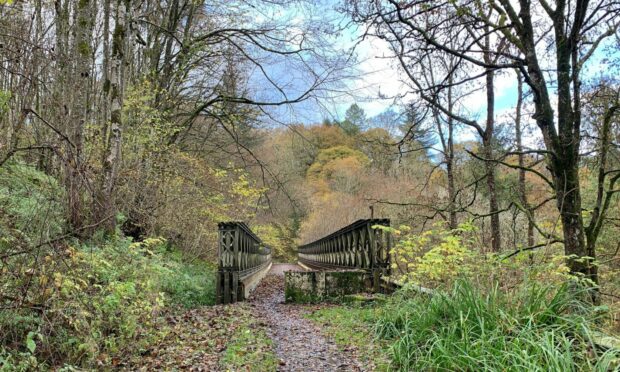
Those of a certain vintage will remember well the old line of the A93 heading out of Blairgowrie which twisted through the steep-sided woodland of the Craighall gorge, and the familiar rumble and swoosh of the tyres when crossing the Bailey bridge.
The bridge had been a temporary solution to persistent problems of subsidence but this section was finally shut off in 2008 when a new bypass was opened.
It’s always fascinating to watch how quickly nature recolonises abandoned roads and buildings and the Craighall section of this circular walk around the banks of the River Ericht is a prime spot.
Entering from the northern end, initially the road surface seems just like any other. In fact, it is actually in better condition than parts of the new road.
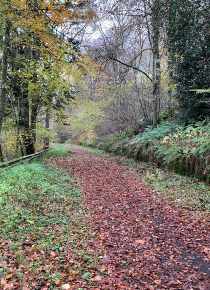
But the deeper you go, the more nature takes over: grass verges closing in to overpower the tarmac, tree branches reaching over from either side to join forces, the white line up the middle of the road disappearing, overwhelmed.
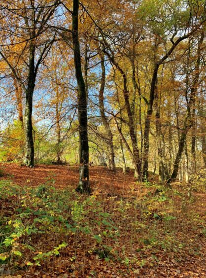
In late autumn the old road is particularly impressive, a multi-coloured carpet of fallen leaves covering over the faintest traces of its former purpose. The bridge is still intact, moss-covered blocks at one end where traffic lights once sat, the crash barriers running alongside now turning green rather than rust.
Although this is undoubtedly the highlight of the walk, there is much to enjoy en route. Follow the signs for the Cateran Trail along the western bank of the Ericht from Blairgowrie Bridge to reach two viewing platforms among the trees.
The second of these is Cargill’s Leap, where the outlawed minister Donald Cargill is said to have made a daring escape from pursuing dragoons by jumping across the raging waters of the narrow gorge.
Cargill, who was born in Rattray, had fallen foul of Charles II by refusing to acknowledge laws to establish bishops in Scotland, and the king put a price on his head, accusing him of treason. Despite his narrow escape here, he was eventually captured and executed in 1681.
Textile manufacturing played a huge part in the area’s prosperity during the 1800s, and all along the river are reminders of that industrial past, derelict or renovated buildings, including Oakbank Mill, the first in Scotland to spin jute.
The trail continues through mixed woodland, home to more ruins and a number of nature sculptures and a great place to spot red squirrels. I left the Cateran Trail just before the private entrance to Lornty, heading over a bridge and then uphill on the surfaced road to Woodhead Farm.
The track became rougher and wetter, running along the edge of woodland before turning to find a passage between fields and then through open grazing to a pedestrian gate where a sign pointed to a right turn down through Middle Mause farmyard and out to the A93 for the crossing to the old Craighall road. A couple of kilometres of birdsong, peace and natural resurgence ends at a metal barrier where you emerge again on the A93 at the road bridge.
The way back into Blairgowrie is mostly on pavements, but there is a short section without which needs care before you reach a car park on the right. Head out the back and take the signed path for Cargill’s Leap which leads down a flight of wooden steps to reach the bridge over the river at Oakbank Mill. Cross, turn left and retrace your steps along the river back to the start.
ROUTE
1. Walk down to Blairgowrie Bridge, turn left to follow Cateran Trail (signed) along River Ericht.
2. Head left up wooden steps and turn right along path, drop right to river viewpoint and continue on to Cargill’s Leap before heading uphill again to rejoin path.
3. Stay left to pass Oakbank Mill then at junction turn right to reach road beyond Brooklinn Mill.
4. Turn right (Cateran Trail) then right again at private entrance for Lornty to cross bridge and head uphill on surfaced track. Pass some cottages on right and continue to Woodhead Farm.
5. Keep straight ahead on rough, muddy track which runs along edge of woodland to reach junction.
6. Go straight on signed track running between fields. Go through gate into sheep field and follow grassy track to reach metal farm gate with pedestrian gate alongside.
7. Turn right (arrow) and follow track down through Middle Mause farmyard, then keep left on track heading down to A93.
8. Cross carefully and follow old road (signed) past metal barrier to cross Bailey bridge and then continue following road which eventually emerges back on A93 at Craighall Bridge.
9. Walk back along pavements into outskirts of Blairgowrie (one short stretch with no pavement) and turn right into car park. Go through and pick up path (signed for Cargill’s Leap) which goes down steps and across bridge to rejoin outward route beside Oakbank Mill and retrace steps to start.
INFORMATION
Distance: 10km/6.25miles
Ascent: 245m/805ft
Time: 2.5-3.5 hours
Grading: Pleasant circular walk along river and back by old abandoned road, suitable for all ages and fitness levels along riverside and woodland paths, field edges and minor roads. One short section on main road without pavement, care needed. Very muddy in places, good footwear advised. Route passes through farmland, dogs under tight control. Please close all gates.
Start/finish: Wellmeadow car park in Blairgowrie (Grid ref: NO 180451) or in town centre.
Map: Ordnance Survey 1:50,000 Landranger Map 53 (Blairgowrie & Forest of Alyth); OS 1:25,000 Explorer sheet 381.
Tourist Information: VisitScotland, Perth iCentre, 45 High Street, Perth, PH1 5TJ (Tel 01738 450600).
Public transport: Regular bus service from Dundee and Perth to Blairgowrie (Nos 57, 59).


Conversation