Culross and Preston Island, Fife
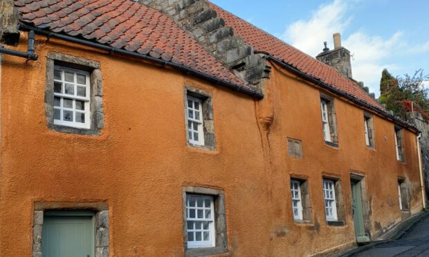
A wander round the cobbled streets and beautifully preserved buildings of Culross always feels like taking a step back in time. Little wonder that it is a perfect filming set for the romantic historical drama Outlander.
The village also has a rich industrial heritage. Scotland’s first coal mine was dug here in 1575 and 20 years later the world’s first undersea mine, the Moat Pit, was constructed, running under the waters of the Firth of Forth.
The contrasting faces of this pretty settlement can be encapsulated in a fine circuit which heads east along the coast before returning in a loop via a peaceful woodland before dropping back through the streets, with the option of an interesting detour to a ruined church.
There is a variety of start points – if you fancy an even longer walk, you can begin from Devilla Forest – but we chose the car park at the western end of the village, stepping up on to the surfaced Fife Coastal Path which runs east alongside the rail line. The remains of the Moat Pit lie off to the right.
After a short distance, we turned right through the metal pedestrian gates which crossed the railway and then took the right fork at a signpost, leaving the line of the coastal path to loop around Preston Island.
The man-made island was the work of Sir Robert Preston, a local merchant who his fortune in India, and was used for salt production in the 19th Century. The reclaimed land, no longer an island, is now part of the Torry Bay nature reserve and the artificial lagoons are a haven for wintering birds. There are a couple of viewing hides around the bay.
The track eventually emerges from the ‘island’ and after passing through a small wooded section, crosses a rail bridge (watch for turn on left) into a car park, then takes a lazy twisting line to the road. After passing a memorial to the victims of the 1939 Valleyfield Colliery disaster, we crossed the main road higher up to enter Valleyfield Woods.
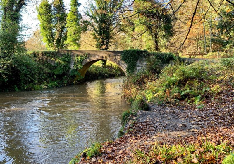
Our route followed the water in a series of signed twists and turns through autumnal colours to reach an old stone arch bridge which could have come straight from the set of Outlander.
We crossed and followed the path uphill, then left through an underpass and over open ground until a path on the right led us past houses and out to the B9037. Another path on the opposite side of the minor road took us between fields with views of the sparkling waters of the Forth in the distance to the left.
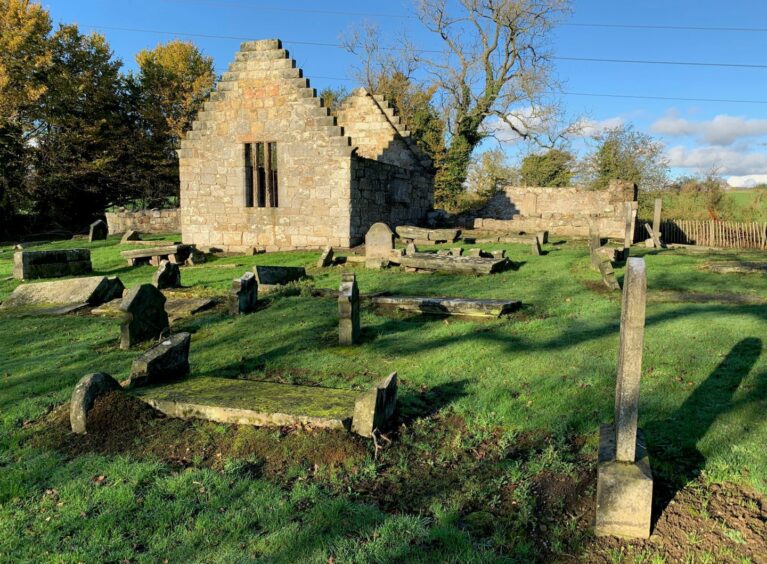
Before heading down the series of minor roads into Culross, we turned right for the short detour to the ruined West Kirk and its graveyard.
There are a couple of options to return to Culross, but we chose to retrace our steps to the last junction and walk downhill past the abbey, taking our time to explore the narrow streets.
The leisurely walk had taken less than three hours, but the hours and minutes seemed an irrelevance in such a timeless setting.
ROUTE
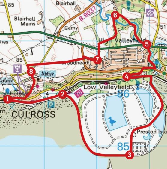
1. Head east on surfaced Fife Coastal Path which runs parallel with rail line. Shortly after passing another car park on left, go through metal gates on right to cross railway.
2. Go right at signpost (coastal path goes left) on track running round edge of Preston Island, south at first then east for about 1km until reaching track split.
3. Follow track left and round edge of Torry Bay to enter woodland by path on right. This curves left going through two wooden gates past level crossing, then further on turns left to cross bridge over railway into car park.
4. Exit car park by path on right which leads to road. Cross and head up to junction, passing memorial on right, then cross main road to Valleyfield Woods entrance.
5. Take path to left of information panel, follow alongside water and under A985 flyover. Stay on main path until junction and go left (purple arrow), then cross small bridge to continue along opposite bank and at next junction turn left over stone arched bridge.
6. Walk uphill ignoring all path branches, keeping right to exit woods and cross open ground. Path swings left to go through underpass. Keep straight on until taking path on right between trees and fence to emerge on surfaced streets.
7. Pass through houses to reach B9037, turn left and cross to pick up path heading west between fields to metal gate. Go through and keep left on minor road, turn left at next junction. DETOUR: To visit West Kirk, turn next right after junction and when road swings left keep straight ahead on rough track. Retrace steps to turning point (add 1km each way).
8. Head downhill into Culross, passing abbey and then through streets to return to car park.
INFORMATION
Distance: 11km/7miles
Ascent: 140m/460ft
Time: 3-4 hours
Grading: Pleasant low-level route on coastal path, rough tracks, woodland paths and minor roads with couple of road crossings. Suitable for all ages and abilities, can be muddy in places, good footwear advised. Dogs under close control in nature reserve.
Start/finish: Culross West car park (Grid ref: NT 984858).
Map: Ordnance Survey 1:50,000 Landranger Map 65 (Falkirk & Linlithgow); Ordnance Survey 1:25,000 Explorer sheet 367.
Tourist Information: VisitScotland, St Andrews iCentre, 70 Market Street, St Andrews, KY16 9NU (Tel 01334 472021).
Public transport: Bus service from Dunfermline (No.8).





Conversation