Carmyllie Heritage Trail, Angus
The tiny parish of Carmyllie sits in a quiet corner of the Angus countryside, an area rich with history dating back to the Bronze Age yet still largely unknown and unexplored by the vast majority.
If you are searching for a little piece of tranquillity as a break from the festive indulgences then this short circuit fits the bill. I have to confess that this has become a local favourite, but any walk that starts and finishes at a farm coffee shop is a winner in my book.
Although the distances covered are modest, there’s a great feeling of space here. The name Carmyllie means the top of a rocky or bare place, and on a crisp winter day when the wind has that fresh, raw edge, the openness of the landscape is keenly felt.
The walking trail was created in 2017 by the Carmyllie Heritage Society in association with Angus Council in a bid to raise public awareness of the area as a source of historic value. There have been finds of Bronze Age graves (cists), dated as far back as 700 BC, and there is also evidence of large Roman military encampments from the 1st century AD.
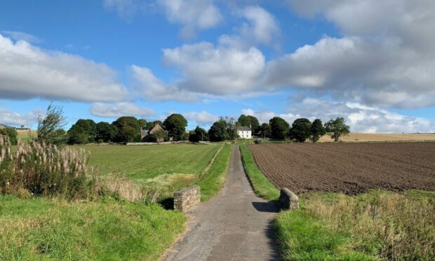
Much of the walking is on minor roads but the traffic is light, so much so that the appearance of a car or van is a bit of a novelty. Instead, you are faced with wide open spaces and the consequential expansive views.
The route starts at Milton Haugh Farm, crosses the B961, then heads between farm buildings and takes a right turn on to a quiet country lane. This crosses the Elliott Water and travels uphill to Carmyllie Parich Church.
The church dates back to 1609, having been built on the same site of St Mary’s Chapel where monks from nearby Arbroath Abbey assisted with services. The current manse was built in 1820 and there was a major refurbishment about 50 years later.
One of the former ministers was the Reverend Patrick Bell, most noted for his invention of the reaping machine. He had experimented with early versions at his father’s farm in Auchterhouse while training for the ministry, and its success helped land him teaching posts in the USA. He returned to become minister at Carmyllie in 1843.
He died in 1869 and is buried in the church grounds. There is a comprehensive information board nearby detailing his remarkable work.
The rowan trees in the church grounds provided a splash of colour and an attraction for the local birdlife as I continued north on the tarmac. The sun had painted the wide sweep of the Tay as solid silver bars on the distant horizon to the right, while flocks of birds rose every so often to breach the otherwise encircling silence.
It was hard to imagine that this was once a more industrial landscape: the Slade quarries had employed hundreds in the early 19th Century when Carmyllie stone was in great demand for roof slates and buildings, and there was a rail line built to transport the stone.
The fields seemed to run forever in accentuated lines, the feeling of space and distance keeping pace with my progress. A turn left on to a rough marked track brought the far-off Sidlaws into the eyeline, a touch of white brushing their tops.
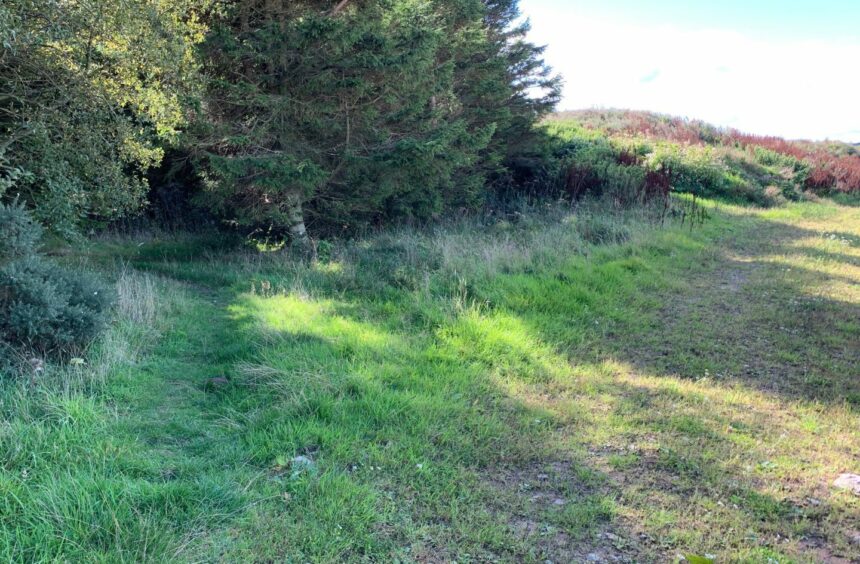
There was a short passage through a small wood, a secluded spot for pigeon trysts judging by the amount of feathers spread throughout the tree branches, before I emerged on to a grassy track bwteen fields down to Greystone, the oldest village in the parish.
From here, it was all road walking, uphill at first to the earlier junction then a retracing of steps back to the farm shop. And, of course, a welcome coffee and refreshments before the short hop home.

ROUTE
1. Cross B961 carefully then turn right between farm buildings and house. At end of track turn right on to minor road.
2. Head uphill, passing Carmyllie Church, keeping on until end of road. Turn left at junction, then right after short distance.
3. Follow road as it bends first left then right and when you reach the end, turn left along next road. Pass farm entrance (West Laverockhall) and continue along road until reaching rough track on left (signed for Greystone).
4. Follow track passing left of ruined building and barn. After it bends round left, watch for path heading left into trees just before track starts going right.
5. When it emerges from woodland, continue on grassy corridor down to Greystone.
6. Turn left at end of grass track heading down surfaced track past houses. Ignore turn left, instead follow curve of track right and down to road.
7. Turn left and walk up road past Mains of Carmyllie farm to reach road on right signed for Carmyllie Church. Retrace your steps from here past church and then left on track back to Milton Haugh.
INFORMATION
Distance: 7.5km/4.7miles
Ascent: 90m/298ft
Time: 1.5-2 hours
Grading: Pleasant short circuit in a quiet corner of Angus, mostly on quiet roads and tracks plus short woodland section. Minimal ascent, suitable for all fitness levels. Farmland route, dogs under close control as livestock may be encountered.
Start/finish: Milton Haugh Farm and Coffee Shop (Grid ref: NO 122017) off B961.
Map: Ordnance Survey 1:50,000 Landranger Map 54 (Dundee & Montrose); Ordnance Survey 1:25,000 Explorer sheet OL 382.
Tourist Information: VisitScotland, Dundee iCentre, V&A Dundee, 1 Riverside Esplanade, Dundee DD1 4EZ (Tel 01382 527527).
Public transport: None.


Conversation