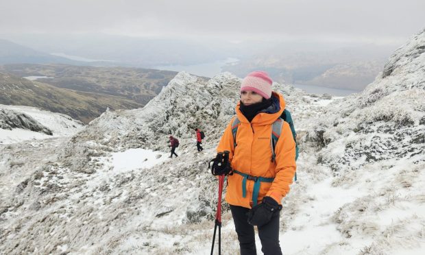
Clachnaben, Glen Dye, Aberdeenshire
This is the time of year when the weather is a vital factor in deciding where and when to walk, so with much of the country suffering from snow, ice or heavy rain our choices were limited.
We were fortunate to have a short window of opportunity in the east, however, and as it is also the time of year to pop in to see old friends, we made the relatively short journey up to Clachnaben.
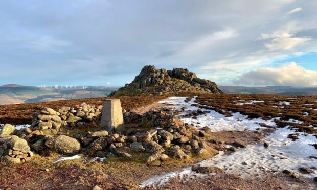
Sitting just to the south of Banchory, this iconic hill may be just 589 metres high but the large granite tor which marks the summit distinguishes it for miles around. It was said to be so distinctive that ships were able to use it to take bearings from out in the North Sea.
The journey from the south goes over the Cairn o’ Mount, and although we had set off in early sunshine the road was iced and the temperature dropped to zero as we crossed the high pass. The consolation was the sight of the tor ahead on the horizon, standing out against the drab ground and wan sky, and getting closer all the time.
There were a few cars in the small forest car park in Glen Dye (it can get very busy) and underfoot conditions were icy. Even the soft path of copper pine needles through the wood had hardened enough that we felt we needed micro spikes to avoid a slip.
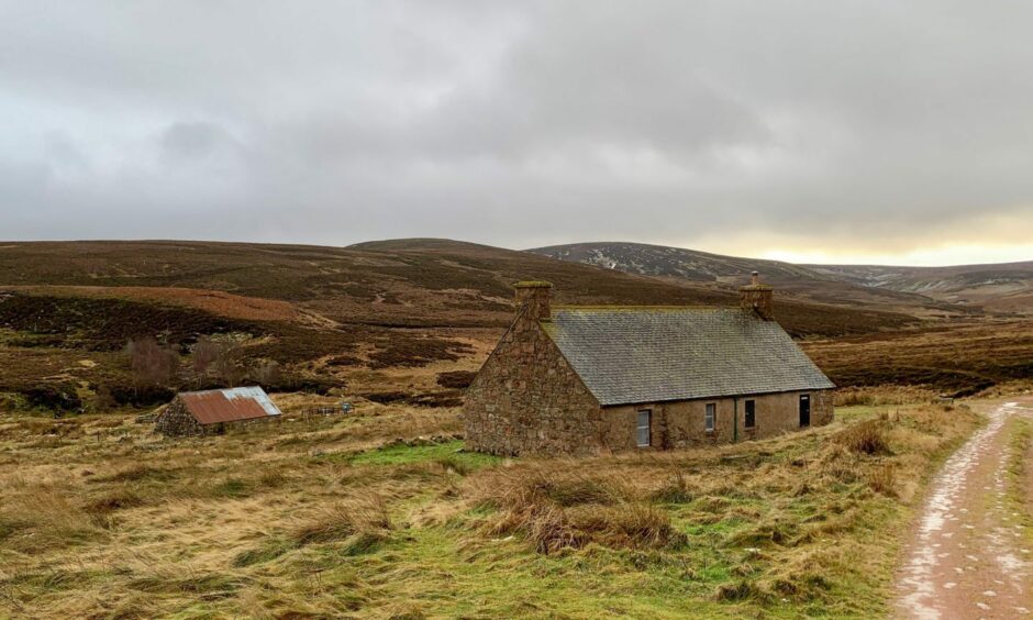
There is a variety of routes on good paths and tracks, as long or as short as you wish to make the day. We were looking for a longer circuit, a good hill workout to work off those festive excesses, so decided to loop round onto the hill via Charr bothy. This had the advantage of shelter for an early lunch stop, before starting the harder, uphill work.
After the initial woodland approach, we soon found ourselves alone on the track heading along the river, most of the other walkers taking the shorter way up.
We reached the bothy just as the rain came on, perfect timing. Another group arrived five minutes later, and were already soaked. Ten minutes later we emerged to a complete change – blue skies and sunshine.
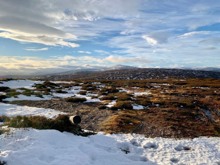
The track climbed steadily uphill, icy at times and occasionally covered by high banks of snow. It twisted away from the line of the burn and then back again over the side of the first top, Cairn of Finglenny.
We could have ignored this top, but the summit was just a fingertip away and we followed faint paths through the heather to a fitting reward, a superb view of the skyline ahead, probably the best of the whole walk.
The track continued to a junction on the uninspiring Hill of Edendocher, a named high point rather than a summit, but the improved atmospherics provided a beautiful long view left to the Corbett Mount Battock, the highest point on the whole rolling ridge.
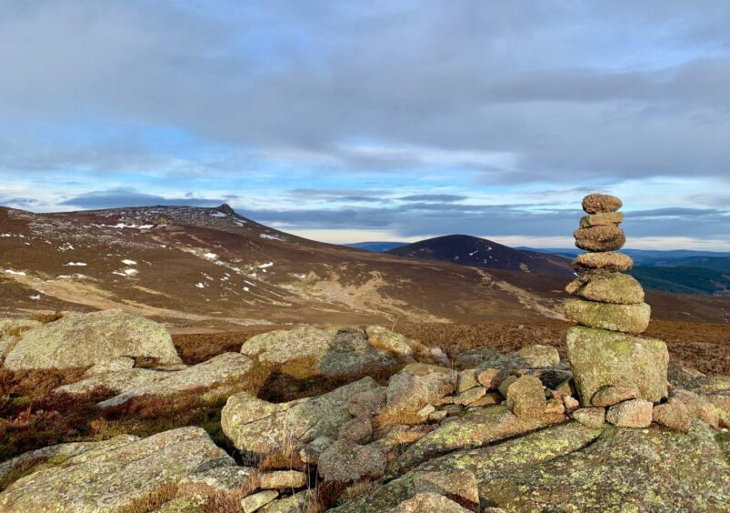
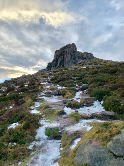
A right turn led over a shallow dip followed by an easy rise to the trig point and cairn of Clachnaben, that outrageous summit tor just beyond. We managed to scramble up the icy rocks with care, the wind adding the need for an extra layer of caution.
The heather lump of Mount Shade lay dead ahead but with the light fading we decided to leave it for another time. We dropped down the hill path into the trees and then crossed the well-named Miller’s Bog – some very wet and muddy sections – before the last push to the car park.
This was punctuated by regular stops to turn our eyes to that hypnotic tor, a dramatic focal point for the continuous changing of the light.
ROUTE
1. Take path into woods at south end of car park and follow to reach track heading south past Glendye Lodge. Pass through pedestrian gate to left of high metal gate.
2. Ignore track on right, heading straight on. When track splits, take left branch which follows river.
3. Pass through gate in wooded section, ignore track going down to bridge on left and continue by river. Turn right uphill before weir and follow track to Charr bothy.
4. Turn right on track heading uphill at first by Brocky Burn, then turning to pass Cairn of Finglenny. This summit is easily obtained by brief detour.
5. Keep following track north-west, passing cairn on left to reach top of Hill of Edendocher and track junction.
6. Turn right to head for trig pillar on Clachnaben with prominent tor just beyond and scramble up rocks to airy summit.
7. Descend east on good path which drops to wood and follow along edge of trees. There is also a lower unmarked path above the burn. Both emerge at gate beside information cairn.
8. Go through gate and follow muddy track through section known as Miller’s Bog. When this rejoins initial inward track, turn left and retrace steps through trees to car park.
INFORMATION
Distance: 16km/10miles
Ascent: 635m/2080ft
Time: 4.5-6.5 hours
Grading: Lovely, quieter circuit around around a popular little hill. Good tracks and paths all the way but route crosses high, exposed ground so relevant hill experience and fitness required, especially under winter conditions. Care needed on scramble up rocky summit tor. Some boggy sections, sturdy footwear essential. Dogs under close control on lower ground.
Start/finish: Woodland car park (Grid ref: NO 648868) about 500m north of Bridge of Dye.
Map: Ordnance Survey 1:50,000 Landranger Map 45 (Stonehaven & Banchory); Ordnance Survey 1:25,000 Explorer sheets 395 and 396.
Tourist Information: VisitScotland, Ballater iCentre, Station Square, Ballater, AB35 5QB (Tel 01339 755306).
Public transport: None.

Conversation