Craig Varr, Kinloch Rannoch, Perth & Kinross
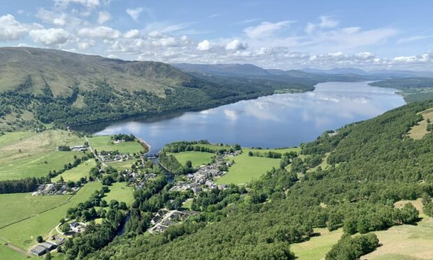
The waters of Loch Rannoch lay still as a sheet of ornamental glass stretching off to the distant horizon, a perfect reflection of the blue sky and cotton wool balls of white cloud.
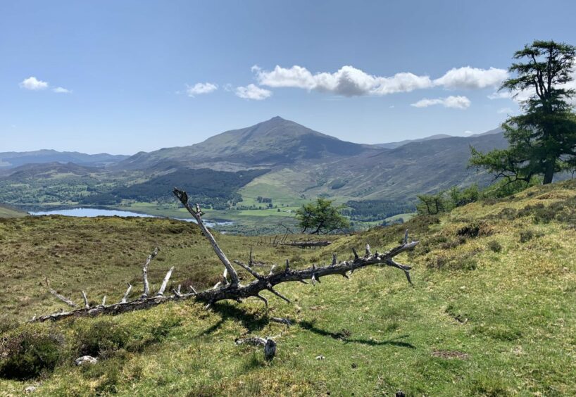
There was blue in the other direction as well, but the focus here was on the scree pyramid of Schiehallion soaring above Dunalastair Water.
The views from Craig Varr, the crag which towers over the village of Kinloch Rannoch, are second to none, an impressive boast considering the modest amount of ascent and effort needed to experience them. No surprise then that this is a well-used and well-loved route.
Despite its prominence, though, Craig Varr is merely a rocky rise at the end of a minor ridge rather than a separate peak. The highest point is Ceunn Caol na Creige, itself a lower, outlying summit rolling off to the south-west of its parent, Beinn a’ Chuallaich.
It is possible to continue to the Corbett over the intervening lumps and bumps but that involves a lot more uphill work and an awkward return journey to avoid a long road walk.
Although the Craig Varr route is well-signed and it’s pretty difficult to go wrong, this is a walk which demands fine weather to make the most of the views, no matter the season.
The starting point was the little square in the centre of the village where parking can be scarce at busy times of the year. If there is no room, spaces can sometimes be found just over the bridge, but remember to be considerate to local needs.
A prominent wooden sign just past the garage up from the square pointed the way. We went through a gate where there was an information board and off to the right a lovely little waterfall pouring gently down a slabby rock face.
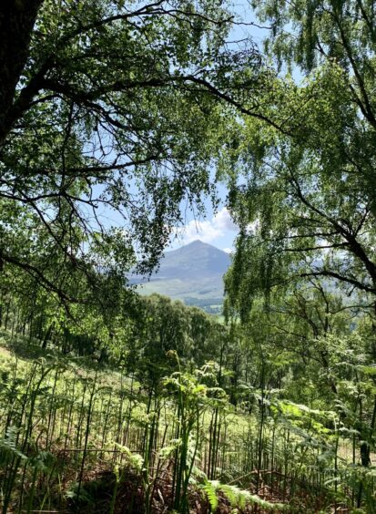
It was a steady but steep pull-up on the zig-zag track enhanced by glimpses of distant Schiehallion every so often, its hazy blue/grey shape framed through breaks in the verdant tree cover contrasting beautifully with the greenery.
Once out of the trees and through another metal gate, we kept right, heading over a footbridge and then along beside an old wall. Our destination was now in plain sight, a few cairns spread along the ridge which sloped down to the bookend of Craig Varr.
One last steep section led to the prize, flawless views of Loch Rannoch and the toytown buildings of Kinloch Rannoch to the west, Schiehallion to the east.
We were also taken with the few trees which grace this high top: most had toppled and were rotting away but they were far from dead, new life sprouting powerfully at different and somewhat bizarre angles. Two in particular formed an ideal square space for a photo frame.
It had been a short excursion so far, so we decided to head for the top of the ridge, following the old wall over a couple of rises and passing some finely built cairns to reach the high point. This provided a different perspective of surroundings hills, Beinn a’ Chuallaich to the north-east and Meall Dubh to the west, another snaking wall across its slopes.
We returned to Craig Varr for a lunch break and to spend more time drinking in the views, then dropped back the way we came, this time turning left at a junction, climbing a stile and heading down into the woods.
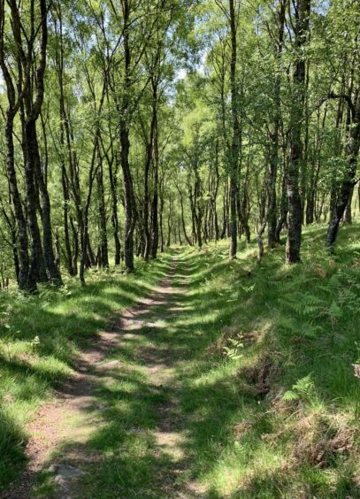
The track took its time on a series of long switchbacks, all the better for the alternating light of sun and shadow filtering through the canopy, before the final section on a path parallel with the road over little bridges and wooden stairs.
We emerged on the road for the short walk – brief, but you have to be careful – back into the village. Looking back up at the crag, we couldn’t help but promise to revisit on a day of deep snow cover and perfect winter skies.
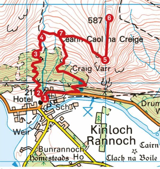
ROUTE
From village square, walk north for short distance along road and after passing garage turn left on track (signed for Craig Varr).
Pass waterfall on your right. Ignore signed path going left then fork right off main track on to older one heading steeply uphill through trees in series of zig-zags.
Higher up, ignore another track coming in from left, instead keep right on track to leave woods to reach metal gate.
Go through gate and turn right to cross wooden footbridge and follow track down towards another gate. Leave track here and follow path by line of old wall, then more steeply up final rise to the superb viewpoint of Craig Varr.
To reach the highest point on the ridge, Ceunn Caol na Creige, head north following an old wall to reach the summit cairn.
Return to Craig Varr, then descend on the path as far as the last gate.
Cross the stile over the fence and follow the path down into the trees where a series of switchbacks eventually leads to the road back into Kinloch Rannoch.
INFORMATION
Distance: 4.5km/2.75miles
Ascent: 340m/1115ft
Time: 2-3 hours
Grading: Short, sharp ascent to a superb viewpoint on good, well-signed circuit of tracks and paths. Suitable for most fitness levels and kids will love it. One very short section on road needs care. Some boggy ground, good footwear advised. Sheep on the hill, dogs under close control.
Start/finish: Kinloch Rannoch village square (Grid ref: NN 661587). Further parking available over bridge.
Map: Ordnance Survey 1:50,000 Landranger Map 42 (Glen Garry & Loch Rannoch); Ordnance Survey 1:25,000 Explorer sheet OL49.
Tourist Information: VisitScotland, Pitlochry iCentre, 22 Atholl Road, Pitlochry, PH16 5BX (Tel 01796 472215).
Public transport: Bus service to Kinloch Rannoch.



Conversation