The upland country between Glen Almond and Strathbraan in Perthshire is dotted with fine wee hills. The best known of these is Birnam Hill, its popularity stemming from both Shakespearean connections and the presence of a long established and well-walked trail to the summit.
By contrast, neighbouring Craig Obney, which lies to the south and is only a metre lower in height, is equally interesting but oft overlooked. Those who do venture this way, however, will discover a shapely peak with a dash of history and, on a clear day, panoramic views.
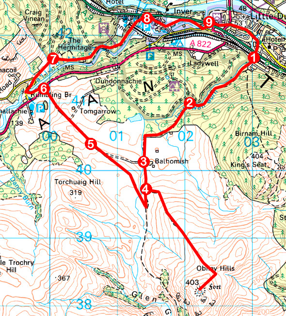
Track and path offer a direct there-and-back approach from Strathbraan but I opted instead to set off from Birnam on a circuit that would take me to the top of the hill before returning home via the spectacular waterfalls of Rumbling Bridge and The Hermitage.
The route initially follows the Birnam Hill path out of the village, passing under the A9 and parallel railway, but where trails to the top of MacBeth’s heavily forested hill branch left, I stuck with Inchewan Burn, following the stream up through a wooded valley.
Emerging on to felled slopes, the way curves left, rising sharply above Birnam Glen Falls which, concealed by trees, lie at the foot of a path that dips to the right, dropping steeply by a deer fence. A small, unofficial sign points the way.
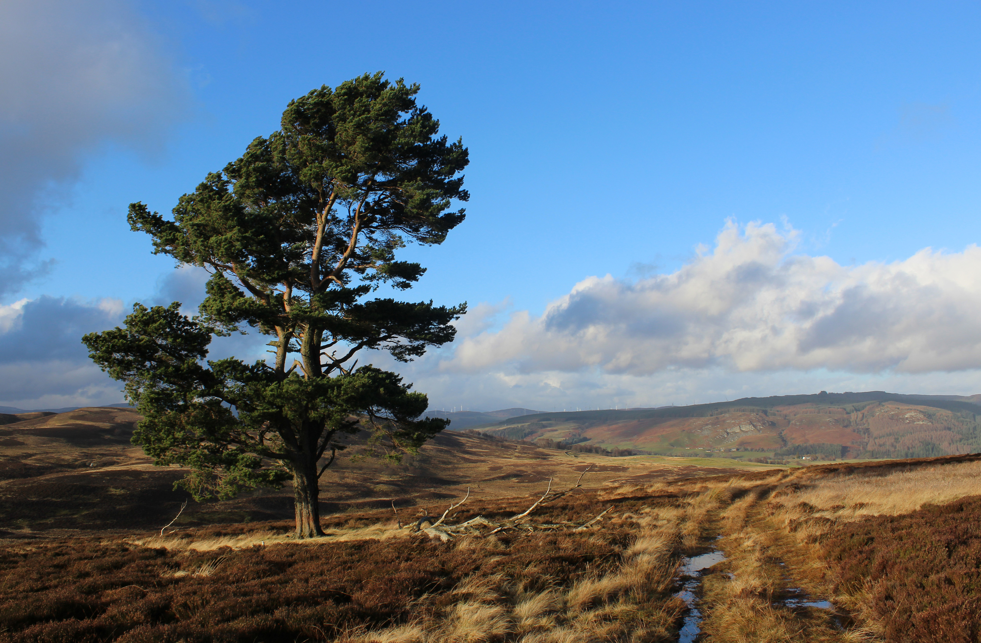
At the top of the slope, the track dog-legs through a band of trees and across farmland to a junction by the steading at Balhomish. Passing through gates and bearing right across rough pasture, a gate at the top of the field led me out on to grouse moor.
A heathery track ascends the north-west flank of the hill, topping out at a shallow col where a path branching right completes the hike up to the rocky summit.
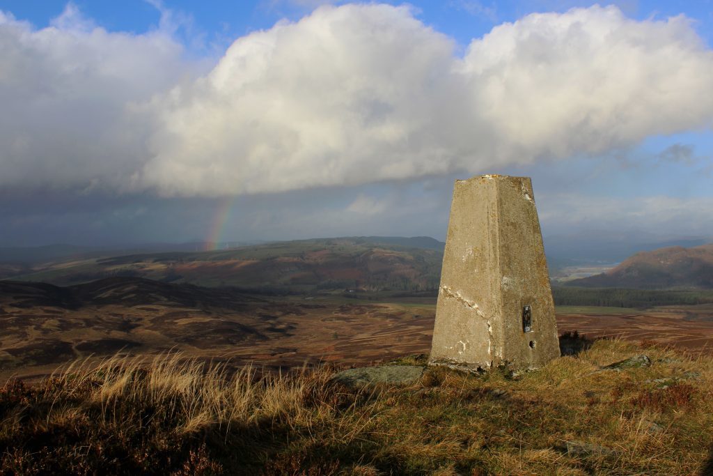
Site of an ancient hill fort, the oval plateau offers a vista stretching far and wide over the surrounding countryside. Closer to home, Birnam Hill lies to the north while neighbouring Craig Gibbon sits on the other side of Glen Garr, a slender, steep-sided dip.
A right of way leading to Strathbraan cuts through this cleft but with the slope below me rather too precipitous, I retraced steps down towards Balhomish, joining it just above the fence separating pasture from moor.
Following the line of an old wall north-west, the trail meets up with a track that makes a leisurely descent to the A822, a path on the other side of the road weaving through mixed woodland to Rumbling Bridge.
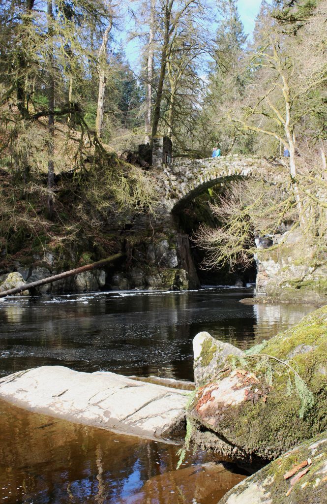
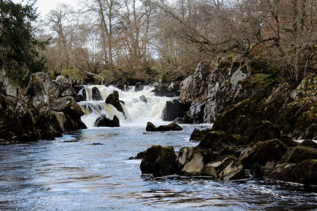
Along the way, a viewpoint offers a first glimpse of the old stone bridge that spans a deep rocky ravine through which the river tumbles, the pounding beat of the cascading current blessing the crossing with its name.
Waterfalls above and below the bridge are spectacular, particularly after periods of heavy rain, and the River Braan continues to impress further downstream at The Hermitage.
Once the landscaped wooded policies of Dunkeld House, they remain a popular scenic spot, complete with an 18th century summerhouse overlooking the river and a hermit’s cave tucked away in the trees.
After such a dramatic descent, the River Braan loses its vigour below The Hermitage and, together, we meandered towards Birnam, the river ending its journey in the Tay while I finished up at a local coffee shop.
ROUTE
1. Follow Birnam Glen road south (signed Birnam Hill Path) under A9. Below railway, bear left up path to junction. Branch right (signed Inchewan Paths), following Inchewan Burn upstream.
2. Turn left on ascending path then track to Balhomish.
3. Cross stile, pass through metal gate opposite, then wooden gate, bearing right over field to junction beyond next gate.
4. Fork left and ascend Craig Obney. Return to point 4, turn left, descending to waymarker, then go right, following path north-west.
5. Continue north-west on track to A822.
6. Follow path (signed Rumbling Bridge) to meet minor road below car park. Go right, over Rumbling Bridge, ascend road then go right through gate, forking right where path splits.
7. Enter woodland and turn right, descending through The Hermitage to A9.
8. Turn right, following path by A9 then road through Inver, turning left at Forestry Commission depot.
9. Cross River Braan, pass under A9, go right to A923 then follow Perth Road east.
INFORMATION
Distance: 15km/9¼ miles
Ascent: 440m/1500ft
Time: 4 hours
Grading: Moderate route following good paths and tracks to summit of low hill with some prologue ascent. Keep dogs under close control on open hillside and over farmland
Start/finish: Junction of Perth Road and Birnam Glen (opposite Birnam Hotel), Birnam (Grid ref: NO 031419)
Map: Ordnance Survey 1:50,000 Landranger sheet 52 or 53; Ordnance Survey 1:25,000 Explorer sheet 379
Tourist Information: Dunkeld iCentre, The Cross, Dunkeld PH8 0AN (Tel 01350 727688)
Public transport: Stagecoach 23 and Citylink M91 bus services from Perth stop in Birnam as do trains on Perth to Inverness line
