MacGregor’s Cave, Nr Kinloch Rannoch, Perth & Kinross
If you’re looking for a mini-adventure to keep the youngsters happy for a few hours then the short woodland walk to the reputed outlaw hide-out of MacGregor’s Cave may be the answer.
Although the cave sits high among the trees above Dunalastair Water and the River Tummel, the ascent is minimal and the distance even more so and should be within the capabilities of most.
The walk starts a few miles west of Kinloch Rannoch and cycling from the village is a good option. Parking is at the Lassintullich Forest entrance on the minor road over to Schiehallion, and there is also space directly across the road but be sure not block the gates at either spot.
From there, it’s a short road walk east – the road is quiet but there is plenty of room to step on to the grass verge – to reach the track entrance signed for Bridge Cottage.
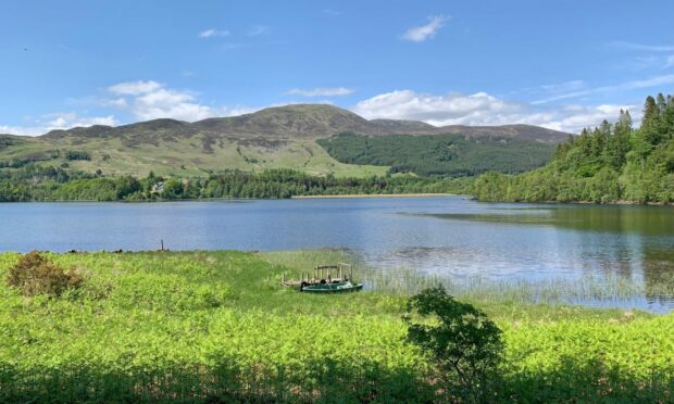
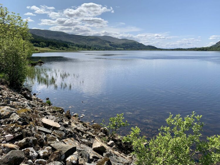
The rough track twists its round the policies of Crossmount and drops to the shores of the man-made reservoir of Dunalastair Water, a beautiful spot to sit for a while when the sun is shining.
The track runs out at Bridge Cottage, and just before reaching this point a path (signed) heads to the right, uphill into the trees. Beyond a high gate, the pines to the left have been cleared and although a bit unsightly, this does allow a view down to the tumbling waters of the Tummel.
The path continues on a gentler line, winding and weaving its way through the trees dominated by stately old oaks and Scots pines as the cover becomes more fulsome with every step.
There’s a rare feeling of peace here, only birdsong of a wide variety echoing through the silence and a few munching sheep in the bracken, and a wonderful juxtaposition of light and shade among the many outrageous shapes of elderly and fallen giants that give off a lost world vibe.
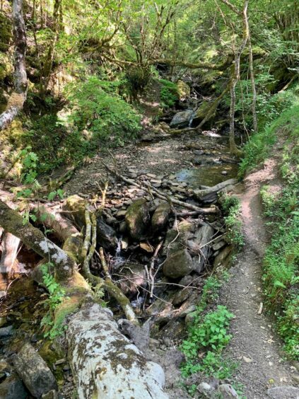
After a section of fairly level walking, the path takes a steeper and narrower line down somewhat eroded ground to reach a stream. There are stepping stones and in normal conditions you should get across with dry feet, but in times of heavy rain this could prove impassable – the debris at the crossing point gives a clue.
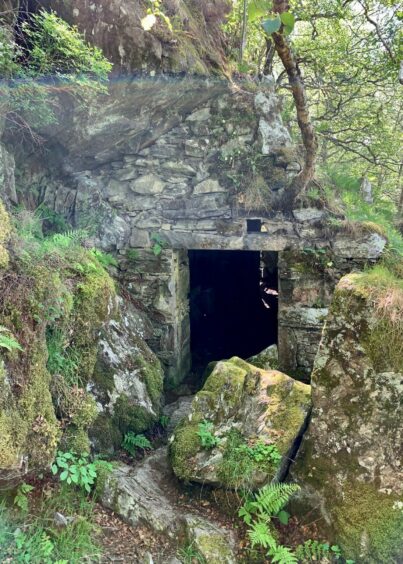
The path for the climb back out of this little gorge on the other side of the water is also narrow and again eroded but once past this point, the way ahead is simple and you are soon at the cave which is situated among the rock and boulder jumble to the right.
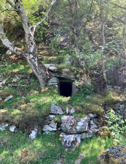
This is said to be where members of the outlawed MacGregors hid out to evade the government redcoats: one story tells how three clan members were chased to their deaths in the river below, another how one man escaped his pursuers by leaping across the Tummel from a high rock.
The romance of the tales obviously impressed the Victorians who ‘gentrified’ the structure and made it a favourite picnic spot.
The cave was likely little more than an overhang during the MacGregor era – now it has an entrance at each end and a squared-off window, although this sheds little light on the inside which stays dark even in the brightest days. There’s also an interior stone seat should you need shelter from the elements.
Directly across from the path from the cave is a rocky knoll, which gives views across to the eerie and rather poignant ruin of Dunalastair Castle, its towers peeking up through the trees. This baronial mansion was used to house Polish refugees during World War II but was abandoned in 1952 and has been left crumbling ever since.
The path continues for a bit longer although its abrupt halt further on offers no easy alternative return route and it’s better to simply retrace your steps from the cave.
The way back may feel familiar, but there’s always a fresh take with the Corbett of Beinn a’ Chuallaich and its long ridge down to the rocky prominence of Craig Varr dominating the skyline over Dunalastair Water.
ROUTE
1. Head east along minor road from parking and after passing cottage, turn left on to track signed for Bridge Cottage.
2. Follow track as it passes to left of Crossmount house and gardens and go through gate, then head down to shore of Dunalastair Water.
3. Just before Bridge Cottage at end of track turn right (signed) and take woodland path heading uphill to reach deer fence.
4. Go through gate and keep following path as it twists and turns through the trees, then drops to cross stream on stepping stones.
5. Once over the water, climb steeply up the other side then follow round to cave on right-hand side of path.
6. Before heading back, go to the rocky knoll opposite for view over the trees to Loch Rannoch, then retrace your steps back to start.
INFORMATION
Distance: 5km/3miles
Ascent: 155m/510ft
Time: 1.5-2.5 hours
Grading: Short and sweet walk on tracks and paths to cave high in the woods, suitable for all fitness levels and ages – youngsters will love it. Muddy in places and raised tree roots, take care at viewpoint (unfenced). Stream crossing may become difficult in wet conditions. Short section of walking on quiet minor road.
Start/finish: Lassintullich Forest parking area (Grid ref: NN 701507) and also on opposite side of road, but be careful not to block gates.
Map: Ordnance Survey 1:50,000 Landranger Map 42 (Glen Garry & Loch Rannoch); Ordnance Survey 1:25,000 Explorer sheet OL49.
Tourist Information: VisitScotland, Pitlochry iCentre, 22 Atholl Road, Pitlochry, PH16 5BX (Tel 01796 472215).
Public transport: None to start point, nearest buses Kinloch Rannoch 5km to the west.