A bright September sun was shining as I set off on my mission to hunt down the curiously named ‘henroost’, high above Forfar.
I parked at Inverarity Parish Church and marched up the road towards Fothringham Home Farm, keeping my eyes peeled for an overgrown path cutting through woodland.
I missed it on my first attempt, finding myself at the entrance to the farm, but a friendly local pointed me in the right direction.
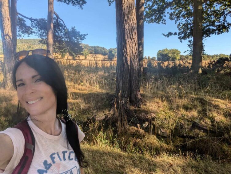
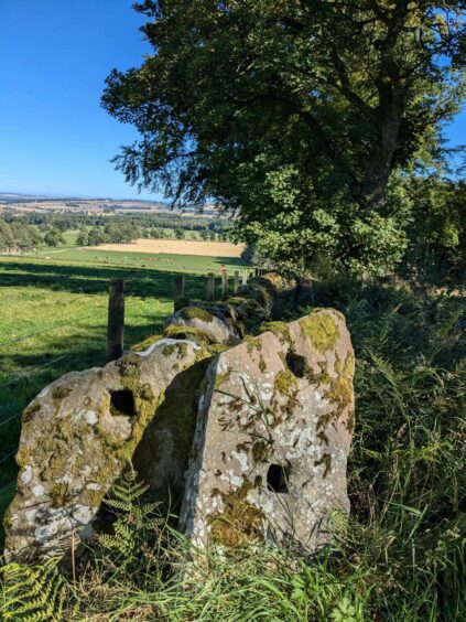
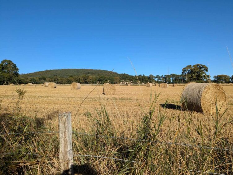
The path was gorgeous, with views of distant hills, trees and fields full of hay bales.
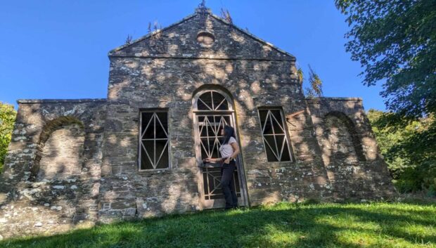
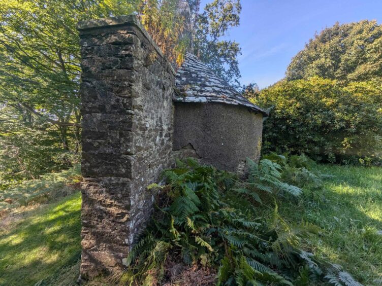
I’d heard about the so-called ‘henroost’, described as a summer house on old maps, but despite having lived in Angus almost 13 years, I’d never tracked it down.
It lies about halfway up Fothringham Hill, but if you’ve not got your wits about you, or your head’s buried in your phone, you could miss it.
After about 10 minutes on the lovely woodland path, I reached a proper track – the service road for an aerial mast near the summit.
Where is the henroost?
It was a fairly steep slog up the hill and as I looked around me, I began to wonder if I’d walked right past the folly.
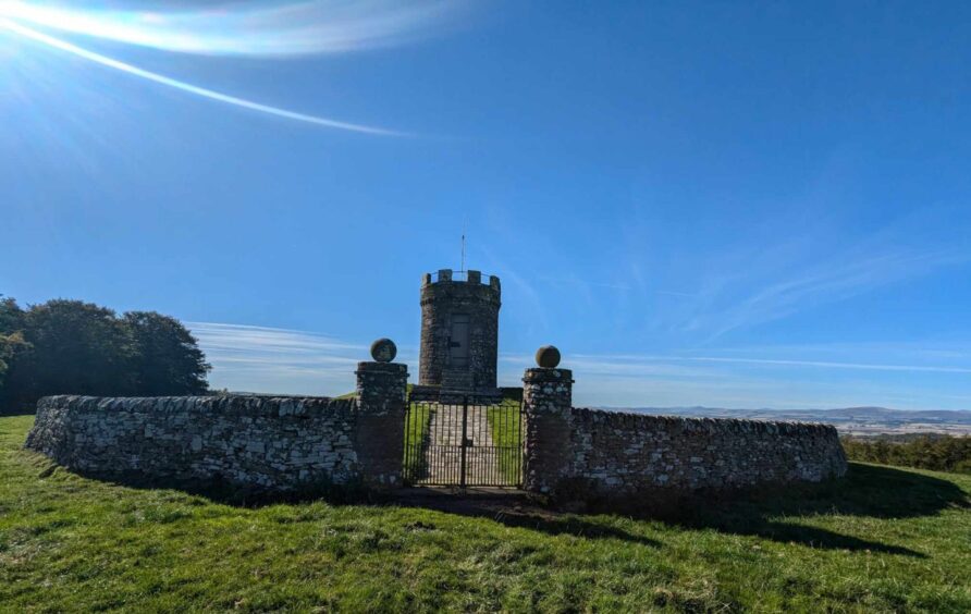
But soon enough it came into view, partially hidden by swathes of rhododendron.
It’s in a stunning spot, with sweeping views over the surrounding farmland.
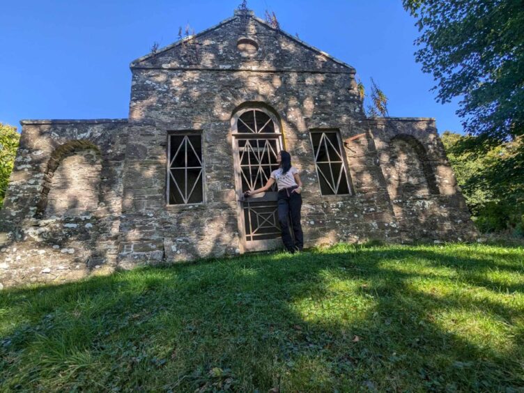
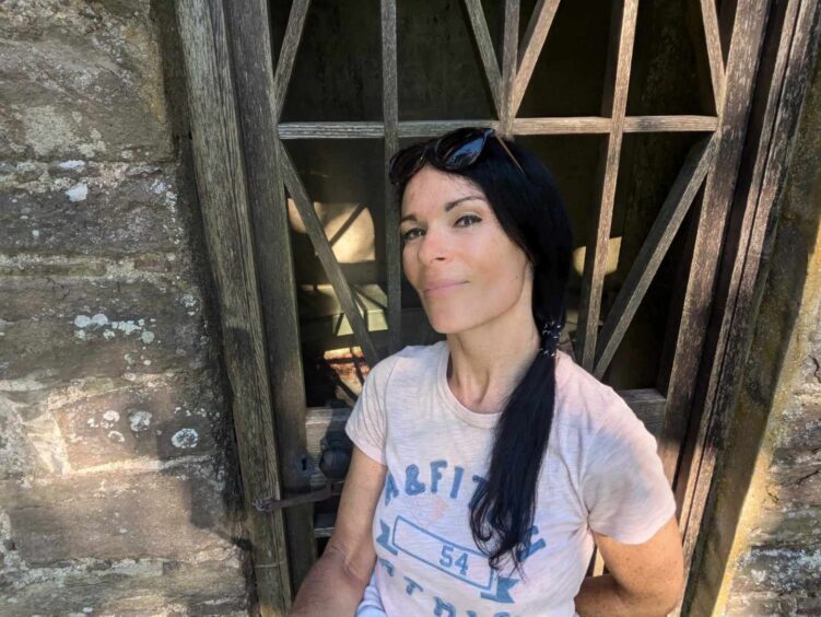
The door wasn’t locked so I was able to pop in for a peek and a sit down on the semi-circular bench.
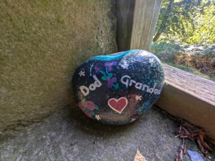
Someone had left a painted memorial pebble in one of the windows – a poignant touch.
So when was the henroost built and what was its purpose?
The Scotland’s Places website has a description of the feature dating from around 1860 which states: “The Henroost: A small ornamental plantation with walks and seats on the home farm of Fotheringham.”
What was the henroost used for?
The folly isn’t marked on current maps, but old ones described it as a “Summer House” in 1865.
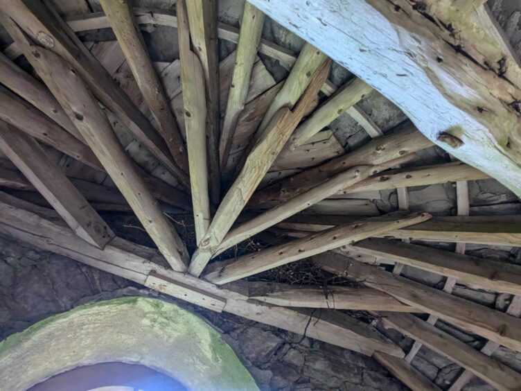
Look closely and you might spot the date 1803 on the gable end.
Some say it was used by a painter, and certainly, there’s plenty to inspire the artistic eye here.
It’s the perfect spot for a picnic, too.
But one thing you won’t see? Roosting hens! Why then was this called the henroost?
Answers on a postcard, please!
I carried on towards the summit, passing a rickety fire lookout tower, and soon reached the top, at 254m.
I failed to spot the trig point – it must be there somewhere.
A red brick building houses some sort of aerial mast, and, a little further down the hill, a disused – and vandalised – wireless station.
The search for the Temple of Lour
From here, my aim was to find the mysterious sounding Temple of Lour, and it was at this point that things got rather confusing.
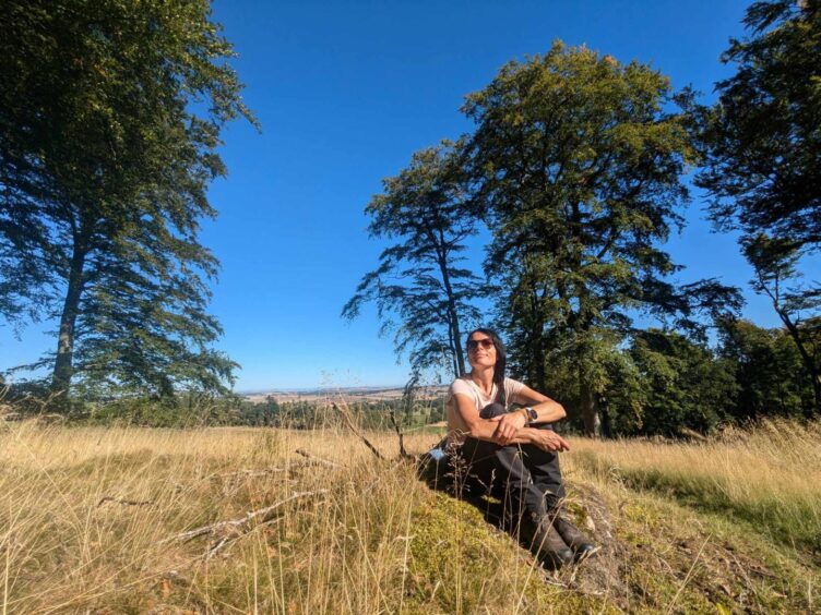
I sat down to consider where I was going for a while, and gazed out across picture-perfect fields dotted with cattle.
Any tracks heading in the direction of the Temple of Lour, a bizarre monument that crowns the Hill of Lour, are not obvious at this point – although there’s an alternative and possibly easier way of getting to it from the other side.
Not one to give up, however, I blundered through vegetation and clambered over fallen trees until I found myself in a tattie field – I’d gone in the totally wrong direction.
What I should have done is to look for a metal gate – and I suggest you do that. Go through it, keeping an eye out for livestock, and skirt the edge of the field.
Go armed with a map!
There are various gates, moss-covered drystane dykes and fences to navigate but when you see a line of trees on the hill to the north-east, you’ll know you’re heading the right way.
Even better, take a map and compass!
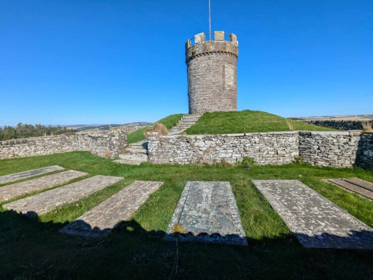
The hill is topped by the imposing Temple of Lour, a burial ground for the former Lords of Lour and the Carnegie/Carnegy families.
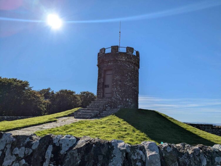
It boasts a crenellated tower in the centre and a circular boundary wall with a padlocked gate.
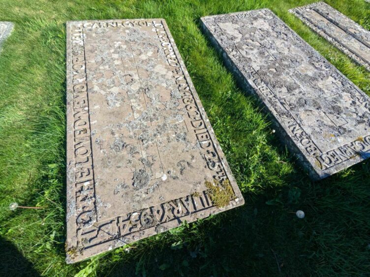
A precinct on the west side contains ornate-looking tombstones of the Carnegy family dating from the middle of last century – including one dedicated to Frances Edward Carnegie who was born in 1858 and died in 1929.
The ‘temple’ monument was apparently erected in the name of Major J Elliott Carnegy.
It’s marked on a 1865 map of the area, which shows that the area inside the wall had trees then.
Stunning views from Hill of Lour summit
The views in all directions are incredible – I spotted the isolated peak of the ‘fairy’ Munro of Schiehallion – and there’s a real sense of calm and tranquillity here.
There wasn’t a breath of wind; the only sounds were birds tweeting and the odd cow lowing.
It’s not a bad place to rest in peace for all eternity…
The return journey was much easier but instead of retracing my steps the entire way, I branched off to pass Angus Riding for the Disabled Centre at South Bottymyre.
It made a nice change and plus, I spotted several horses sunbathing and grazing happily. Bliss.
This road eventually joined the B1927, and I strolled along it, pausing to drink in views of Fothringham Hill and thinking: “I just climbed that”, as I am wont to do after scaling hills of any size.
It was only a few minutes before I reached my car, but with the odd vehicle flying past at goodness knows what speed, you do need to be careful.
Essentially, it’s a nice three hour walk – or longer if you get lost, as I did!
- The walk is temporarily closed due to a tree felling and harvesting operation.


Conversation