Looking for some ideas for enjoyable Dunfermline walks either in or near the Fife city?
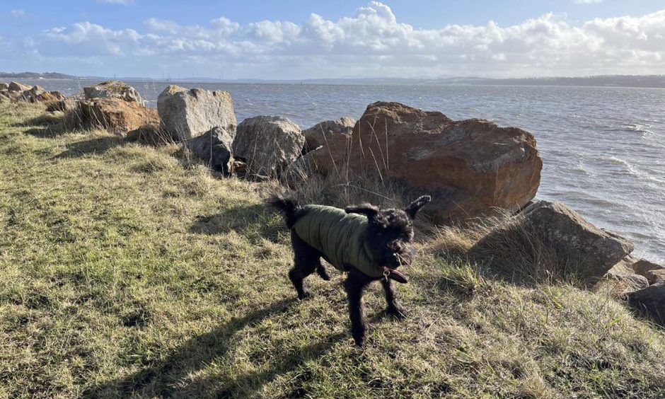
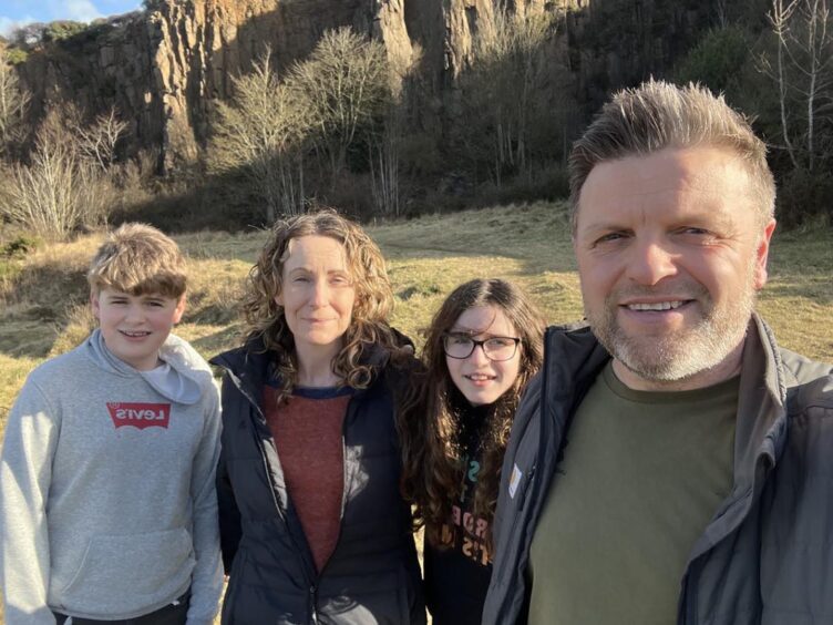
I tried out a few routes with my dog Ivy and, on some, the rest of my family.
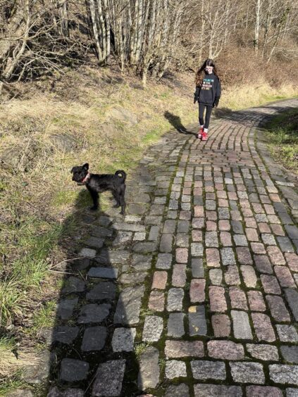
Ivy loved them all, of course, but our favourite was St Ninians, otherwise known as the Walnut Whips.
All are ideal for getting some exercise, fresh air and enjoying the area’s fantastic scenery and open space.
The walks are also all suitable for older children and dogs, although not all are buggy-friendly or fully accessible. Preston Island might be quite a distance for little legs.
As well as giving the lowdown, I’ve stated the distance, time it took us and how accessible I thought each Dunfermline walk and walk near Dunfermline was.
Calais Woods and Duloch Park
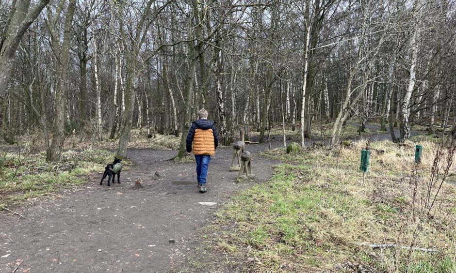
There’s loads for children to see and explore on a ramble round Calais Woods and Duloch Park.
Clearly marked routes vary in length from one to five kilometres and they’re all pretty flat.
We walked round the perimeter of the park and woods, which was a combination of gravel and tarmac paths, all suitable for buggies. The wide tarmac paths in the park look ideal for scooting and kids learning to ride a bike.
Amid a large residential area, there were loads of other walkers even on pretty busy even on the chilly day we visited.
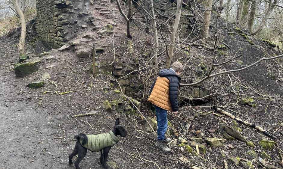
Ancient Calais Woods were first mapped in the 1700s but the park is a recent addition.
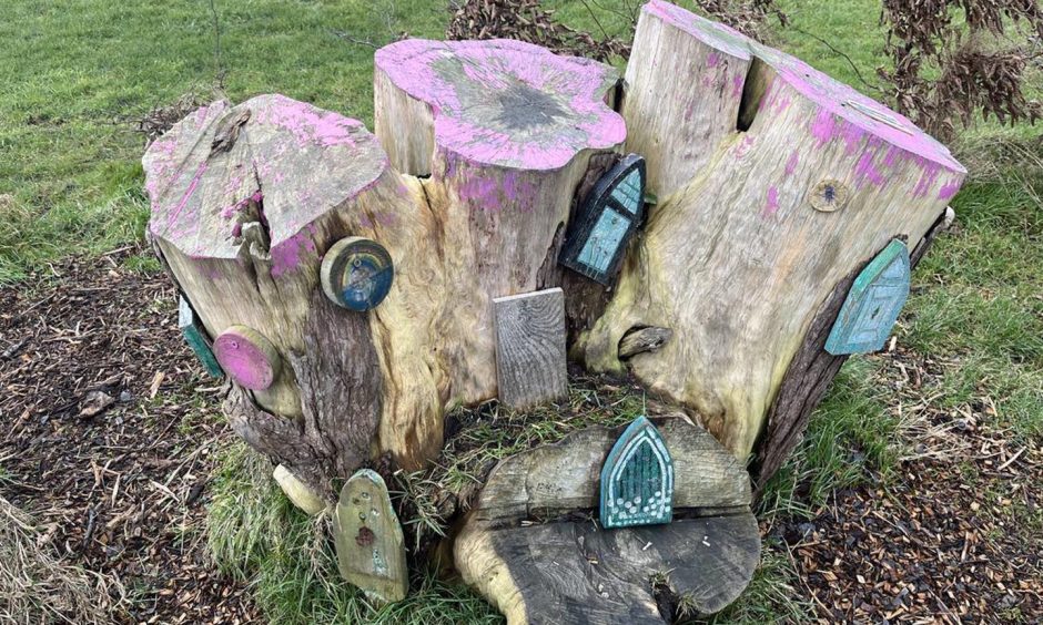
We explored the remains of a lime kiln in the woods, spotted a few art installations and stopped to admire a fairy garden.
Where: Start and finish at Duloch Leisure Centre car park, Nightingale Place. A map in the park shows suggested routes.
Distance: 1.75 miles
Time: 40 minutes
Accessibility: Very good. Suitable for buggies and wheelchairs. Tarmac and gravel paths are wide and flat.
Townhill Loch
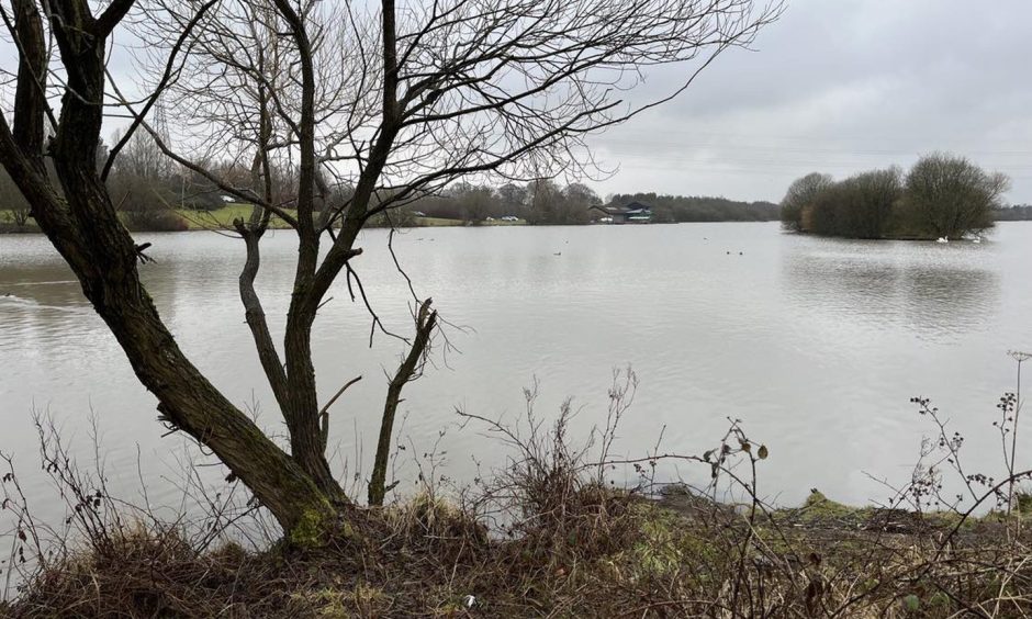
The flat, tarmac path which circles Townhill Loch is a quick, easy and extremely pleasant walk.
There’s loads of wildlife to look out for, including swans and ducks. I’m reliably informed that there often herons, but I didn’t see any when we were there.
Head round at dusk and I’m also told it’s a good place to spot bats.
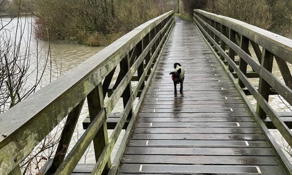
We parked at Townhill Country Park centre and took our time strolling round clockwise, crossing a wooden bridge at the western end of the loch.
There are signposted options to lengthen your walk, including taking the bridle paths towards Wellwood and Townhill woods.
Where: Start and finish at Townhill Country Park car park
Distance: 1.2 miles
Time: 30 minutes
Accessibility: Very good. Suitable for buggies and wheelchairs. Path is flat all the way round.
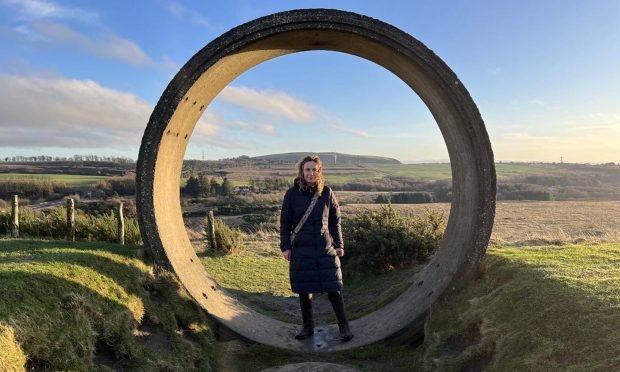
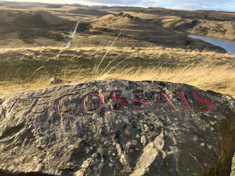
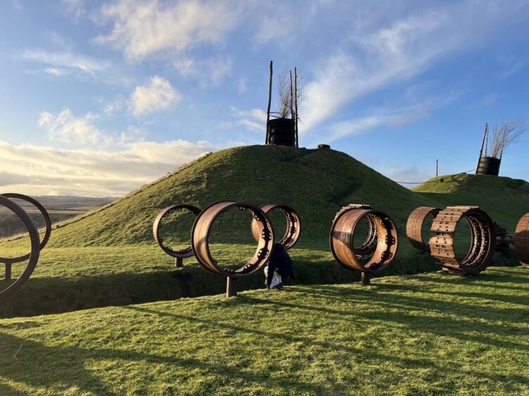
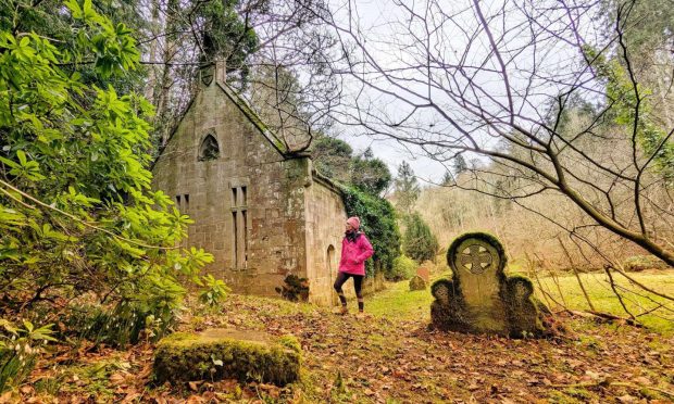
St Ninians (aka the Walnut Whips)
From a distance St Ninians looks a little eerie. Piles of tyres with branches jutting from them on the summit reminded me of The Wicker Man film!
The two artificial hills on a former opencast mine are an incomplete landscape art project by Charles Jencks, the artist behind Jupiter Artland in West Lothian.
Sadly the Fife Earth Project was abandoned when the landowner went bankrupt. There are, however, new plans to develop the area.
That doesn’t stop St Ninians from being a fascinating spot and thoroughly enjoyable hike.
A series of paths cut across the site, some of them quite boggy on the day we visited so we were glad of our waterproof boots.
We took the direct route up the larger of the two hills, St Ninians East. It was steep in parts but should be manageable even for younger kids.
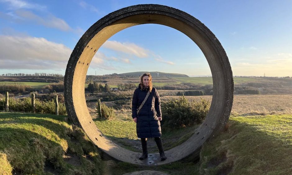
Art installations at the top include the tyres which are visible from the nearby M90. Stones are inscribed with messages in various languages and there’s an avenue of old mining equipment.
Exploring the features and admiring the view kept us entertained for a while before our descent.
Paths spiral round each hill – hence the Walnut Whips nickname – and we took this easier but longer route down, guessing how many circuits we’d do before reaching the bottom.
Where: Start and finish at the car park off the B912 around a mile north of Kingseat and follow the track round to the right.
Distance: 1.75 miles
Time: 1 hour 10 minutes (including time exploring the summit)
Accessibility: Difficult. Not suitable for buggies and wheelchairs. Even the easier spiral path is a bit rough and sections were pretty muddy.
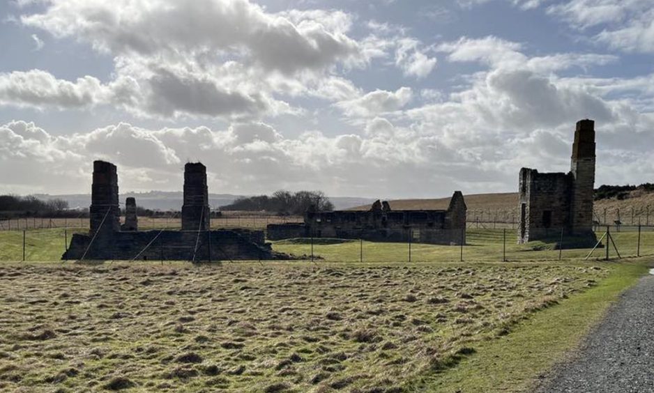
Preston Island, Culross
Contrary to its name, Preston Island is no longer an island. Manmade for salt production in the 19th Century, it became a Forth peninsula with land reclaimed using ash from Longannet Power Station.
A path circles the outer edge of the ‘island’ before cutting back inland and taking you back to where you started.
To reach it take the Fife Coastal Path east from Culross then cross over the railway track.
It was a pretty blustery day when we tackled this route so the first mile and half anti-clockwise of Preston Island was pretty bracing.
The uninterrupted views out to the Forth were worth it though, and got even better when we rounded the island to see the Forth bridges and their newer sibling in the distance.
On our right was the low sea wall and on our left a continuous fence keeping ramblers away from the Longannet ash lagoons within.
As you head back inland (and out of the wind!) you can see the ruins of the salt works. I also took a small detour to peek through the bird hide at Torry Bay nature reserve.
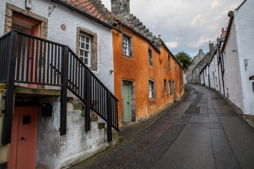
A pleasant woodland walk completes the route back to historic Culross. We strolled through the town’s cobbled streets before stopping for a delicious and well-earned lunch in dog-friendly Biscuit Café.
Where: East or west car parks in Culross. We chose west to allow a walk through Culross but east is closer.
Distance: 4.75 miles
Time: 1 hour 30 minutes
Accessibility: Moderate. Path is wide and flat but muddy in places. Doable for buggies and mobility scooters with good all-terrain tyres but bumpy in parts.
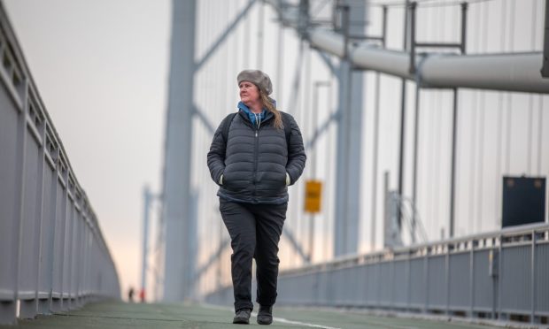
North Queensferry coastal loop
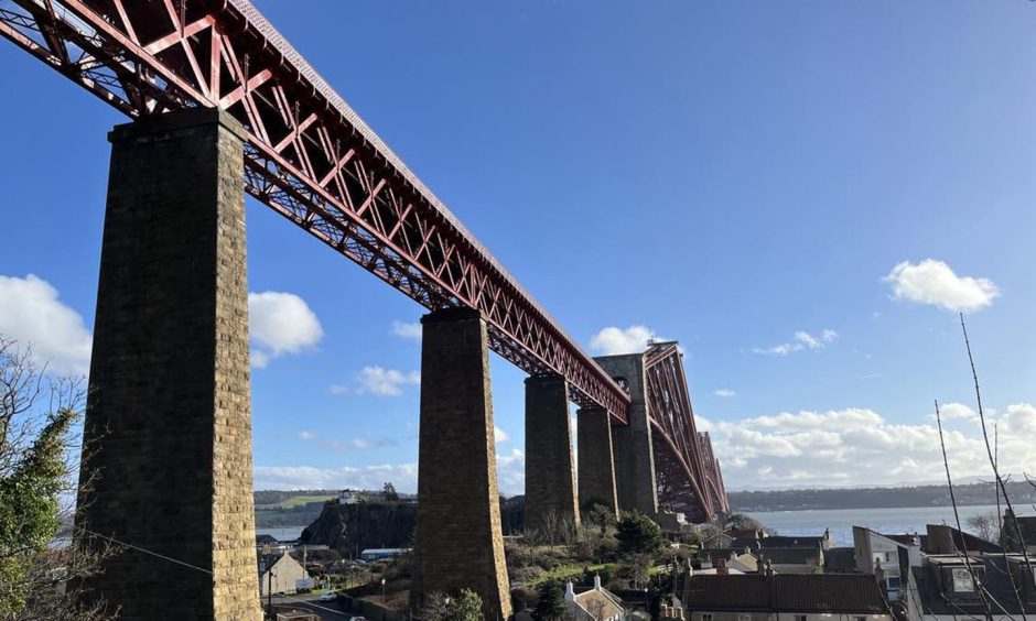
Stunning views of the Forth Bridge from a unusual angle get this walk off to an epic start.
Joining Fife Coastal Path, we walked under the bridge and before making a cobbled ascent towards the cliffs at Carlingnose Point nature reserve.
The coastal path is undulating but extremely pretty as you follow the coast round to Inverkeithing
There’s a nice stretch of beach at Port Laing.
When we reached Ferrytoll park and ride we took the pavement alongside the A900 bus lane back to the Forth Road Bridge and the steps back down to North Queensferry.
Although the pavement is wide, it’s close to the M90 for a few minutes and the traffic is really noisy. So I was glad when the A900 and M90 diverged! I think I would have my heart in my mouth walking this section with young children.
A quieter option for returning is Ferryhill Road, although the pavement is quite narrow.
If you need refuelling and refreshment, there’s a lovely little place called Rankin’s Café just before you get back to the car park.
Where: Start and finish at Battery Road car park. Take Fife Coastal Path east under the Forth Bridge.
Distance: 3.35 miles
Time: 1 hour 10 minutes
Accessibility: Poor. Parts of the coastal path are rough and sometimes muddy so not suitable for buggies or wheelchairs.


Conversation