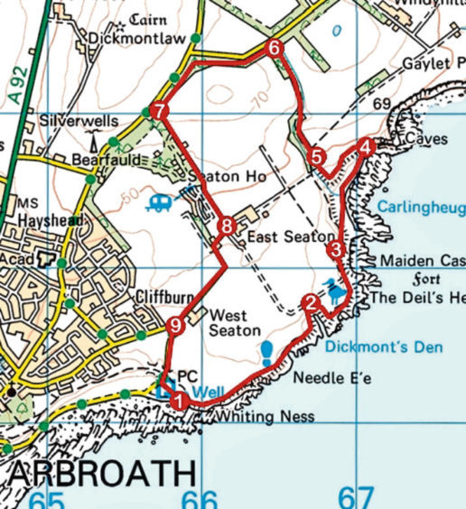
Seaton Cliffs and Den, Arbroath, Angus
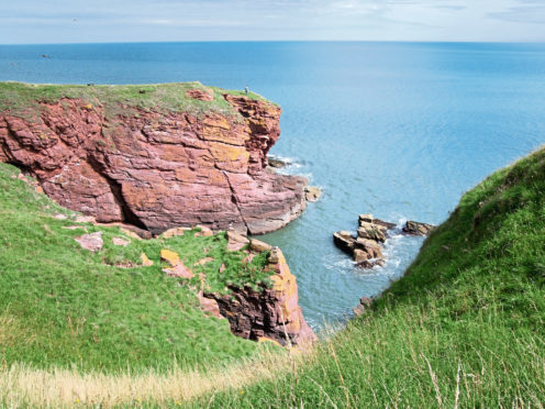
North of Arbroath, the mighty Seaton Cliffs offer one of the most dramatic walks in Angus. Along the frequently exposed and often breezy trail there are high crags, natural arches, cavernous inlets, secret coves, a sea stack and caves to explore.
One of my favourite outdoor playgrounds, my coastal adventures here begin at Whiting Ness, at the eastern end of Victoria Park, where, by St Ninian’s Well, a path climbs briskly into Seaton Cliffs Nature Reserve.
Owned by the Scottish Wildlife Trust, the rugged folds of sea-smashed sandstone are home to colonies of seabirds, including gulls, shags and guillemots, while grasses and wildflowers bristle along the top, attracting butterflies in the summer.
The route rises steadily to the Needle’s E’e, a narrow hole worn into the rock. A steep path winds down to this fascinating geological feature from where there are some great views up and down the coast.
Back on the main trail, I passed above a deep rocky cove and more perilously steep cliffs before curving inland at Dickmont’s Den where an outcrop of rock at the mouth of this deep, narrow channel is a good place to spot seabirds.
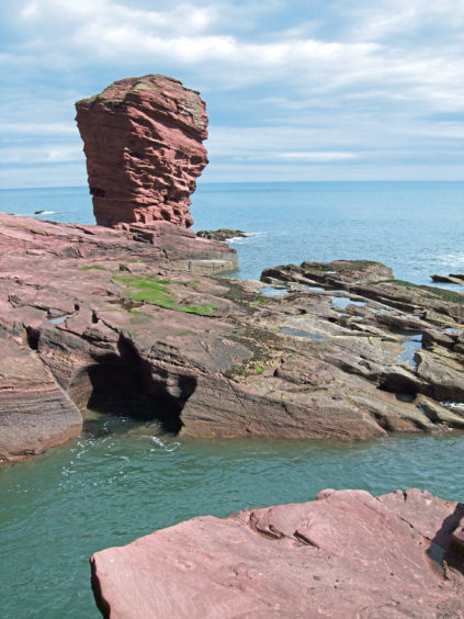
Looping round the chasm, I tramped back towards the sea where another geological treat lies just around the next corner – the Deil’s Heid, a stack with a wonderfully evil face. There is a viewpoint just ahead of the bullish bluff and, depending on the state of the tide, it is possible to venture down over slabs to its base.
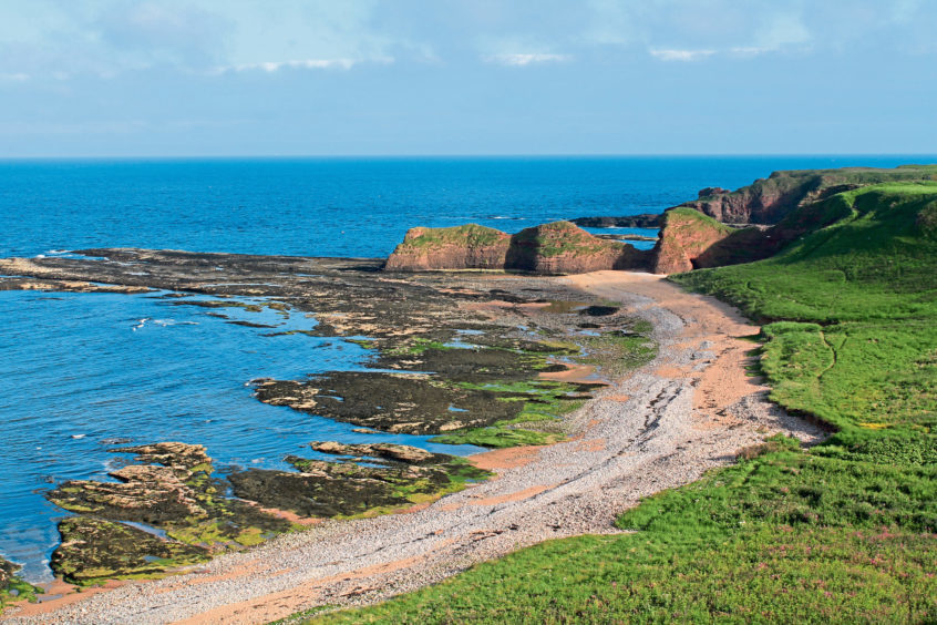
Beyond the Deil’s Heid, the way arcs left towards Carlingheugh Bay, passing above a couple of pebbly coves and the Three Sisters, a trio of knolls bordering the southern end of the bay.
The path to Seaton Den – my next port of call – once progressed straight ahead at this point but, a victim of coastal erosion, the old route is slowly crumbling away and a sign directs walkers down steps to Carlingheugh Bay.
It is a pleasant detour, however, the trail running through grassland above the shoreline towards another set of steps, these ones climbing out of the bay. However, before ascending, it is worth wandering over the beach to the next headland where there are a couple of caves, both accessible when the tide is low.
The first is not very deep but the second – Forbidden Cave – tunnels through the headland, emerging into the next bay.
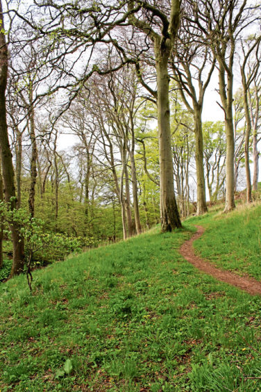
At the top of the steps, where the coastal path to Auchmithie progresses north, the path to Seaton Den branches left, a field-edge foray leading into the sheltered wooded glade, mature beeches towering over a trickling wee stream.
It is tempting to dip left towards the burn but the trails in the base of the ravine tend to be used by bikers and soon become a little muddled, so bear right at the waymarker arrow and take the high road.
It runs up the west side of the valley, crossing the stream at the midway point before sweeping through thickets of gorse to meet the Auchmithie to Arbroath road.
A parallel path weaving through a slender band of woodland kept me off the asphalt and, with the smell of the sea soon wafting through the air again, farm track and country lane guided me past the berry fields of Seaton back to the waterfront.
ROUTE
1. Ascend surfaced path and follow cliff-top trail north-east, passing above Needle E’e. Approaching Dickmont’s Den, bear left and head inland to top of inlet.
2. Ignore path branching left into field and bear right (signed Seaton Den), heading seaward. Follow path round headland, passing above Deil’s Heid.
3. Turn right (signed Seaton Den) and descend steps to Carlingheugh Bay. Continue round bay on shoreline path.
4. Turn left and ascend steps. At junction at top of slope, go left (signed Seaton Den) and follow path around field edge to woodland.
5. Where trail forks, go right (arrowed) and follow path up through Seaton Den.
6. Approaching road, turn left along wooded path running parallel to road.
7. Turn left and descend track then, continuing straight ahead at Mains of Seaton, path to East Seaton.
8. Turn right along minor road, passing West Seaton.
9. Turn left and descend road to Victoria Park.
INFORMATION
Distance: 7.2km/4½ miles
Ascent: 140m/460ft
Time: 2-3 hours
Grading: Easy route following cliff-top trail, woodland paths and tracks. Above cliffs, stick to main path as there are steep, unguarded drops. Stout footwear recommended
Start/finish: Car park at Whiting Ness, at east end of King’s Drive, Arbroath (Grid ref: NO 658411)
Map: Ordnance Survey 1:50,000 Landranger sheet 54; Ordnance Survey 1:25,000 Explorer sheet 382
Tourist Information: Dundee iCentre, 16 City Square, Dundee DD1 3BG (Tel 01382 527527)
Public transport: Stagecoach bus service 73 connects Dundee and Arbroath while ScotRail services on Edinburgh/Glasgow to Aberdeen route stop in Arbroath
