Dull Wood, Aberfeldy, Perth & Kinross.
It is fair to say that I did not have high hopes for Dull Wood. Perhaps the name was marring my expectations. But, as the hamlet of Dull, which lies below the plantation, has successfully played on its moniker, and is now well known for its twinning with Boring, in Oregon, America, and Bland, in Australia’s New South Wales, I thought I would give it a go.
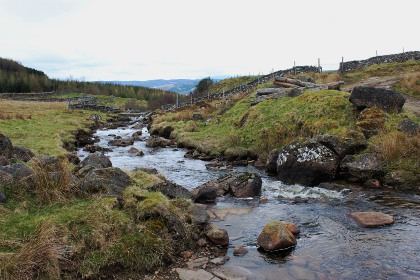
Setting out from the village hall in the neighbouring community of Camserney and passing above a former mill, I wandered up the valley of the Camserney Burn, the water skipping down through woodland above the peaceful cluster of cottages and steadings.
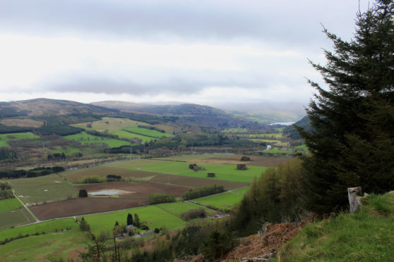
As approaches go, it was a very pleasant start and, as the track strayed east from the burn and continued its ascent above Appin of Dull, I was soon enjoying fine views over this flat plain of riverside land that stretches west from Aberfeldy towards the distant watery finger of Loch Tay.
During early Christian times, the fertile ground supported a monastery in Dull (‘appin’ meaning abbey land) and, while the monks are long gone and their ancient home replaced by the local parish church, it remains productive farmland, carved up into a neat patchwork of arable fields.
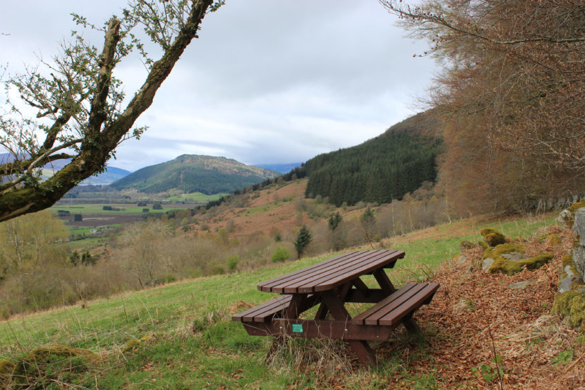
A bench at the first corner and a picnic table sheltered by mature beeches higher up offer spots to sit and savour this vista before the track pushes north towards rougher ground, pasture and bands of forestry preceding moorland.
Entering Farleyer Estate at a gate below a stone sheepfold, I continued north briefly before branching west towards Dull Wood, ponies grazing the open ground around me as I dipped to meet up with the Camserney Burn once again.
While some of the footbridges marked on the map in this area are no more, the one I wanted was thankfully still in place and I crossed the lively flow without incident, entering the sheltered confines of the plantation at a high gate beyond.
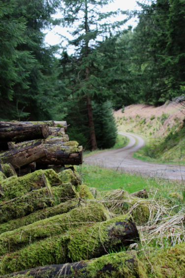
Disappearing into the trees, a sturdy forest road sweeps south, flanked either side by tiers of conifers, banks of yellow primroses adding a splash of colour to the scene.
Aside from attracting walkers, the tracks here are popular with mountain bikers too, so stay alert to the possibility of faster moving two-wheeled traffic approaching.
Skirting below craggy, boulder-strewn slopes under Rock of Dull, the way rises steadily to a wonderful viewpoint with an uninterrupted outlook over Appin of Dull towards forested slopes south of the River Tay. To the west, Loch Tay and Drummond Hill are visible while, below me, Dull was very much the model village.
With the climbing complete, the track enjoys a leisurely descent, a long straight stretch and then a series of hairpin bends dipping into the valley, the way looping east, running through the peaceful lower fringes of the plantation.
Approaching Dull, the track ends but, beyond boulders, a path leads on, skirting above the hamlet where I snatched a glimpse of the parish kirk and, close by, a charming wee 19th century tin tabernacle that, threatened with demolition, was dismantled and relocated here from its original site in Aberfeldy.
Crossing open ground, a trail links Dull and Camserney, concluding a lovely walk with some great views on a circuit that turned out to be anything but dull.
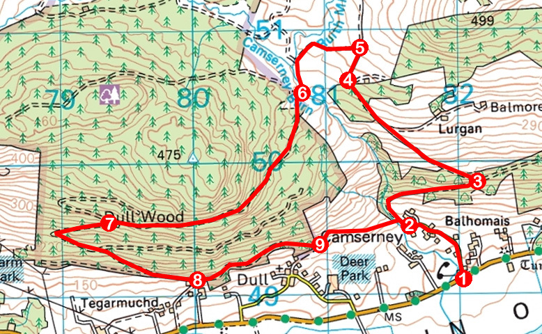
ROUTE
1. Ascend road through Camserney to thatched Crachan Cottage.
2. Continue ahead on track, entering woodland. Ascend track, ignoring path branching left to Dull.
3. Turn left (signed Dull Wood Circular) and ascend track. At next junction, where track branches right to Lurgan, continue straight ahead, passing through metal gate (the middle one of three gates)
4. Go through gate and walk 250m north to junction.
5. Turn left and follow track west then south to bridge over Camserney Burn.
6. Cross, ascend through high gate to junction and turn left along forest track.
7. Ignore track branching right and loop down through bends, staying on main track as it swings east, descending to junction by Carse Farm House.
8. Bearing left, follow track to its end then continue ahead on path, passing above Dull.
9. Go through gate, turn left and follow path east to bridge over Camserney Burn. Cross, turn right and retrace steps to start.
INFORMATION
Distance: 10km/6¼ miles
Ascent: 400m/1320ft
Time: 3 hours
Grading: Moderate walk following good tracks through woodland and across open hillside with some strenuous ascent early on. Keep dogs under close control on moorland where sheep and ponies graze
Start/finish: Camserney Village Hall, two and a half miles west of Aberfeldy on B846 (Grid ref: NN 820491). Limited parking by hall or on opposite side of B846
Map: Ordnance Survey 1:50,000 Landranger sheet 52; Ordnance Survey 1:25,000 Explorer sheet 386
Tourist Information: Perth iCentre, 45 High Street, Perth PH1 5TJ (Tel 01738 450600)
Public transport: Limited bus service (number 91) from Aberfeldy
