Gateway to the Firth of Tay, the Fife town of Tayport has a long maritime history stretching back to the 12th century when its ferry conveyed pilgrims travelling from St Andrews to Arbroath Abbey across the river.
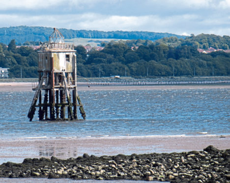
It has also played a vital role in aiding safe passage up the estuary, thanks to its trio of lighthouses, two of which occupy the shoreline, while the third, rather more inaccessible, sits out in the water.
From the harbour, this walk heads upstream, passing the two land-based lights and, at points along the way, proffers views over the river to their water-based companion.
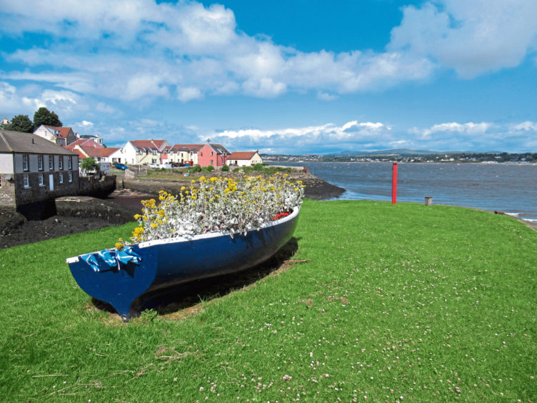
While boats have been shuttling in and out of Tayport for centuries, the present harbour dates from the mid-19th century when it was remodelled during the development of east coast rail services.
A busy cargo and passenger port, the last regular ferry sailed in the 1920s and today it is a bustling marina, the older, disused quay to the west, a pleasant place to sit and enjoy the outlook towards Dundee and Broughty Ferry, the castle a distinctive landmark.
Here I briefly joined the Fife Coastal Path, following it along Inn Street and West Shore before squeezing through a slender passageway between walls to a small parking area at West Lights.
A single-track road dips towards the shoreline and, with the coastal path forking left, I hiked on through West Common with its grassy picnic areas and sheltered shingle beaches bounded by outcrops of lichen-encrusted rock.
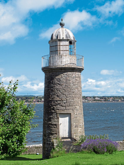
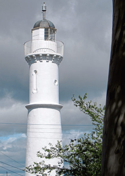
Quickly engulfed by woodland, the lane passes the disused East Lighthouse and its keeper’s cottage, both built in 1823 by the harbour board of Dundee. Aligned with the taller West Lighthouse, which sits towards the end of the lane, their leading lights guided mariners safely into the estuary.
Designed by renowned lighthouse engineer Robert Stevenson, both sit on private land but can be admired from the roadway.
From the whitewashed West Lighthouse, a slim path climbs to meet the main road as it enters Tayport, Scotscraig Drive opposite lifting me towards arable farmland cloaking the slopes of Spears Hill, where fine river views await.
Midway along a lovely stretch of path linking Spearshill Road with Reform Street, I paused at a well-placed bench to enjoy the vista over the estuary and, with the tide out, its vast mudflats.
South of the river, the regimented treeline of Tentsmuir Forest extends seaward to Tentsmuir Point and the Abertay Sands, havens for seals but potentially treacherous obstacles for vessels approaching the firth.
The third of the route’s lights is just visible from this vantage point and, to reach it, I made a brief foray into Scotscraig Estate before cutting through the southern portion of the town, a good path leading to Tayport Community Garden from where Pond Lane and Mill Lane guided me back to the shoreline.
As the name suggests, Harbour Road offers one way back to the harbour, but continue ahead along Promenade and, just before it curves right, a path branches left, running along above the beach.
Without a boat, this was as close as I would come to the offshore Pile Lighthouse, a timber box frame structure mounted on stilts with a lantern on top. Erected in 1848 to replace the East Lighthouse, it was abandoned in 1960 but remains a quirky wee feature of the Tay.
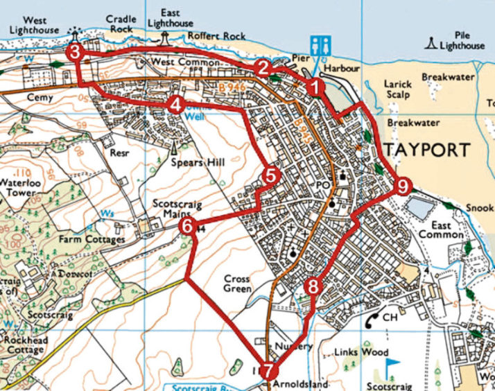
ROUTE
1. Follow Inn Street west to its end, go left along West Shore, ascend gravel path, then bear right through gap between walls to West Lights parking area.
2. Continue ahead on roadway to East Lighthouse and then West Lighthouse.
3. Go left up path to B946. Bear left to roundabout, cross B946 and ascend Scotscraig Drive to its end.
4. Continue ahead, past play area, on path then track. Descend Spearshill Road for 200m then go right along path to Reform Street.
5. Go right along Reform Street, left down Craig Lane then right, following Craig Road then surfaced track up towards Scotscraig Mains.
6. At next junction, go left down surfaced track to junction, then left along minor road to B946.
7. Cross B946 and proceed ahead on gravel path. Cross Sandyhill Road and continue ahead on path to community garden.
8. Go right along Pond Lane to meet Nelson Street by Tayport Arms. Go left to roundabout then right along Mill Lane then Promenade to shoreline.
9. Go left along shoreline path to harbour.
INFO
Distance: 6km/3¾ miles
Ascent: 100m/330ft
Time: 2 hours
Grading: Easy route following town streets, tracks and paths, generally on the level but with a couple of sections of ascent. Stout footwear recommended and keep dogs under close control on Scotscraig Estate
Start/finish: Tayport Harbour, Inn Street, Tayport (Grid ref: NO 457290)
Map: Ordnance Survey 1:50,000 Landranger sheet 54 or 59; Ordnance Survey 1:25,000 Explorer sheet 371
Tourist Information: St Andrews iCentre, 70 Market Street, St Andrews KY16 9NU (Tel 01334 472021)
Public transport: Moffat and Williamson bus service 92 or Stagecoach bus service 54
