The hills and glens of Scotland are littered with aircraft wreckage and there are many lonely monuments to those who perished in these tragedies.
One of the most poignant is at the area known as the Fairy Lochs, near Gairloch. Fifteen people lost their lives when a plane taking service personnel home to the US at the end of the Second World War crashed.
On June 13 1945 the B-24H Liberator had taken off from Prestwick, but while flying over the north-west Highlands in poor weather, the plane hit the top of Slioch, the huge mountain which towers over Loch Maree, and suffered severe damage to the undercarriage.
The pilots decided to make an emergency landing and made several efforts to find a suitable spot, but on the final attempt the plane crashed and disintegrated. All nine crew and six passengers died.
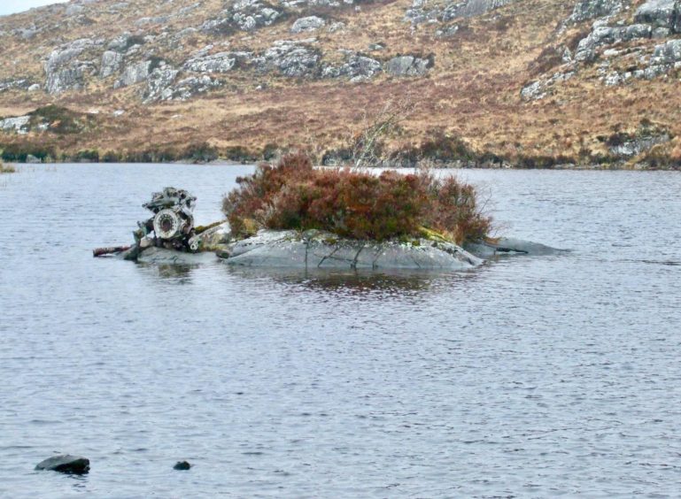
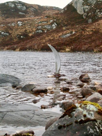
Most of the debris has remained where it lay, scattered over a series of little lochs and grassy rises and the site at Na Lochan Sgeireach – popularly known as the Fairy Lochs – is a designated war grave.
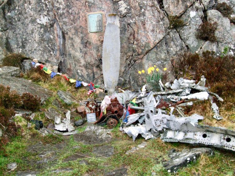
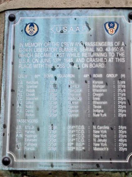
A plaque has been fixed to the rock, one of the huge propeller blades standing in the forefront, a sentry for the fallen. Teddy bears, prayer flags, good luck charms and other personal effects lie there also, placed there over the years by relatives.
The loneliness of the landscape seems fitting for a final resting place. The silence is eternally eerie; apart from the odd haunting bird call, there’s a hush here. Those who walk the hour or so in to see the site are also reverential. There’s no raised voices, no laughter. Even after all this time there is still the respect for these young men who perished so tragically.
A closer look at the plaque reveals the devastating details – the crewmen were
aged between 20 and 26, from eight different US states. Four of the six passengers were also in their 20s and one was 30. It’s sobering to think that their parents, brothers, sisters are mostly long gone as well. Some will never have made it to this grave to say goodbye.
Access is near the start of the B-road which comes in from the A832 until it runs out some nine miles further on at Red Point, a fine viewpoint on the west coast.
Despite being off the beaten track, this is a popular walk, and is one to keep tucked away for the days when we can travel freely again. It is suitable for all ages but be prepared for a muddy trek over some rough ground. And if the cloud is low, it may be advisable to forget the circuit from the crash site and head back the way you came.
There’s a big parking area close to the start and the main route is well sign-posted. The uphill sections never seem too taxing, and there are some lovely views back down towards Gairloch when you are in need of a breather.
The trickiest part of the day is the crossing from the site to the more prominent Loch Braigh Horrisdale. The path is faint, in some places hard to spot, but there are a few cairns to keep you right. There is a ford to cross the stream and then it’s just a case of sticking with the track which leads all the way back to the start.
Those fancying an overview of the site should make the extra effort for the short climb to the trig point on the nearby summit of Sithean Mor, which sits slightly to the north of the lochs.
The sanctity of the site is a tribute to the people of this country, the strangers who take the time, whether through curiosity or the simple need to pay their respects, who have left it untouched and undesecrated all through the years.
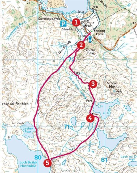
Route
1. Walk east from car park and turn right to track (signed). Follow past ruin and when track veers right at fork keep going straight on to reach cairn and sign.
2. Turn left on to narrow path, and when path splits at another cairn, take left-hand branch climbing uphill through trees. At next signpost, the path goes right to eventually reach deer fence and gate.
3. Pass through gate and keep following path as it keeps right of loch then heads down to second lochan and memorial.
4. Head south on faint path around left side of lochan and then turn south-west over rougher ground (some cairn markers) to reach the shores of Loch Braigh Horrisdale.
5. Cross the stream at ford on to track and turn right to head north past a smaller loch and then all the way to the incoming path junction and retrace steps to start.
Lowdown
Distance: 6km/3.75 miles
Ascent: 230m/950ft
Time: 3-4 hours
Grading: Rough track and hill paths, some rough, featureless ground. Short climb, suitable for most walkers, though navigation could be tricky in poor weather: if in doubt return from memorial by way of ascent. Muddy underfoot, good footwear and waterproofs recommended. Dogs under close control.
Start/finish: Car park west of Shieldaig Hotel on B8056 (Grid ref: NG 805725), accessed from A832.
Map: Ordnance Survey 1:50,000 Landranger Map 19 (Gairloch & Ullapool); Ordnance Survey 1:25,000 Explorer sheet 434.
Tourist Information: VisitScotland, Ullapool iCentre, Argyle Street, Ullapool, IV26 2UB (Tel 01854 612486).
Public transport: None.
