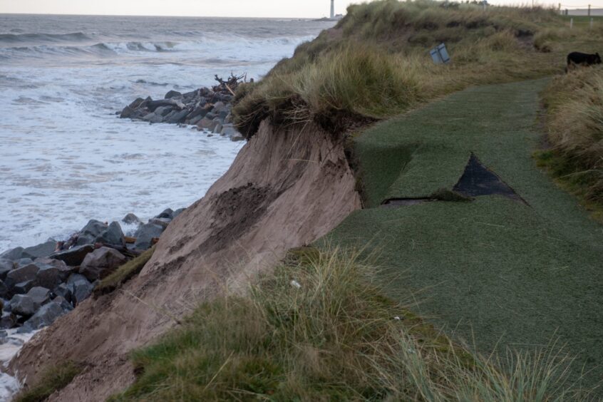
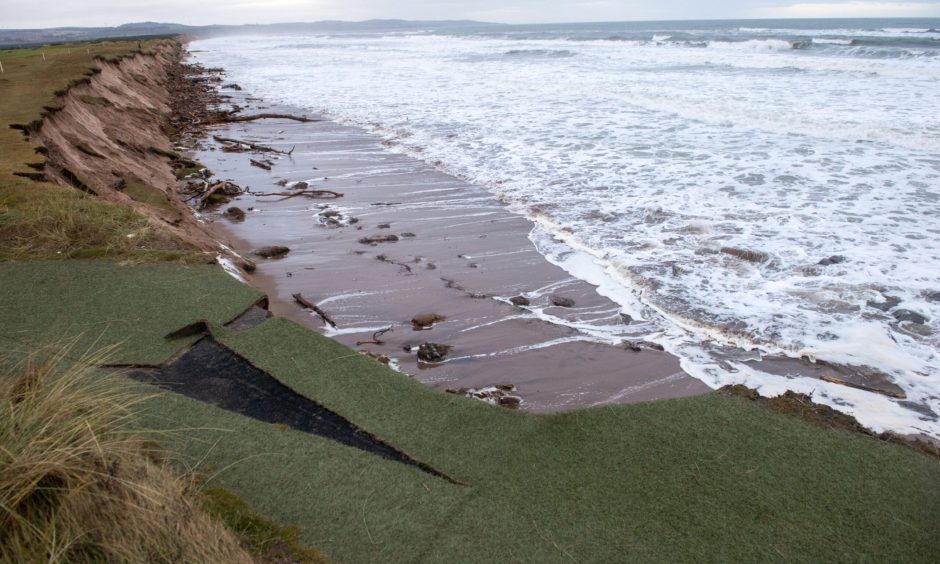
The plan to combat coastal erosion threatening Montrose is moving forward – slowly.
Last month, Angus Council signed off a report around short-term measures which will see Montrose beach replenished with more than a million tonnes of sand.
At the same time, huge rocks will be used as armour against the force of the waves.
It is part of the wide-reaching plan to prevent potentially catastrophic flood corridors opening.
If those breach the dunes, it will spell disaster for the town.
Here we examine the latest stage of the technical planning process.
And we can reveal that natural features blamed for decades of serious flooding in Brechin will not be any part of the solution to Montrose’s erosion threat.
Environmental study on Montrose coastal erosion
In April, consultants AECOM submitted an environmental impact assessment screening report around the next stage of protection work at Montrose.
It involves:
- Construction of a permanent vehicular beach access
- Two-phase dune restoration and beach nourishment
- Construction of two rock groynes
The amount of material needed to replenish the beach has been put at 800,000 cubic metres over 10 years.
At 1.5 tonnes per cubic metre it equates to a massive amount of sand.
Experts want to use the sand to “mimic natural processes” for the restoration of dunes.
And groynes angled against the tide will be created with rock armour already in place at Montrose.
The view of planners is the protection measures can be put in place without significant environmental impact.
But where will the material come from?
Angus Council says it is still working on that.
“Consideration of various sites has been undertaken along with dialogue with relevant stakeholders,” said a spokesperson.
“Transportation method would be dependent on source material location, however, due to required volumes this is anticipated to be a significant expense regardless.”
And there is a hint sand from the mouth of the South Esk may be part of the solution.
Highlighted within the screening report is: “Assuming material is suitable and available, there is an opportunity for beneficial use of River South Esk dredged sediment as recharge material to help slow erosion.”
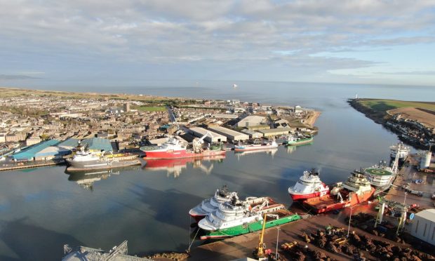
The council says: “This is in relation to dredged material from the navigation channel of the River South Esk at the Montrose Port specifically.
“This area is regularly dredged by the Montrose Port Authority as part of its operational requirements.
“This does not extend to any other areas of the River South Esk.”
Brechin’s gravel bank
It rules out any prospect of Brechin’s gravel bank being dredged as part of a double-edged solution to the Montrose situation.
For decades the River Street gravel bank has been considered by many to be a major contributory factor in the town’s flood events.
But as far back as 2009 its possible removal was rejected as plans were being laid for town flood defences.
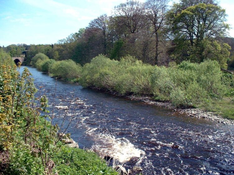
The potential impact on rare freshwater mussels and salmon was a key factor against clearing gravel from the river there.
Brechin’s £16m flood scheme finally opened in 2016.
Last October the wall stood firm – but was ultimately powerless against record river levels caused by Storm Babet.
It led to devastation which will give Angus Council another headache for years beyond the multi-million pound repair job in the storm’s immediate aftermath.
The council added: “Dredging of the gravel bank at Brechin would not provide the correct type of material for beach nourishment.
“The quantity of material would also be significantly below the quantity required.”
It means the unrelenting battle against the force of nature will continue to be waged in separate actions just miles apart.
In our series, The Courier is highlighting the dangers of rising sea levels and destructive storms, and demanding councils and government act now before it is too late.
The Montrose community is also calling for the pace to be upped – and they want to know where the money will come from.


Conversation