Calendar An icon of a desk calendar. Cancel An icon of a circle with a diagonal line across. Caret An icon of a block arrow pointing to the right. Email An icon of a paper envelope. Facebook An icon of the Facebook "f" mark. Google An icon of the Google "G" mark. Linked In An icon of the Linked In "in" mark. Logout An icon representing logout. Profile An icon that resembles human head and shoulders. Telephone An icon of a traditional telephone receiver. Tick An icon of a tick mark. Is Public An icon of a human eye and eyelashes. Is Not Public An icon of a human eye and eyelashes with a diagonal line through it. Pause Icon A two-lined pause icon for stopping interactions. Quote Mark A opening quote mark. Quote Mark A closing quote mark. Arrow An icon of an arrow. Folder An icon of a paper folder. Breaking An icon of an exclamation mark on a circular background. Camera An icon of a digital camera. Caret An icon of a caret arrow. Clock An icon of a clock face. Close An icon of the an X shape. Close Icon An icon used to represent where to interact to collapse or dismiss a component Comment An icon of a speech bubble. Comments An icon of a speech bubble, denoting user comments. Comments An icon of a speech bubble, denoting user comments. Ellipsis An icon of 3 horizontal dots. Envelope An icon of a paper envelope. Facebook An icon of a facebook f logo. Camera An icon of a digital camera. Home An icon of a house. Instagram An icon of the Instagram logo. LinkedIn An icon of the LinkedIn logo. Magnifying Glass An icon of a magnifying glass. Search Icon A magnifying glass icon that is used to represent the function of searching. Menu An icon of 3 horizontal lines. Hamburger Menu Icon An icon used to represent a collapsed menu. Next An icon of an arrow pointing to the right. Notice An explanation mark centred inside a circle. Previous An icon of an arrow pointing to the left. Rating An icon of a star. Tag An icon of a tag. Twitter An icon of the Twitter logo. Video Camera An icon of a video camera shape. Speech Bubble Icon A icon displaying a speech bubble WhatsApp An icon of the WhatsApp logo. Information An icon of an information logo. Plus A mathematical 'plus' symbol. Duration An icon indicating Time. Success Tick An icon of a green tick. Success Tick Timeout An icon of a greyed out success tick. Loading Spinner An icon of a loading spinner. Facebook Messenger An icon of the facebook messenger app logo. Facebook An icon of a facebook f logo. Facebook Messenger An icon of the Twitter app logo. LinkedIn An icon of the LinkedIn logo. WhatsApp Messenger An icon of the Whatsapp messenger app logo. Email An icon of an mail envelope. Copy link A decentered black square over a white square.

Angus Council hit back on Brechin flood defence ‘theories’ one year on from Storm Babet

This weekend is the first anniversary of the record-breaking storm which caused devastation in the Angus town.

Members of a Coastguard Rescue Team in Brechin during Storm Babet. Image: Andrew Milligan.
Members of a Coastguard Rescue Team in Brechin during Storm Babet. Image: Andrew Milligan/PA

Angus Council says it plans to explode myths surrounding Storm Babet’s impact on Brechin as the first anniversary of the disaster looms.

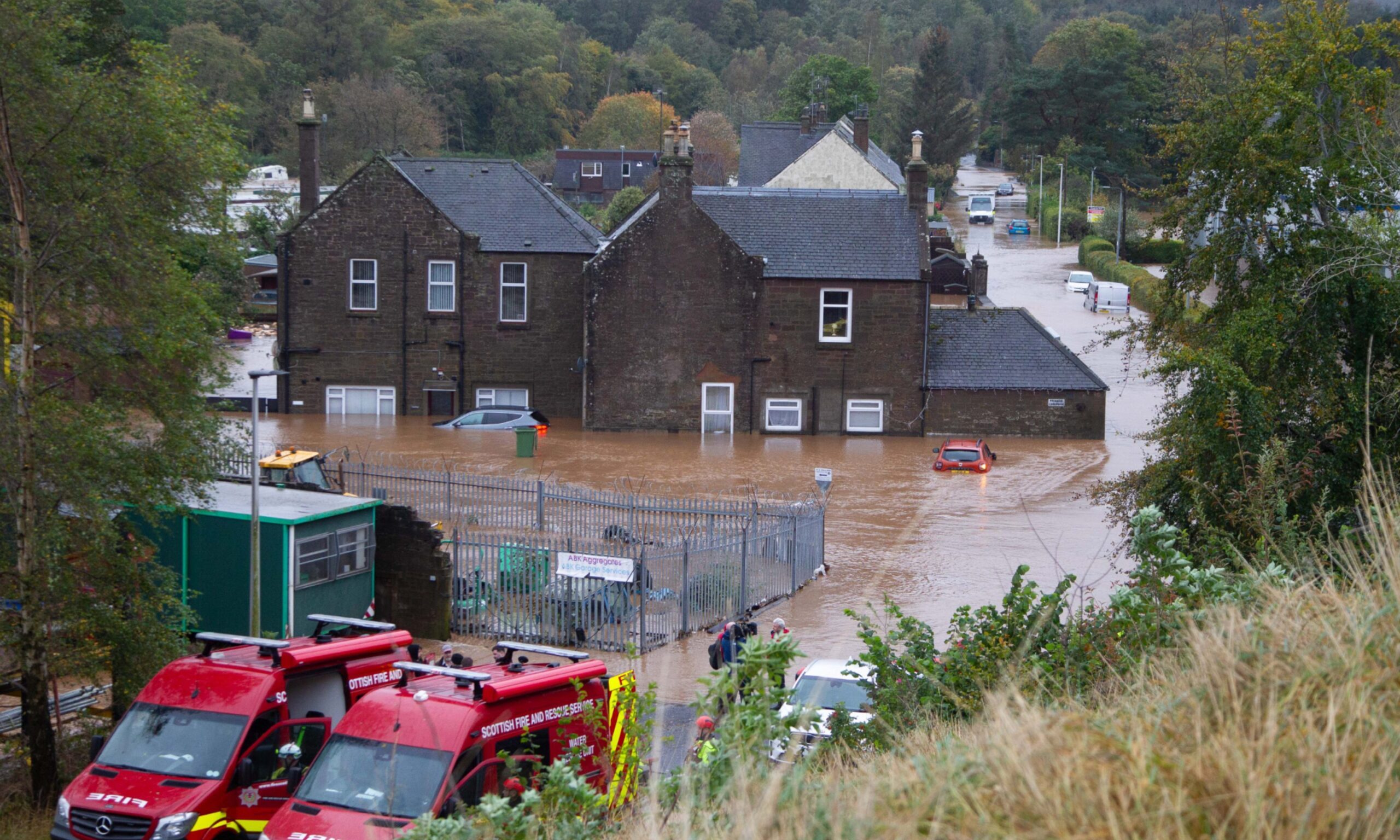
This weekend is a year since record-breaking levels in the River South Esk sparked the biggest multi-agency rescue operation ever witnessed in Angus.

Hundreds of people had to be rescued from their homes.

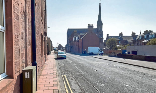
Brechin’s River Street was its epicentre, but the storm caused widespread devastation in other communities.

Council social media post

The council said: “As we near the anniversary of the terrible Storm Babet, we want to reassure the community of Brechin by putting to rest some long running theories about the flood defence scheme, the response and the future of flooding in Brechin.”

In a ‘Flooding Facts’ post on X it said the theory Brechin’s £16m flood protection scheme had failed during Babet was false.

The River Street project was one of of the largest civil engineering schemes completed in Angus when it opened in 2016.

The council said: “The current flood prevention scheme operated to the level it was designed to take – to 3.7 metres over normal levels.

Flooding in Brechin after Storm Babet.
Storm Babet caused devastation in Brechin. Image: Paul Reid

“Storm Babet reached 4.6m over normal levels, so the scheme worked, but was simply overwhelmed by the most serious flooding ever recorded in that area.”

The Courier charted the rapid rise of the River South Esk during Storm Babet.

And in February we revealed engineers had found the flood defences to be in “good condition”.

They were originally built to withstand a one-in-200-year flood event.

An old wall wing leading to Brechin Bridge, which was not part of the defences, collapsed.

Flooding in Brechin
The aftermath of the flooding on River Street which claimed part of an old wall leading to Brechin Bridge. Image: Paul Reid

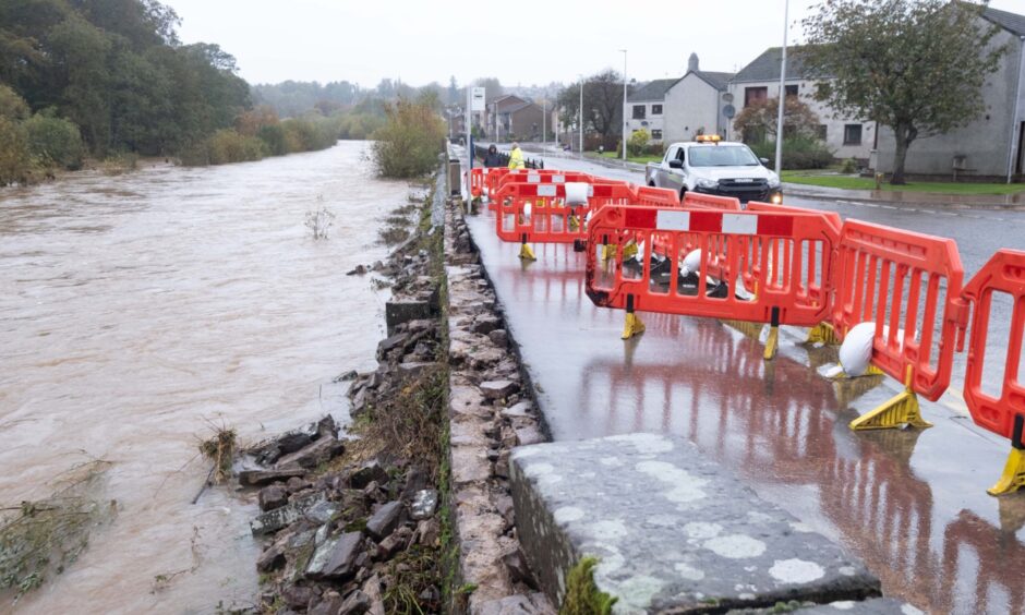
But it led to questions over the flood wall’s suitability after being over-topped in the space of less than a decade.

An interim report on Brechin’s recovery from Storm Babet is due to go before councillors next month.

However, authority chief executive Kathryn Lindsay previously warned it will not provide definitive answers on plans around areas such as the future of dozens of council houses which remain unoccupied.

Conversation