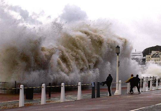
Storm Caroline is predicted to batter Tayside and Fife with winds of up to 80mph on Thursday.
The Met Office has updated its severe weather warning for wind to cover the entirety of both regions, warning of powercuts, travel chaos and dangerously high waves across coastal communities.
https://www.thecourier.co.uk/fp/news/scotland/558971/storm-caroline-scottish-government-release-statement-weather-chaos-predicted/
A more serious “amber” warning is in place for neighbouring Grampian.
The worst of the weather is predicted to hit the area between 6am and 6pm on Thursday.
A Met Office yellow warning of snow and ice is also in place across Tayside from Friday into Saturday, with “blizzard conditions” across Scotland.
A statement from the forecaster said: “Storm Caroline is expected to bring a spell of very windy weather to much of Scotland and parts of the north of Northern Ireland on Thursday.
“Gusts of 60-70 mph are expected quite widely, with gusts to 80 mph possible over high ground and around exposed coasts.
“Road, rail, air and ferry services may be affected, with longer journey times and cancellations possible. Some short term loss of power and other services is possible.
“It is likely that some coastal routes, sea fronts and coastal communities will be affected by spray and/or large waves.”
The Met Office’s chief forecaster said: “The strongest winds will reach northern parts the Western Isles and the far northwest of Scotland early on Thursday, extending eastwards across the north of Scotland and the Northern Isles during the day.
“Winds will be easing from the west as they begin to peak over the Shetland Islands later in the afternoon. Snow showers will turn increasingly frequent and heavy through the day.”
