Prolonged dry weather has exposed historical secrets and relics hidden beneath Fife’s soil.
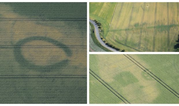
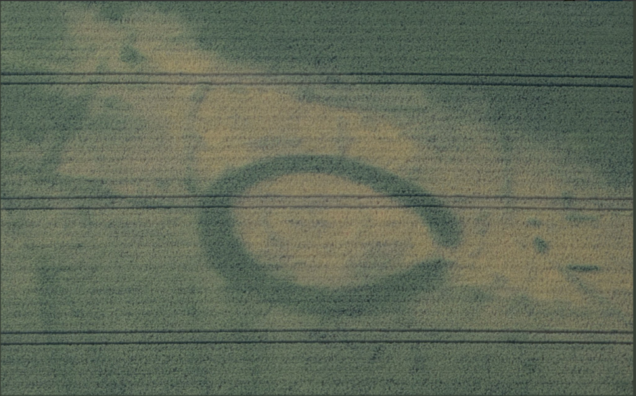
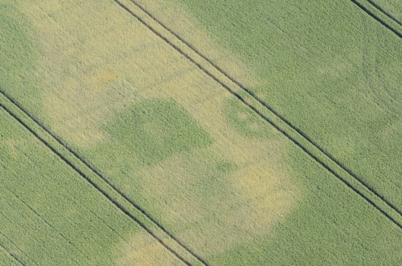
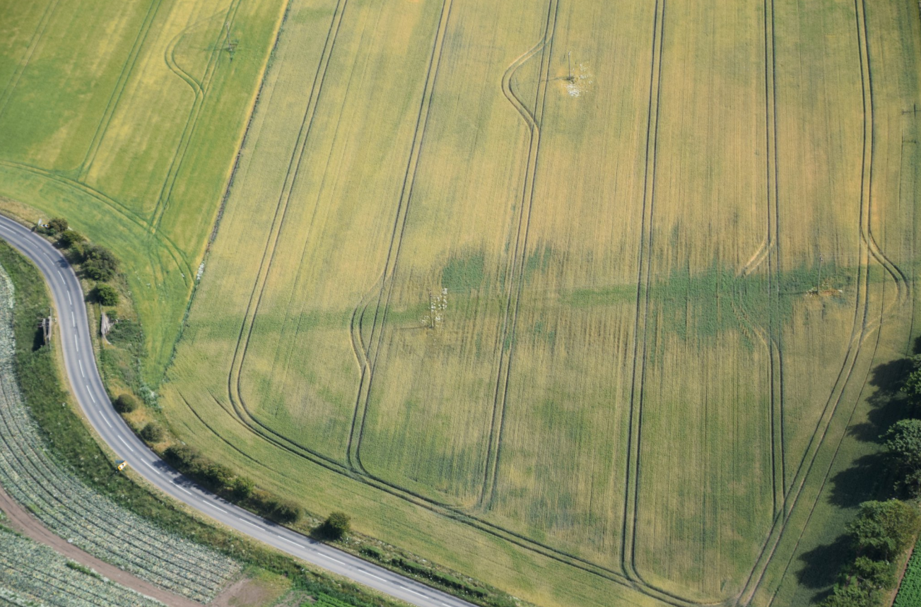
Crop patterns have revealed a prehistoric henge monument at Balmalcolm, an abandoned railway line west of Pittenweem and an 18th Century coal mine near St Monans.
Archaeologists have pored over hundreds of aerial photographs of the region for previously unknown and rarely seen buried remains.
Mirroring discoveries across the UK as parched fields and grasslands show shapes of structures and mounds below, the Fife finds have excited historians.
Fife Council archaeologist Steve Liscoe said: “It’s great to see manifestation of the sites we are aware of but we don’t otherwise see because they are under topsoil and crops and to have the opportunity to get more information about new sites discovered and expand our knowledge of Fife’s archaeological heritage.
“We will possibly not get another opportunity like this for another 10, 20, 30 years, we don’t know. The last good opportunity was in the late 1970s.”
Recent dry weather has revealed dozens of hidden sites all over Fife. FC Archaeological Unit have been inspecting recent aerial photography to discover buried remains. Below an 18thC coal mine, a prehistoric henge monument and an abandoned railway all appear in the parched crops. pic.twitter.com/G9N2mTzGcz
— FifeCouncil Planning (@FifePlanning) July 18, 2018
Crop or parch marks occur in prolonged dry weather when underground ditches retain more water, so crops above are greener than those round about, or, conversely, structures below make the land drier.
The colliery at St Monans from the 1770s was associated with the nearby salt pans, while the railway is part of the coastal line closed in the 1960s due to the Beeching cuts.
Also spotted near St Monans was one of two clusters of Iron Age round houses not previously known of. Another is at Pitmilly, near St Andrews.
Other 18th Century collieries whose locations were not known have been pinpointed in the photographs.
Time is running out before rain obliterates the signs of the past once more but Fife’s archaeological unit still hopes to find markings of known prehistoric remains at Leuchars and the Marie Eglise henge south of Burntisland.
Markings of the prehistoric henge which has a medieval chapel at its heart were photographed by the RAF in the 1940s but have not been seen since.
Photographs have been provided through a partnership with the SCAPE Trust, in St Andrews, and the Sky Watch Civil Air Patrol.
They are interpreted by the Fife archaeologist who matches them against records of known sites.
Not all are what they initially seem, however, such as a photograph of an outline at Muiredge, Buckhaven.
Steve said: “It looks at first glance like a Roman fortress but in fact it is a 1940s or 1950s miners’ hostel.”
Archaeological treasures exposed elsewhere in the UK range from ancient fortifications to Second World War remnants.
In Wales pictures have shown an early medieval cemetery, a Roman villa, a prehistoric or Roman farm and a Roman fortlet.
Members of the public have even found Bronze Age burial grounds and Second World War air raid shelters in back gardens and school grounds.
