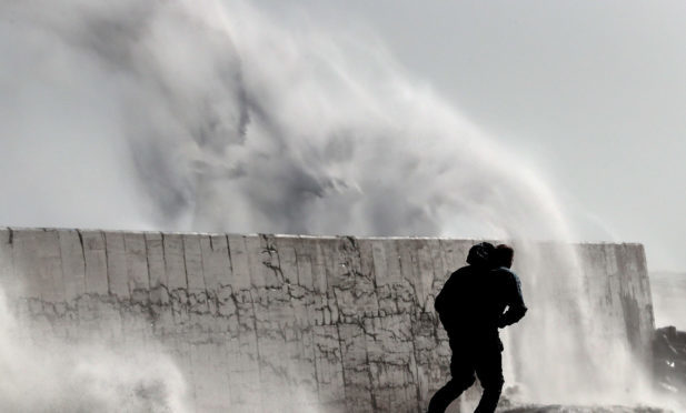
Locals have been told to brace themselves for weather chaos after Storm Caroline was predicted to batter Tayside with winds of up to 80mph on Thursday.
Conditions are forecast to deteriorate during the day, impacting on roads, bridges and railway lines and battering coastal communities with huge, potentially dangerous waves.
A Met Office severe “yellow” warning is in place for the whole of Tayside and Fife from 6am until 6pm, with much of Scotland – including neighbouring Grampian – placed under a more serious “amber” warning as Storm Caroline moves in from the Arctic.
Gusts could reach up to 90mph in the north of Scotland.
It'll be wet and windy overnight for all of us with the approach of #StormCaroline, but the strongest winds are expected tomorrow across Scotland #weatheraware pic.twitter.com/kioYKw2A5k
— Met Office (@metoffice) December 6, 2017
And the storm will be followed by a blast of Arctic weather bringing widespread snow showers across the UK, causing a drop of some 10C on temperatures experienced on Wednesday.
Spokesman for the Met Office, Grahame Madge, said the white stuff could land “anywhere” in the UK from Friday into Saturday, but that no more than 2in was likely at lower levels.
Snow is more likely in rural parts of Tayside, however Dundee is not in the clear.
Mr Madge added: “You can expect very strong winds, even within the yellow area there could be gusts of up to 70mph – 80mph.
“If you are within the yellow warning area there is the potential for disruption. There could be structural damage, loose tiles, trees down, and disruption to power, ferry services and bridges. There are all sorts of issues which could present a problem.
“When it (Storm Caroline) begins to make its way into the North Sea and into Scandinavia, a flow of air from the Arctic will bring temperatures right down. There will be a 10C drop on Friday compared with what we have now.
“It will bring snowfalls and snow showers. We will get snow showers that will have the potential to drop anywhere. Fife largely sits outside of the snow warning that we have.
“At lower levels, some areas will receive 2cm-5cm. The higher levels of 20cm are up in the Highlands. It is possible you could see snow at lower levels.”
A number of trains have already been cancelled with ferry services likely to be disrupted in the coming days. Gritters will also patrolling Scotland’s trunk roads.
Rail services though Courier Country will be affected with speed restrictions in place on services between Perth and Aberdeen and Perth and Inverness.
ScotRail has also suspended Thursday services from Aberdeen to Inverness, Inverness to Wick and Kyle of Lochalsh, and Glasgow to Oban, Fort William and Mallaig.
A decision on when to resume services will be made following safety inspections.
Tickets already purchased for cancelled services will be eligible for use until Monday or can be refunded.
The Scottish Environment Protection Agency (Sepa) has placed eight flood alerts and a further eight warnings on communities across the north and west of Scotland, and the western and northern isles.
Scottish and Southern Electricity Networks (SSEN) has deployed 850 frontline staff, put two helicopters on standby and prepared 83 mobile generation units in preparation for the storm.
Scottish transport minister Humza Yousaf warned Scots will face “challenging conditions” from Thursday through to Saturday, warning drivers to “check ahead” before travelling.
