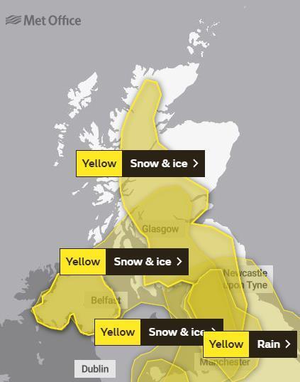
Two weather warnings of snow and ice has been issued for Tayside and Fife.
Experts say most of the region is likely to be affected by the first warning, which runs from 3am on Sunday.
Only the East Neuk of Fife and Angus remain outside the warning zone.
A Met Office statement said: “Following clearance of heavy rain this evening, colder conditions will lead to ice forming on untreated surfaces across many parts of the warning area.
“There will also be showers which will turn increasingly to snow on high ground: parts of western Scotland look likely to see a few cm above about 200 m elevation, with a slight cover at low levels in heavier showers.
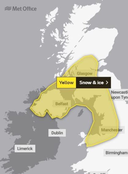
The second warning runs until Monday morning
“Over Northern Ireland, southern Scotland and northern England, any snow cover will be mostly restricted to high level routes, above around 300m, where the odd cm may accumulate during Sunday.”
The alert runs until 3pm, however a second weather warning predicts that Tayside and Fife potentially see up to 10cm of snow over a 16 hour period.
Western parts of the area are likely to be hit from 6pm on Sunday.
The yellow weather warning remains in force until 10am on Monday.
The parts of Fife that could see snow include Cowdenbeath, Rosyth and Dunfermline, while Tayside will be affected as far east as Perth and as far north as Kenmore.
A statement from the Met Office said: “A band of rain, sleet and snow followed by wintry showers will move south across Scotland and Northern Ireland on Sunday evening and into parts of northern England and north Wales early on Monday morning.
“Localised accumulations of 1-3 cm are possible to lower levels but higher accumulations are likely over higher ground.
“Above 250 metres, accumulations of 5-10 cm are possible.
“Whilst skies are expected to clear from the north overnight, icy patches are likely to develop and persist through to Monday morning.”
