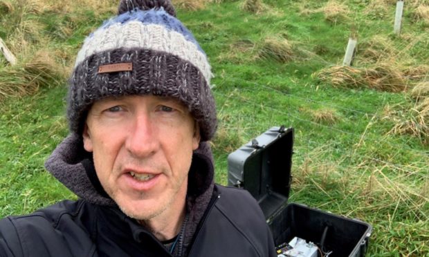
Michael Alexander asks Fife-raised British Geological Survey head seismologist Dr Brian Baptie why there has been a spate of Perthshire earthquakes in recent months and what trends might develop in future.
They are amongst the most powerful natural disasters on Earth with the potential to cause devastating loss of human life, destruction of property and massive humanitarian disruption.
But while it’s been many millennia if not millions of years, since what we now call Scotland last experienced earthquakes on a scale of those now experienced in some other parts of the world, earthquakes on a much smaller scale do occur in and around the British Isles almost every day.
One such area known for its ‘earthquake swarms’ is south Perthshire.
At the end of November, the British Geological Survey (BGS) recorded a 2.0 magnitude tremor which led some residents in the Blackford, Auchterarder, Aberuthven, Braco, Gleneagles, Glendevon and Greenloaning area to believe there had been an “explosion”.
The epicentre was near Gleneagles golf course with people reporting that their “whole house shook”, “windows and doors rattled” and that it “sounded like an explosion”.
It was the 20th time the area had been hit by an earthquake in just over two months following a 0.9 magnitude quake on November 21 and two tremors within six minutes of each other four days earlier, measuring 0.7 and 0.9 magnitude.
Another 0.7 magnitude quake was recorded on November 11.
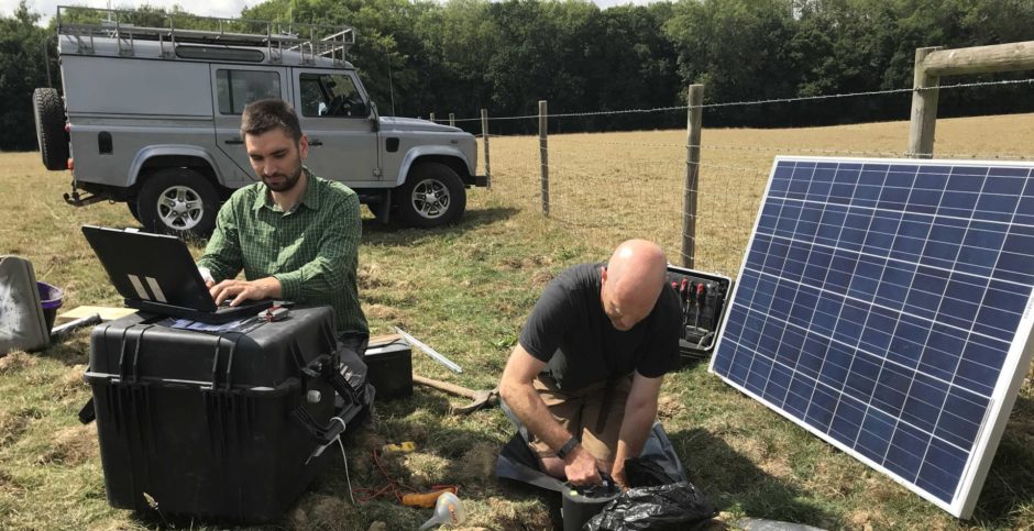
But while seismic activity on this scale rarely causes damage and mostly passes unnoticed, from the perspective of the BGS which measures seismic activity via 80 sensors deployed across the whole of the UK, it gives a fascinating insight into ancient fault lines and ever changing geological pressures deep within the Earth’s crust.
Historic observations
“We can’t be specific about which faults are responsible for these earthquakes in Perthshire,” says Kirkcaldy-raised BGS head seismologist Dr Brian Baptie.
“But we know there are historic observations of earthquakes in Scotland that date back hundreds of years – back to the 14th century – and there are lots and lots of accounts of earthquakes that have been felt by people.
“Similarly when we first started deploying sensors to measure earthquakes across the UK from the 1970s onwards, the first of those sensors were in and around the Midland Valley in Scotland up into Perthshire and those started to reveal lots of small earthquakes as well as these more frequent larger ones.”
Captivated by Mount St Helens eruption in 1980
Dr Baptie, who first became hooked on science while watching the infamous eruption of Mount St Helens in the USA on TV in 1980, says geological faults are the main reasons for earthquakes.
Even though we are far from any of the world’s earthquake hotspots, the earth under our feet is still being slowly squeezed and that leads to stress that builds up on these faults.
After a period of time the stress overcomes the resistance of the faults.
The rocks side slide past each other and that releases energy in the form of these seismic waves, or vibrations, that travel through the Earth and make the ground shake.
What was Scotland’s largest recorded earthquake?
Scotland’s largest recorded earthquake was in 1880 when a 5.2 magnitude quake centred on Loch Awe in Argyll was widely felt all over Scotland.
Fortunately the epicentre was in a relatively remote area where population density is quite low.
In 1894 – there was a magnitude 5 in Fort William and in 1901 there was another magnitude 5.1/5.2 earthquake in Inverness that caused quite a lot of mainly superficial damage to buildings. Chimney pots came down, plaster cracked and roofing materials were dislodged.
In August 1974, a 4.4 magnitude earthquake which had its epicentre in Kintail in the north west Highlands was part of a ‘swarm’ of 20 seismic events that followed.
However, for an earthquake to be felt the threshold is round about magnitude two.
Anything smaller than that is unlikely to be noticed, yet the incredible sensitivity of BGS sensors means that today they can measure very small vibrations down to something like 1/1000th of a micron or a millionth of a millimetre.
Seismic career
Dr Baptie obtained his Ph.D. in Seismology from the University of Edinburgh in 1995, after studying the behaviour of seismic waves in anisotropic wave-guides and their use for identifying fractured layers.
He joined the British Geological Survey in 1996 as a member of the multi-disciplinary team monitoring the eruption of the Soufriere Hills Volcano in Montserrat, West Indies, where he was responsible for all aspects of the seismic monitoring, from data acquisition to interpretation of volcano-seismicity to local radio interviews, intended to improve understanding of volcanoes and earthquakes.
While working on Montserrat he collaborated widely with colleagues both within the UK and overseas on work that has helped to gain key insights into the nature of volcanic earthquakes.
In 1999 Brian joined the Seismology and Geomagnetism Programme to work mainly on improving understanding of natural seismic activity in the UK and offshore areas.
In 2008 he became team leader of the Earthquake Seismology Team.
He has also continued to study active volcanoes, including the ongoing eruption of the Soufriere Hills and Eyjafjallajokull in Iceland.
Looking back through history, some of the most devastating earthquakes ever recorded were in China, causing over half a million casualties.
One of them was in the 1550s in an area with lots of people and buildings constructed not to withstand earthquakes.
More recently, the 1976 Tangshan quake resulted in over 242,000 deaths.
“Generally places where you get big earthquakes and places where population densities are high like Japan, Indonesia, China, those are the places that you can get the devastating earthquakes,” he says.
“Smaller earthquakes can also cause devastation. They don’t need to be magnitude nine earthquakes – you can get 7/7.5 earthquakes that are capable of devastating cities.
“The 2004 Boxing Day earthquake and tsunami also resulted in something like 200,000 deaths not just in Indonesia but across the wider area – Sri Lanka, Thailand.”
Dr Baptie says science has certainly “moved forward” in terms of predicting earthquakes.
However, we are still not very good at making one off predictions.
Longer term forecasts
“We have not been able to say, for example, there’s going to be a magnitude seven earthquake in Los Angeles on March 3, 2021,” he says.
“Those kind of one off spot forecasts either for volcanos or earthquakes we are just not very good at and may never be able to predict earthquakes just because they are quite random.
“But we are much better at making longer term forecasts.
“Over time periods of say 50 years or 100 years – those kind of time periods – we can work out probabilities of earthquakes happening and probabilities of how strong those ground motions will be.
“That means within those time scales we can start to engineer buildings properly and take measures to prepare people so that people know what to do in the event of an earthquake.
“The buildings should at least be resistant. You can only really average out over longer periods of time and prepare.
“Obviously that preparation is quite a costly process as well.
“The countries that are well prepared for earthquakes like the US or Japan or even countries in South America like Chile – they are relatively rich countries while much poorer countries they have much less resource to put in that kind of thing. There are lots of economic and social reasons why people might not be so well prepared for earthquakes.”
Will major earthquakes return to Scotland?
While normal residential housing stock in Scotland is not designed with earthquakes in mind due to the risk being so low over the lifespan of the housing, sensitive structures like nuclear power stations and dams are constructed with earthquake engineering resistance in mind.
But given enough geological time, is it possible that what we call Scotland could again be struck by massive earthquakes at some point in the distant future?
“That’s possible,” says Dr Baptie, “and there’s a number of reasons why we might get that.
“If we think about plate tectonics and movements of the plates in those kind of time scales and where we are now, if a plate boundary was to form close to Scotland or close to the UK then sure we could start to experience many more earthquakes.
“The most likely top scenario for that is what we call a subduction zone opening up on the edge of the Atlantic – the Atlantic Oceanic plate being pushed down underneath the European plate – so something like that is not impossible over those kind of time scales.
“The other interesting thing possibly is if there was to be another ice age.
“If there were to be an ice cap over the UK or over Scotland like there was round about one million years ago or so, that can change seismic activity because of loading.
“Especially if the ice cap forms and melts again, you can actually in theory see much higher levels of earthquake activity as a result of this isostatic rebound or glacial rebound process.”
