Calendar An icon of a desk calendar. Cancel An icon of a circle with a diagonal line across. Caret An icon of a block arrow pointing to the right. Email An icon of a paper envelope. Facebook An icon of the Facebook "f" mark. Google An icon of the Google "G" mark. Linked In An icon of the Linked In "in" mark. Logout An icon representing logout. Profile An icon that resembles human head and shoulders. Telephone An icon of a traditional telephone receiver. Tick An icon of a tick mark. Is Public An icon of a human eye and eyelashes. Is Not Public An icon of a human eye and eyelashes with a diagonal line through it. Pause Icon A two-lined pause icon for stopping interactions. Quote Mark A opening quote mark. Quote Mark A closing quote mark. Arrow An icon of an arrow. Folder An icon of a paper folder. Breaking An icon of an exclamation mark on a circular background. Camera An icon of a digital camera. Caret An icon of a caret arrow. Clock An icon of a clock face. Close An icon of the an X shape. Close Icon An icon used to represent where to interact to collapse or dismiss a component Comment An icon of a speech bubble. Comments An icon of a speech bubble, denoting user comments. Comments An icon of a speech bubble, denoting user comments. Ellipsis An icon of 3 horizontal dots. Envelope An icon of a paper envelope. Facebook An icon of a facebook f logo. Camera An icon of a digital camera. Home An icon of a house. Instagram An icon of the Instagram logo. LinkedIn An icon of the LinkedIn logo. Magnifying Glass An icon of a magnifying glass. Search Icon A magnifying glass icon that is used to represent the function of searching. Menu An icon of 3 horizontal lines. Hamburger Menu Icon An icon used to represent a collapsed menu. Next An icon of an arrow pointing to the right. Notice An explanation mark centred inside a circle. Previous An icon of an arrow pointing to the left. Rating An icon of a star. Tag An icon of a tag. Twitter An icon of the Twitter logo. Video Camera An icon of a video camera shape. Speech Bubble Icon A icon displaying a speech bubble WhatsApp An icon of the WhatsApp logo. Information An icon of an information logo. Plus A mathematical 'plus' symbol. Duration An icon indicating Time. Success Tick An icon of a green tick. Success Tick Timeout An icon of a greyed out success tick. Loading Spinner An icon of a loading spinner. Facebook Messenger An icon of the facebook messenger app logo. Facebook An icon of a facebook f logo. Facebook Messenger An icon of the Twitter app logo. LinkedIn An icon of the LinkedIn logo. WhatsApp Messenger An icon of the Whatsapp messenger app logo. Email An icon of an mail envelope. Copy link A decentered black square over a white square.

Cross Tay Link Road ‘green bridge’ set to open next month as part of Perthshire paths bonanza

More than 12km of new and upgraded paths will be available by the time the new Perth bypass opens next spring

artist impression of grassy pedestrian bridge over new Cross Tay Link Road near Perth
The green bridge is part of the Cross Tay Link Road. Image: Supplied

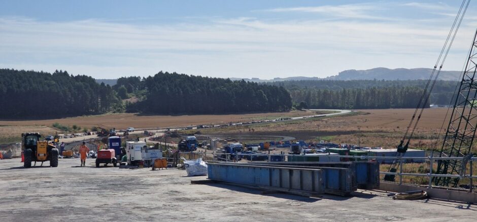
More than 12km of new and upgraded paths are set to open by the spring, as part of Perth’s Cross Tay Link Road project.

And the much-discussed “green bridge” could be ready for visitors by the end of next month.

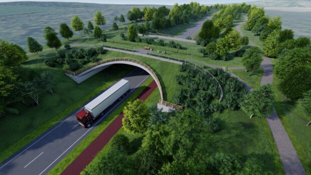
This grassy crossing, near Scone, connects the Highfield Woods on either side of the new route.

It has been designed to appeal to wildlife, as much as humans.

And it comes as the Cross Tay Link Road, north of Perth, edges closer to completion.

The £150 million bypass – complete with Destiny Bridge – is also on track to be ready by spring 2025.

Aerial view, showing roads connecting the A9 to the new Destiny Bridge across River Tay and the Cross Tay Link Road beyond.
The A9 end of the Cross Tay Link Road. Image: Cross Tay Link Road Project/Broadwing Media.

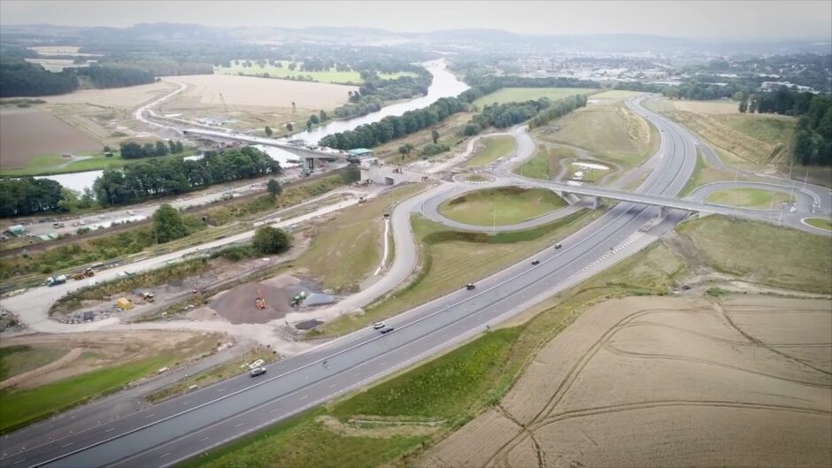
It will feature 6km of new road connecting the A9 to the A93 to Blairgowrie and the A94 to Coupar Angus.

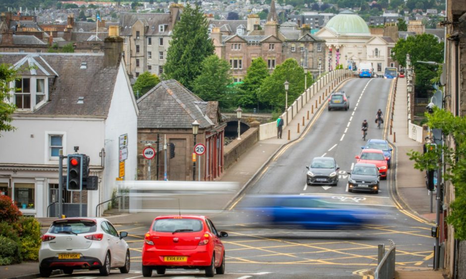
It is intended to speed up journey times and take pressure off roads in the north of the city.

Cross Tay Link Road paths plans unveiled

The new active travel paths network will include a hub with wheelchair accessible benches, cycle shelters and EV charging points.

This will be based at the park-and-choose site being built off the old A9.

The hope is that motorists will park out of town and switch to foot, bike or wheelchair to explore the new and existing paths.

Map showing new route with new and existing paths in locality
Paths around Perth are a big part of the plans for the new route. Image: Cross Tay Link Road Project.

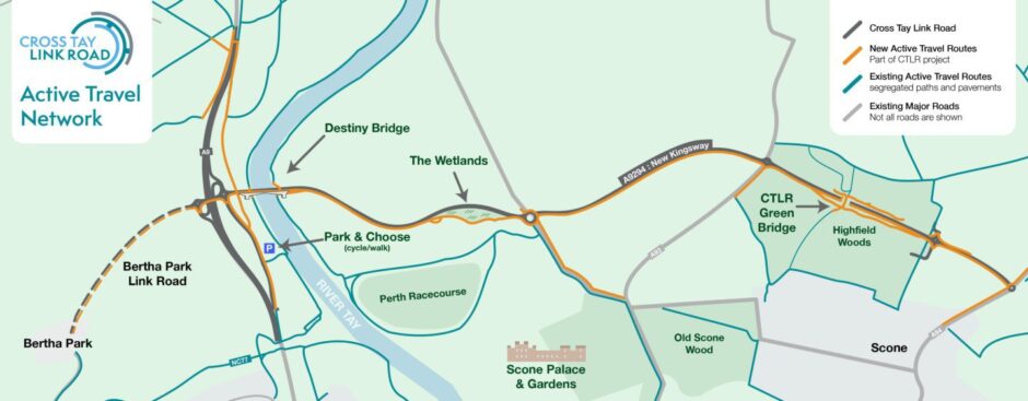
The plans also include:

• 7km of new, 3m-wide, shared-use path running along the entire route of the project;

• An upgraded and widened path alongside the A94 road;

• A 500m stretch of new shared-use footway beside the A93;

• Upgraded paths either side of the River Tay;

• An upgraded and widened footpath beside the A9;

New roundabout with grass covered pedestrian bridge in distance
The green bridge in the distance as work on the Coss Tay Link Road continues. Image: DC Thomson.

• A new core path and bus stop access at Redgorton;

• Seven toucan crossings along the New Kingsway.

Lots of interest in ‘green bridge’

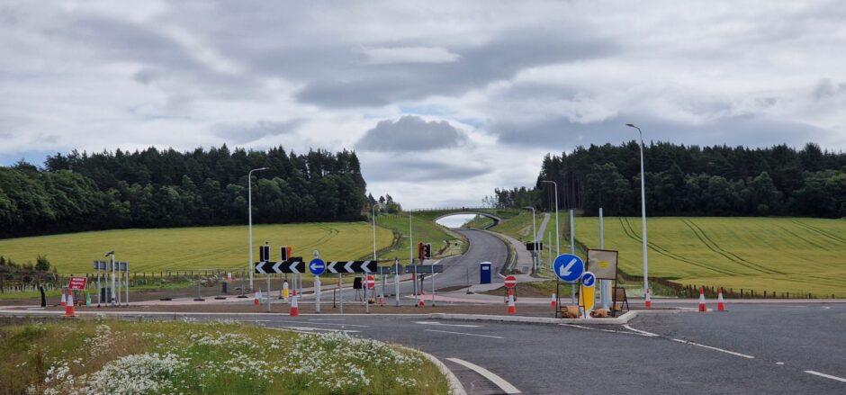
Works are well under way, with some of the paths around Perth expected to open before the end of the year.

All will be open to pedestrians and cyclists, and much of the network will be suitable for wheelchair users.

More than 3km of vegetation has also been cleared at Redgorton, between Balbeggie and Perth Airport, to make it easier for people to pass through.

Constriction materials and workers on Destiny Bridge looking east as the new road snakes through the countryside
The view looking east from Destiny Bridge. Image: DC Thomson

Jillian Ferguson, roads and infrastructure manager for Perth and Kinross Council, says the plan is to open the green bridge before the end of November.

“This particular feature of the project has generated much in the way of interest,” she said.

New road intended to ease pressures on Perth

The Cross Tay Link Road is the biggest infrastructure project ever undertaken in Perth and Kinross.

Supporters say it will reduce congestion and air pollution for Perth residents, as well as opening up opportunities for economic growth.

bridgend perth roadworks
The Cross Tay Link Road is intended to reduce traffic levels in Perth, particularly around Bridgend and Scone. Image: Steve MacDougall/DC Thomson.

Perth and Kinross Council is paying for the lion’s share of the construction costs.

The Scottish Government also contributed £40m to the project.

Perth and Kinross Council leader Grant Laing: “Active travel – the simple act of walking, wheeling or cycling – has many benefits including improved health, safer communities, and reduced environmental impacts,” he said.

“Now, with over 12km of new and improved paths it will be easier than ever before for local people and visitors to get out and enjoy our area.”

Conversation